
 United Kingdom
 France
 Germany
 Netherlands
 Sweden
 USA
USA
 Italy
Italy
 Spain
Spain
More From Contributor


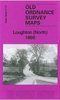
Loughborough 1901
Loughborough in 1901 in a fascinating series of reproductions of old Ordnance Survey plans in the Alan Godfrey Editions, ideal for anyone interested in the history of their neighbourhood or family. Selected towns in Great Britain and Ireland are covered by maps showing the extent of urban development in the last decades of the 19th and early 20th century.In this title: the map is double-sided. The main map covers most of the town, extending from Cobden Street westward to Knight Thorpe Hall and Burleigh Hall, and from Cambridge Street southward to Mountfields House and Corporation Road. Features include LNWR Charnwood Forest Branch with terminus, Southfields, Queens Park, Convent, New Walks, Grammar School, All Saints church, Town Hall, Market Place, St Peter's church,
Workhouse, Burleigh Fields, Midland Horticultural Works, end of Loughborough Canal with Regent Wharf etc. On the reverse is a portion of adjacent sheet 18.05 extending coverage eastward to include Great Central Railway with station, and Elm Park. (Note that the Midland Railway is not on the map.) About the Alan Godfrey Editions of the 25
Workhouse, Burleigh Fields, Midland Horticultural Works, end of Loughborough Canal with Regent Wharf etc. On the reverse is a portion of adjacent sheet 18.05 extending coverage eastward to include Great Central Railway with station, and Elm Park. (Note that the Midland Railway is not on the map.) About the Alan Godfrey Editions of the 25
Product Description
Reviews/Comments
Add New
Intelligent Comparison
Archived Product

Loughborough 1901 Stanfords
£3.50
Archived Product
Loughborough Stanfords
£6.39
Archived Product

Mexborough 1901 Stanfords
£3.50
Archived Product
Conisbrough 1901 Stanfords
£3.50
Archived Product

Masbrough 1901 Stanfords
£3.50
Archived Product

Greasborough 1901 Stanfords
£3.50
Archived Product
Peterborough 1901 Stanfords
£9.99
Vouchers
No voucher codes found.
Do you know a voucher code for this product or supplier? Add it to Insights for others to use.
Do you know a voucher code for this product or supplier? Add it to Insights for others to use.
 Denmark