More From Contributor
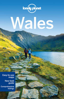
£6.95
Wallpaper* City Guides present a tightly edited, discreetly packaged list of the best a location has to offer the design conscious traveller. Here is a precise, informative, insider`s checklist of all you need to know about the world`s most intoxicating cities. Whether you are staying for 48 hours or five days, visiting for business or a vacation, we`ve done the hard work for you, from finding the best restaurants, bars & hotels (including which rooms to request) to the most extraordinary stores & sites, & the most enticing architecture & design. Wallpaper* City Guides enable you to come away from your trip, however brief, with a real taste of the city`s landscape & the satisfaction you`ve seen all that you should. In short, these guides act as a passport to the best the world has to offer. ...
Archived Product
£14.95
Walking guide to Gran Canaria in the Canary Islands, describing 45 day walks & sections of the new, waymarked, long-distance trail GR131. The fourth in a comprehensive five-book series covering all the Canaries, it

Includes::
from Las Palmas in the north to the southern Playa del Ingles, with the stunning volcanic hill-country in between, all illustrated with detailed contour maps. The guide has walks suitable for those of all abilities, the dramatic landscape little known outside of the Canaries, but offering an ideal winter walking destination featuring rocky treks & mountain paths, clifftop & beachfront walks & forest trails through varied, breathtaking scenery. The guide provides lots of background information on geology, wildlife, plants & flowers as well as practical information on accommodation, currency & language.

...
Archived Product
£6.95
Wallpaper* City Guides present a tightly edited, discreetly packaged list of the best a location has to offer the design conscious traveller. Here is a precise, informative, insider`s checklist of all you need to know about the world`s most intoxicating cities. Whether you are staying for 48 hours or five days, visiting for business or a vacation, we`ve done the hard work for you, from finding the best restaurants, bars & hotels (including which rooms to request) to the most extraordinary stores & sites, & the most enticing architecture & design. Wallpaper* City Guides enable you to come away from your trip, however brief, with a real taste of the city`s landscape & the satisfaction you`ve seen all that you should. In short, these guides act as a passport to the best the world has to offer. ...
Archived Product
£14.95
With over 80 routes, this handy guidebook by an expert author offers walkers many opportunities to explore the ridges, plateaus, glens & woodland of highland Perthshire. The area covered here relates to the old county boundary & is bound by the Dalwhinnie to the north, Crieff & Dunkeld to the south east & stretching to Bridge of Orchy in the west. The long grass slopes & peaty cols provide a wealth of walking opportunitites, on heather & pebble-strewn plateaux & rounded ridges. & in March & April the soggy grass becomes crisp snow, the boggy cols freeze over & Ben Lawers & Meall nan Tarmachan look all Alpine along the skyline. The graded routes described here include all 42 Munros in the area as well as 22 selected Corbetts, 15 smaller summits & the historic Atholl passes of Gaick & Minigaig
- all within easy reach of Perth. Routes are grouped into ten geographical areas: Comrie & Crieff, Killin & Glen Lochay, Glen Lyon, Bridge of Orchy, Perth & Dunkeld, Aberfeldy, Tummel & Loch Rannoch, Rannoch Moor, Pitlochry & Blair Atholl & Drumochter.A combination of 1:50, 000 & 1:100, 000 mapping is included as appropriate along with the author`s unforgettable photographs.
...
Archived Product
£8.25
Map No. 75, Waterford North in the Discovery series from the OSI, the Ordnance Survey of Irel&, which presents the country on detailed topographic maps at 1:50, 000, with additional overprint highlighting campsites & caravan parks, youth hostels, etc. Current 4th edition of this map was published in January 2013. Maps in the Discovery series have contours at 10m intervals, with plenty of spot heights & additional altitude colouring. Graphics indicate different types of woodlands. An overprint highlights waymarked or unmarked walking trails as well as cycle routes. National or forest parks & nature reserves are marked & a range of symbols provide tourist information: campsites, caravan parks, youth hostels (An Óige & independent), tourist offices, parking & picnic places, & viewpoints. Golf courses indicate the number of holes. The maps also highlight antiquities & historical sites such as megalithic tombs, standing stones, battlefields, etc. Road network grades third class roads according to their widths &

Includes::
local tracks. Railways are shown with stations & the maps include other details expected of topographic mapping at this scale. Where appropriate, place names are given in both Irish & English. Each map covers an area of 40 x 30km (25 x 19 miles approximately) & has a 1km ITM (Irish Transverse Mercator) grid, plus latitude & longitude margin ticks at 1` intervals. Map legend is in Irish & English. To see the list of all the titles in this series please click on the series link.

...
Archived Product
£5.99
With Lonely Planet`s Western Europe Phrasebook & Dictionary, let no barriers
- language or culture
- get in your way. Get more

...
Archived Product
£14.95
This Cicerone guide to walking on the Mediterranean island of Menorca by Paddy Dillon

Includes::
a wide variety

...
Archived Product
£12.95
This guide describes 30 easy walks of between 3 & 10 miles in length, covering all areas of the New Forest National Park in southern Engl&. Walks can be easily lengthened, shortened or combined to suit all walkers. The New Forest gained national park status in 2005; it is a landscape of beautiful woodl&, open heaths & a lengthy coastline. ...
Archived Product
£12.95
The Fenland region of Norfolk`s far west is flat & low-lying, as are the marshes & waterways of the Broads in the east, but between these two extremes there is a great deal of topography going on. The county is far more varied than most outsiders imagine, with several distinct & unique landscapes. As well as Broads & the Fens, it has the sandy Brecks, rolling farml&, ancient woodl&, meandering rivers & the gorgeous North Norfolk coast with its beaches, shingle banks, salt marshes & tidal mud flats. This book describes 40 easy-to-moderate circular walks, grouped by area: Northeast coast & the Broads; South Norfolk, the Yare & the Waveney; North Norfolk & Coast; Central Norfolk & Breckland & West Norfolk & Fens. Each walk is described step-by-step, illustrated with 1:40K OS map extracts & packed with historical, geological & other information about the landscape the route passes through. There is also an appendix summarising long-distance routes that pass through Norfolk that may tempt readers to longer excursions. Written by an established outdoor writer & passionate local resident, this book aims to overturn prejudices & win new converts to Norfolk as an excellent walking destination for all abilities. ...
Archived Product
£8.99
Samaria – Sougia area of the White Mountains on Crete on a waterproof & tear-resistant, GPS compatible & contoured hiking map at 1:25, 000 from Anavasi, extending from the famous Gorge of Samaria westwards to Azogyres & Plemeniana, & north past Omalos & the peaks of Troili & Kaimeni Kafala. Topography is shown by contour lines at 20m intervals, enhanced by hill-shading & altitude colouring, plus spot heights & graphics to show different types of land cover. Footpaths are clearly marked, indicating well defined or less obvious sections. The map also shows locations of mountain refuges & rangers’ huts, etc. Place names are shown in both Greek & Latin script. The map has a UTM grid & latitude & longitude crosshairs at 1` intervals. Map legend

Includes::
English. On the reverse most of the area is also presented on a simplified map without contours & background colouring to highlight hiking routes recommended by the publishers. Most trails are part of the E4 long-distance route & can be combined with local tracks & paths to forms circular walks. Significant points along the trails are annotated with helpful bilingual English/ Greek notes & a summary of the trails is also included. To see other titles in Anavasi’s coverage of Crete on hiking maps please click on the series link.

...
Archived Product

Lonely Planet Wales

Lonely Planet Wales offers advice on what to see, what to skip, and what hidden discoveries await you. Uncover history in medieval castles, eat at the country`s best gastro-pubs, or hike the Wales Coast Path.Highlights and itineraries show you the simplest way to tailor your trip to your own personal needs and interests. Insider tips save you time and money, and help you get around like a local, avoiding crowds and trouble spots. Essential info at your fingertips - including hours of operation, phone numbers, websites, transit tips, and prices. Honest reviews for all budgets - including eating, sleeping, sight-seeing, going out, shopping, and hidden gems that most guidebooks miss. Cultural insights give you a richer and more rewarding travel experience - including history,
literature, music, architecture and landscapes. Over fifty maps. Useful features - including Walking Tours, Outdoor Activities, and Month by Month (annual festival calendar). Coverage of Cardiff, the Gower Peninsula, Pembrokeshire, Snowdonia and more. Looking for more extensive coverage? Check out Lonely Planet`s Great Britain guide.
RIP - This product is no longer available on our network. It was last seen on 25.09.2019

This page now acts as a permanent archive for this product. Add more information using the comments box below to ensure it can still be found by future generations.

Use our search facility to see if it is available from an alternative contributor.
  • External links may include paid for promotion
  • Availability: Out Of Stock
  • Supplier: Stanfords
  • SKU: 9781742201344
Availability: In Stock
£14.99

Product Description

Lonely Planet Wales offers advice on what to see, what to skip, & what hidden discoveries await you. Uncover history in medieval castles, eat at the country`s best gastro-pubs, or hike the Wales Coast Path. Highlights & itineraries show you the simplest way to tailor your trip to your own personal needs & interests. Insider tips save you time & money, & help you get around like a local, avoiding crowds & trouble spots. Essential info at your fingertips
- including hours of operation, phone numbers, websites, transit tips, & prices. Honest reviews for all budgets
- including eating, sleeping, sight-seeing, going out, shopping, & hidden gems that most guidebooks miss. Cultural insights give you a richer & more rewarding travel experience
- including history, literature, music, architecture & landscapes. Over fifty maps. Useful features
- including Walking Tours, Outdoor Activities, & Month by Month (annual festival calendar). Coverage of Cardiff, the Gower Peninsula, Pembrokeshire, Snowdonia & more. Looking for more extensive coverage? Check out Lonely Planet`s Great Britain guide.

Reviews/Comments

Add New

Intelligent Comparison

Oooops!
We couldn't find anything!
Perhaps this product's unique.... Or perhaps we are still looking for comparisons!
Click to bump this page and we'll hurry up.

Price History

Vouchers

No voucher codes found.
Do you know a voucher code for this product or supplier? Add it to Insights for others to use.

Facebook

Jargon Buster

Calendar - A system for organising dates
phone - Short for telephone. A device that transmits sound allowing point to point communication over long distances
History - Anything that happens in the past. An acedemic subject.
Month - A period of time originally related to the phases of the earths moon.
Rewarding - Achieving and doing something good.
Festival - A period usually occurring once a year for celebration, typically for religious reasons.
Personal - Something that belongs more to an individual due to it affecting them more by relating to them.
Experience - To gain further knowledge by practising.

Supplier Information

Stanfords
Stanfords was established in 1853 and opened their iconic Covent Garden flagship store in 1901. They have become the top retailer of maps, travel books and accessories in the UK and arguably offer the largest selection of maps and travel books worldwide. Famous names such as Captain Robert Falcon Scott, Ranulph Fiennes and Michael Palin have purchased from Stanfords. They now have a shop in Bristol and both stores together with other venues operate a calendar of events including talks, book signings and exhibitions. As a specialist map retailer, the map selection is comprehensive and includes road maps, street maps and walking maps from worldwide destinations, as well as a selection of world atlases and wall maps. Books include travel guides and travel literature. Stanfords also stock globes, from miniatures made of blue marble to magnificent floor-standing globes. The website features a selection of interesting articles on travel topics.
Page Updated: 2023-11-12 20:15:36

Community Generated Product Tags

Oh No! The productWIKI community hasn't generated any tags for this product yet!
Menu