-
Home
-
Contributors
-
International
-
Account
-
Information
More From Contributor
Includes:: English. To see the list of all the titles in this series please click on the series link. ...
- Spain’s civilian survey organization, with exceptionally ...
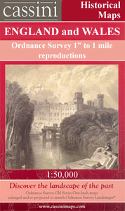
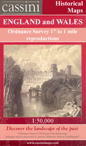
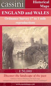
Includes:: notes on the development of Ordnance Survey & the various series produced by them. For those interested in maps & cartography in general, the Cassini series also provides a fascinating insight into how Ordnance Survey cartographic style has developed over a period of over 100 years. Coverage in this title
Includes:: present day Pwllheli, Bontnewydd, Groeslon, Clynnog-fawr, Penygroes, Llithfaen, Nefyn, Garndolbenmaen, Rhoslan, Chwilog, Llanbedrog, Abersoch, Llanengan, Botwnnog, Rhiw, Aberdaron, Rhydlios, Llangwnnadl, Dinas, Boduan, Tudweiliog & Groesffordd, with the Bardsey Island/ Ynys Enlli.* PLEASE NOTE: Stanfords can also print on request mapping from all four series *centring the map on a location of your choice.* For more information please click on the link below. ...
Includes:: notes on the development of Ordnance Survey & the various series produced by them. For those interested in maps & cartography in general, the Cassini series also provides a fascinating insight into how Ordnance Survey cartographic style has developed over a period of over 100 years. Coverage in this title
Includes:: present day Pwllheli, Bontnewydd, Groeslon, Clynnog-fawr, Penygroes, Llithfaen, Nefyn, Garndolbenmaen, Rhoslan, Chwilog, Llanbedrog, Abersoch, Llanengan, Botwnnog, Rhiw, Aberdaron, Rhydlios, Llangwnnadl, Dinas, Boduan, Tudweiliog & Groesffordd, with the Bardsey Island/ Ynys Enlli. PLEASE NOTE: Stanfords can also print on request mapping from all four series centring the map on a location of your choice. For more information please click on the link below. ...
Includes:: notes on the development of Ordnance Survey & the various series produced by them. For those interested in maps & cartography in general, the Cassini series also provides a fascinating insight into how Ordnance Survey cartographic style has developed over a period of over 100 years. Coverage in this title
Includes:: present day Pwllheli, Bontnewydd, Groeslon, Clynnog-fawr, Penygroes, Llithfaen, Nefyn, Garndolbenmaen, Rhoslan, Chwilog, Llanbedrog, Abersoch, Llanengan, Botwnnog, Rhiw, Aberdaron, Rhydlios, Llangwnnadl, Dinas, Boduan, Tudweiliog & Groesffordd, with the Bardsey Island/ Ynys Enlli.* PLEASE NOTE: Stanfords can also print on request mapping from all four series *centring the map on a location of your choice.* For more information please click on the link below. ...
Includes:: notes on the development of Ordnance Survey & the various series produced by them. For those interested in maps & cartography in general, the Cassini series also provides a fascinating insight into how Ordnance Survey cartographic style has developed over a period of over 100 years. Coverage in this title
Includes:: present day Pwllheli, Bontnewydd, Groeslon, Clynnog-fawr, Penygroes, Llithfaen, Nefyn, Garndolbenmaen, Rhoslan, Chwilog, Llanbedrog, Abersoch, Llanengan, Botwnnog, Rhiw, Aberdaron, Rhydlios, Llangwnnadl, Dinas, Boduan, Tudweiliog & Groesffordd, with the Bardsey Island/ Ynys Enlli.* PLEASE NOTE: Stanfords can also print on request mapping from all four series *centring the map on a location of your choice.* For more information please click on the link below. ...

Lleyn Peninsula / Pen Llyn
choice and with a picture provided by you on the cover. For more information please click on the link at the bottom of this description.About Ordnance Survey
This page now acts as a permanent archive for this product. Add more information using the comments box below to ensure it can still be found by future generations.
Use our search facility to see if it is available from an alternative contributor.
- External links may include paid for promotion
- Availability: Out Of Stock
- Supplier: Stanfords
- SKU: 9780319231852
Product Description
Map No. 123, Lleyn Peninsula / Pen Llyn, in the Ordnance Survey Landranger series at 1:50, 000, including Pwllheli, Bontnewydd, Groeslon, Clynnog-fawr, Penygroes, Llithfaen, Nefyn, Garndolbenmaen, Rhoslan, Chwilog, Llanbedrog, Abersoch, Llanengan, Botwnnog, Rhiw, Aberdaron, Rhydlios, Llangwnnadl, Dinas, Boduan, Tudweiliog & Groesffordd, with the Bardsey Island/ Ynys Enlli & a small north-western part of the Snowdonia National Park/ Parc Cenedlaethol Erryri. Edition B3; Publication date: January 2010 This title is also available on our website in a waterproof & tear-resistant version. Maps in this series are only published folded. Stanfords can also print flat versions of Ordnance Survey maps through the OS Select system, centring the map on a location of your choice & with a picture provided by you on the cover. For more information please click on the link at the bottom of this description. About Ordnance Survey
Reviews/Comments
Add New
Intelligent Comparison
Price History
Vouchers
Do you know a voucher code for this product or supplier? Add it to Insights for others to use.


 United Kingdom
 France
 Germany
 Netherlands
 Sweden
 USA
USA
 Italy
Italy
 Spain
Spain


 Denmark