
 United Kingdom
 France
 Germany
 Netherlands
 Sweden
 USA
USA
 Italy
Italy
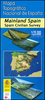
 Spain
Spain
More From Contributor


Lleyn Peninsula - Circular Walks From The Wales Coast Path
This attractive and cleverly structured guidebook gives walkers the ten finest routes along a section of the new Wales Coast Path, officially opened in May 2012, in a popular pocketable format. With clear information, an overview and introduction for each walk, expertly written numbered directions, Ordnance Survey maps, superb, eye-grabbing panoramic photographs, and interpretation of points of interest along the way, these guides set a new standard in clarity and ease-of-use. Featured walks include: Dinas Dinlle, Porth Dinllaen, Tudweiliog, Whistling Sands, Aberdaron, Mynydd Rhiw, Abersoch, Criccieth & Porthmadog.
Product Description
Reviews/Comments
Add New
Vouchers
No voucher codes found.
Do you know a voucher code for this product or supplier? Add it to Insights for others to use.
Do you know a voucher code for this product or supplier? Add it to Insights for others to use.
 Denmark