
 United Kingdom
 France
 Germany
 Netherlands
 Sweden
 USA
USA
 Italy
Italy
 Spain
Spain
More From Contributor


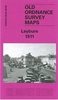

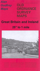
Lewisham 1894
Lewisham in 1894 in a fascinating series of reproductions of old Ordnance Survey plans in the Alan Godfrey Editions, ideal for anyone interested in the history of their neighbourhood or family. Three versions have been published for this area, stretching from Algernon Road and Ladywell station eastward to Lee Road and Burnt Ash Road, and from Lewisham Bridge and Belmont Hill southward to Hither Green station; the maps therefore really cover the centre and south of Lewisham town (not the station) and much of Lee. Features include Ladywell, High Street, High Road, Lee Green, Lewisham Park, workhouse, St Stephen`s Lewisham, St Mark`s, St Swithin`s, The Good Shepherd Handen Road, Holy Trinity Lee, Christ Church Lee, Lee Park, Wantage Road, Blessington Road, Brookbank Road,
Hither Green Lane, etc. All three maps have extracts from contemporary street directories.About the Alan Godfrey Editions of the 25” OS Series: Selected towns in Great Britain and Ireland are covered by maps showing the extent of urban development in the last decades of the 19th and early 20th century. The plans have been taken from the Ordnance Survey mapping and reprinted at about 15 inches to one mile (1:4, 340). On the reverse most maps have historical notes and many also include extracts from contemporary directories. Most maps cover about one mile (1.6kms) north/south, one and a half miles (2.4kms) across; adjoining sheets can be combined to provide wider coverage.FOR MORE INFORMATION AND A COMPLETE LIST OF ALL AVAILABLE TITLES PLEASE CLICK ON THE SERIES LINK.
Hither Green Lane, etc. All three maps have extracts from contemporary street directories.About the Alan Godfrey Editions of the 25” OS Series: Selected towns in Great Britain and Ireland are covered by maps showing the extent of urban development in the last decades of the 19th and early 20th century. The plans have been taken from the Ordnance Survey mapping and reprinted at about 15 inches to one mile (1:4, 340). On the reverse most maps have historical notes and many also include extracts from contemporary directories. Most maps cover about one mile (1.6kms) north/south, one and a half miles (2.4kms) across; adjoining sheets can be combined to provide wider coverage.FOR MORE INFORMATION AND A COMPLETE LIST OF ALL AVAILABLE TITLES PLEASE CLICK ON THE SERIES LINK.

Product Description
Reviews/Comments
Add New
Intelligent Comparison
Archived Product

Lewisham 1914 Stanfords
£3.50
Archived Product
Lewisham Stanfords
£12.99
Archived Product

Lewisham 1863-67 Stanfords
£3.50
Archived Product
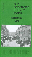
Peckham 1894 Stanfords
£3.50
Archived Product
Leith Walk 1894 Stanfords
£3.50
Vouchers
No voucher codes found.
Do you know a voucher code for this product or supplier? Add it to Insights for others to use.
Do you know a voucher code for this product or supplier? Add it to Insights for others to use.
 Denmark