
 United Kingdom
 France
 Germany
 Netherlands
 Sweden
 USA
USA
 Italy
Italy
 Spain
Spain
More From Contributor


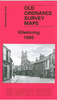


Kilnhurst 1901
Kilnhurst in 1901 in a fascinating series of reproductions of old Ordnance Survey plans in the Alan Godfrey Editions, ideal for anyone interested in the history of their neighbourhood or family. The map covers the village of Kilnhurst, just north of Rotherham. The centre of the village is shown around Victoria Street and coverage extends north to Birdwell Flats and High Thorn, westward to Sandhill Farm, and east to Kilnhurst Bridge and Lodge Farm. The Midland Railway and GCR both run through the map, with stations at Kilnhurst, and between them is the Kilnhurst Cut canal. Other features include Albany Row, St Thomas church, part of the Swinton Iron & Steel Works, Kilnhurst Forge, Victoria Glass Works, Thrybergh Hall Colliery, Beechwood, Warren Vale Colliery Tramway, Holywell
House, Piccadilly, Kilnhurst Pottery, etc. On the reverse is a directory of Kilnhurst in 1902, notes from a Parish Magazine, and the poem `Perils of the Mine` by John Veitch, a miner injured in Thrybergh Hall Colliery in 1937.About the Alan Godfrey Editions of the 25” OS Series:Selected towns in Great Britain and Ireland are covered by maps showing the extent of urban development in the last decades of the 19th and early 20th century. The plans have been taken from the Ordnance Survey mapping and reprinted at about 15 inches to one mile (1:4, 340). On the reverse most maps have historical notes and many also include extracts from contemporary directories. Most maps cover about one mile (1.6kms) north/south, one and a half miles (2.4kms) across; adjoining sheets can be combined to
provide wider coverage.FOR MORE INFORMATION AND A COMPLETE LIST OF ALL AVAILABLE TITLES PLEASE CLICK ON THE SERIES LINK.

Product Description
Reviews/Comments
Add New
Vouchers
No voucher codes found.
Do you know a voucher code for this product or supplier? Add it to Insights for others to use.
Do you know a voucher code for this product or supplier? Add it to Insights for others to use.
 Denmark