
 United Kingdom
 France
 Germany
 Netherlands
 Sweden
 USA
USA
 Italy
Italy
 Spain
Spain
More From Contributor


Kidderminster And Wyre Forest
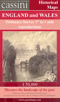
Map No. 138, Kidderminster and Wyre Forest, in the Ordnance Survey Landranger series at 1:50, 000, including Bewdley, Stourport-on-Severn, Ludlow, Much Wenlock, Bridgnorth, Leebotwood, Church Stretton, Easthope, Ditton Priors, Munslow, Abdon, Morville, Worfield, Pattingham, Seisdon, Six Ashes, Claverley, Kniver, Highley, Chelmarsh, Chetton, Burwarton, Stottesdon, Kinlet, Romsley, Cleeton St. Mary, Culmington, Stanton Lacy, Bitterley, Cleobury Montimer, Elton, Brimfield, Tenbury Wells, Bayton, Manithwood, Yarpole, Eyton, Leysters, Whyle, Stoke Bliss, Clifton upon Teme, Shrawley and Ombersley, with the Wenlock Edge. Edition B3; Publication Date May 2011 This title is also available on our website in a waterproof and tear-resistant version.Maps in
this series are only published folded. Stanfords can also print flat versions of Ordnance Survey maps through the OS Select system, centring the map on a location of your choice and with a picture provided by you on the cover. For more information please click on the link at the bottom of this description.About Ordnance Survey
this series are only published folded. Stanfords can also print flat versions of Ordnance Survey maps through the OS Select system, centring the map on a location of your choice and with a picture provided by you on the cover. For more information please click on the link at the bottom of this description.About Ordnance Survey
Product Description
Reviews/Comments
Add New
Intelligent Comparison
Archived Product

Kidderminster And Wyre Forest 1920-1921 Stanfords
£9.99
Archived Product
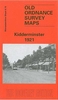
Kidderminster And Wyre Forest 1901-1902 Stanfords
£9.99
Archived Product

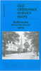
Kidderminster And Wyre Forest 1831-1834 Stanfords
£9.99
Archived Product
Kidderminster And Wyre Forest WATERPROOF Stanfords
£10.39
Archived Product
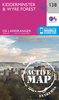
Kidderminster And Wyre Forest OS ACTIVE Map Stanfords
£9.09
Archived Product
Kidderminster And Wyre Forest 1831-1921 (3-map Set) Stanfords
£14.99
Vouchers
No voucher codes found.
Do you know a voucher code for this product or supplier? Add it to Insights for others to use.
Do you know a voucher code for this product or supplier? Add it to Insights for others to use.
 Denmark