
 United Kingdom
 France
 Germany
 Netherlands
 Sweden
 USA
USA
 Italy
Italy
 Spain
Spain
More From Contributor


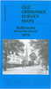


Kidderminster 1921
Kiddermister 1921 in a fascinating series of reproductions of old Ordnance Survey plans in the Alan Godfrey Editions, ideal for anyone interested in the history of their neighbourhood or family. The map covers most of Kidderminster, stretching from Proud Cross and Sutton Road eastward to Chaddesley Road, and from Imperial Avenue southward to Holman Street. Features include GWR railway with station, numerous carpet works, Workhouse (at left margin of map), Stourvale Mill, Long Meadow Mills, Slingfield Spinning Mill, Park Wharf Mills, St John the Baptist church, Infirmary, Staffordshire & Worcestershire Canal, tramways, Constitution Hill area, Cemetery, St George`s church, High Street and town centre, brewery, Holy Trinity Convent, Axminster Works, St Mary & All Saints
church, King Charles I Grammar School, Larkhill area, cattle market, etc. On the reverse is a list of private residents from an 1896 directory. About the Alan Godfrey Editions of the 25” OS Series:Selected towns in Great Britain and Ireland are covered by maps showing the extent of urban development in the last decades of the 19th and early 20th century. The plans have been taken from the Ordnance Survey mapping and reprinted at about 15 inches to one mile (1:4, 340). On the reverse most maps have historical notes and many also include extracts from contemporary directories. Most maps cover about one mile (1.6kms) north/south, one and a half miles (2.4kms) across; adjoining sheets can be combined to provide wider coverage.FOR MORE INFORMATION AND A COMPLETE LIST OF ALL AVAILABLE
TITLES PLEASE CLICK ON THE SERIES LINK.

Product Description
Reviews/Comments
Add New
Intelligent Comparison
Archived Product

Leominster 1927 Stanfords
£3.50
Vouchers
No voucher codes found.
Do you know a voucher code for this product or supplier? Add it to Insights for others to use.
Do you know a voucher code for this product or supplier? Add it to Insights for others to use.
 Denmark