
 United Kingdom
 France
 Germany
 Netherlands
 Sweden
 USA
USA
 Italy
Italy
 Spain
Spain
More From Contributor


Kensington 1894
Kensington in 1894 in a fascinating series of reproductions of old Ordnance Survey plans in the Alan Godfrey Editions, ideal for anyone interested in the history of their neighbourhood or family. Three versions cover the area stretching from Hornton Street to Cadogan Square, from Kensington Palace southward to Harrington Road. The Royal Albert Hall is in the centre of the map and other major features include The Serpentine, Natural History Museum, Brompton Road, Imperial Institute, Cromwell Road, Hyde Park Barracks; South Kensington, Gloucester Road and Kensington High St stations; Victoria & Albert Museum; St Margaret & St John`s Workhouse; Royal Horticultural Gardens (on 1871 map), Kensington Gardens, Kensington Palace, Knightsbridge, etc.About the Alan Godfrey Editions of
the 25” OS Series:Selected towns in Great Britain and Ireland are covered by maps showing the extent of urban development in the last decades of the 19th and early 20th century. The plans have been taken from the Ordnance Survey mapping and reprinted at about 15 inches to one mile (1:4, 340). On the reverse most maps have historical notes and many also include extracts from contemporary directories. Most maps cover about one mile (1.6kms) north/south, one and a half miles (2.4kms) across; adjoining sheets can be combined to provide wider coverage.FOR MORE INFORMATION AND A COMPLETE LIST OF ALL AVAILABLE TITLES PLEASE CLICK ON THE SERIES LINK.
the 25” OS Series:Selected towns in Great Britain and Ireland are covered by maps showing the extent of urban development in the last decades of the 19th and early 20th century. The plans have been taken from the Ordnance Survey mapping and reprinted at about 15 inches to one mile (1:4, 340). On the reverse most maps have historical notes and many also include extracts from contemporary directories. Most maps cover about one mile (1.6kms) north/south, one and a half miles (2.4kms) across; adjoining sheets can be combined to provide wider coverage.FOR MORE INFORMATION AND A COMPLETE LIST OF ALL AVAILABLE TITLES PLEASE CLICK ON THE SERIES LINK.

Product Description
Reviews/Comments
Add New
Intelligent Comparison
Archived Product

Kensington 1914 Stanfords
£3.50
Archived Product

Kensington 1871 Stanfords
£3.50
Archived Product

Kensington Stanfords
£12.99
Archived Product

Heston 1894 Stanfords
£3.50
Archived Product
Ashington 1896 Stanfords
£2.95
Archived Product
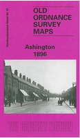
Ashington 1896 Stanfords
£3.50
Archived Product

Dunston 1894 Stanfords
£3.50
Archived Product
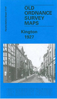
Kington 1927 Stanfords
£3.50
Vouchers
No voucher codes found.
Do you know a voucher code for this product or supplier? Add it to Insights for others to use.
Do you know a voucher code for this product or supplier? Add it to Insights for others to use.
 Denmark