More From Contributor
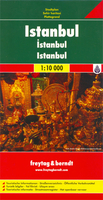
£9.99
Cougar, Tiger, & Rattlesnake Mountain Parks in Washington State in an extensive series of GPS compatible, contoured hiking maps of USA’s national & state parks or forests & other popular recreational areas. Cartography based on the national topographic survey, with additional tourist information. The maps, with most titles now printed on light, waterproof & tear-resistant plastic paper, highlight walking trails along with campsites & other accommodation, picnic sites, areas for various recreational pursuits such as horse riding or skiing, drinking water sources, & many other facilities of interest to the outdoor enthusiast. Cartography is based on information from the USGS (United States Geological Survey
- the country’s national survey organization), revised by the National Geographic Maps in cooperation with the National Park Service, USDA Forest Service, etc. Topography is excellently presented by contours (interval varies according to scale), enhanced by relief shading & colouring/graphics for wood cover, glaciers, etc. All heights are given in feet. The maps have a UTM grid plus latitude & longitude margin ticks & GPS waypoints for selected important locations. Each map is double-sided to give either maximum coverage of the chosen area or additional enlargements of its important sections. Accompanying notes provide useful information on relevant regulations, safety precautions, contact addresses, etc.IMPORTANT
- PLEASE NOTE: the series is very extensive, ranging in scale from 1:400, 000 for the vast national parks of Alaska to 1:25, 000 for local map in several states. We recommend, therefore, viewing the series by state rather than the whole list.

...
Archived Product
£12.99
Topographic survey of France at 1:25, 000 in IGN`s excellent TOP25 / Série Bleue series. All the maps are GPS compatible, with a 1km UTM grid plus latitude & longitude lines at 5’ intervals. Contours are at 5m intervals except for mountainous areas where the maps have contours at 10m intervals, vividly enhanced by hill shading & graphics for rocky terrain. Colouring with graphics indicates different types of vegetation or land use (deciduous or coniferous forests, moors, orchards, vineyards, etc). PLEASE NOTE: coverage of France at this scale is currently being revised – the format & the presentation of each title are indicated by the letters at the end of its Sheet Reference number (e.g. 0416ET, 3531ETR, 1923SB, etc.)MAPS WITH FULL TOURIST OVERPRINT & AN ENGLISH MAP LEGEND: all TOP25 maps & the SB editions of Série Bleue have an overprint highlighting waymarked walking trails including long-distance GR routes &, where appropriate, ski routes. Symbols indicate campsites, gîtes d’etape, refuges, equestrian centres & other recreational facilities or sites, tourist information centres, cultural heritage, etc. Towns & locations of particular interest are highlighted.- ET or OT = single-sided TOP25 map covering approx. 29x 21 km / 18x 13 miles.- ETR or OTR = waterproof & tear resistant TOP25 map covering the same area as the corresponding ET or OT number, but double-sided, printed on a smaller size sheet with a good overlap between the sides.- SB = Série Bleue map with full tourist overprint; these maps, first introduced in summer 2014, each cover approx. 29x 24km / 18x 15 miles.SÉRIE BLEUE maps with numbers ending in E (Est) or O (Ouest): most editions now indicate the GR routes, but do not show any other tourist information. Map legend is in French only. Each map covers approx. 14x 20km / 9x 12 miles. ...
Archived Product
£6.50
Topographic coverage of mainland Spain at 1:25, 000 published by the Centro Nacional de Información Geograficá, the country’s civilian survey organization. The maps have contours at 10m intervals & colouring and/or graphics to show different types of vegetation or land use. Boundaries of national parks & other protected areas are marked. In addition to all the usual information shown on topographic maps at this scale, detailed presentation of the road & rail networks, rural tracks & paths, etc, the maps also show campsites. The maps have a 1-km UTM grid, with margin ticks for latitude & longitude at 1` intervals. Map legend is in Spanish only.PLEASE NOTE: our grid for the whole of Spain is in preparation
- in the meantime, for areas other than those shown on the attached grid please use CNIG’s topographic survey at 1:50, 000 by searching for ‘SI00000832’. Each 25K map covers one quarter of the corresponding 50K map, with the numbering system: I = NW quarter, II = NE quarter, III = SW quarter & IV = SE quarter. CNIG maps in the Provincial Road Maps series at 1:200, 000 are overprinted with the grid for the 1:50, 000 survey & can be used to see the area covered by each 50K or 25K title in more detail. To see the list of titles in this series please click on the series grid
- for map numbers not yet listed on our website please contact us by email.

...
Archived Product
£11.19
Istanbul in the Countries, Regions & Cities series from Rough Guides; comprehensively detailed guidebooks specifically designed for independent travellers & serving a range of worldwide destinations. Widely recognised for their free editorial style, Rough Guide authors are allowed to express their personal opinions on a range of subjects. Although sometimes controversial, this editorial stance allows readers to experience more detailed & personal takes on each destination, a feature often more limited in other guidebooks. Cultural & historical nuances are explored in significant depth throughout the text & descriptions on the ambience of individual settings alongside personal recommendations, particularly in cities, are notably prevalent. Each Rough Guide in the Countries, Regions & Cities series has a similar layout. A ...
Archived Product
£4.99
Istanbul in the Luxe city guides series, which are slim & small enough to fit easily in a pocket or handbag. Information is distilled from elite suggestions by city residents, specially selected for their style, knowledge & expertise. Luxe guides aim at the upper end of the market & subjectively edit to choose the very best recommendations for shopping, restaurants, leisure options & nightlife. Half day shopping & activity itineraries are suggested for you to mix & match your visit to suit your timetable. When folded close the cardboard guide slots into its own protective plastic frame. Vanity Fair magazine calls them ...
Archived Product
£25.00
Step onto the streets of Istanbul & you`ll see a city of wonderful contradictions: wander out of an edgy bar & you`re likely to turn a corner & stumble across colonial-era embassy buildings & tea houses brimming with old men playing okey. It`s this fascinating culture, where east meets west, that inspired Rebecca Seal & Steven Joyce to create Istanbul, a food tour of this wonderful city. Rebecca`s easy yet delicious recipes capture the flavours of Turkey, incorporating both modern & traditional flavours. Whip up Cilbir
- Turkish poached eggs & garlic
- for a lazy Sunday breakfast, or aubergines stuffed with lamb for a satisfying lunch. Learn about the key Turkish ingredients that are not only easy to find but will make your dishes taste authentic.

...
Archived Product
£16.99
Istanbul is the only city in the world that stands astride two continents, spreading across from Europe into Asia at the southern end of the Bosphorus, the incomparably beautiful strait linking the Black Sea with the Sea of Marmara in northwestern Turkey. This Companion Guide to Istanbul goes as far as the region around Marmara from the Bosphorus to the Dardanelles, which flows into the Aegean past the historic ruins of Troy on its Asian shore. Revised & updated for this new edition, the book is a guide to the Byzantine & Ottoman monuments & to the many other places of great historic interest around the Marmara, including Edirne, Bursa & Iznik, ancient Nicaea, as well as the renowned archaeological site of Homeric Troy. It is also an introduction to Turkey itself & to its people & their way of life, which they are more than willing to share with the traveller who takes the time to become acquainted with them. JOHN FREELY has lived & worked on America`s east coast, in Britain, & around the Mediterranean, but is long-time Professor of Physics at the University of the Bosphorus, Istanbul, & has been resident for many years in Turkey. His understanding of the land & its people has made him a respected interpreter of Turkey ancient & modern. ...
Archived Product
£4.99
Istanbul in the Luxe city guides series, which are slim & small enough to fit easily in a pocket or handbag. Information is distilled from elite suggestions by city residents, specially selected for their style, knowledge & expertise. Luxe guides aim at the upper end of the market & subjectively edit to choose the very best recommendations for shopping, restaurants, leisure options & nightlife. Half day shopping & activity itineraries are suggested for you to mix & match your visit to suit your timetable. When folded close the cardboard guide slots into its own protective plastic frame. Vanity Fair magazine calls them ...
Archived Product

Istanbul

Central Istanbul at 1:10, 000 on a laminated, waterproof and tear-resistant street plan from the AA with on the reverse a mini guide to the city highlighting its top 25 sights, recommendations for eating out and shopping, plus general tourist information.The plan covers just the central district of the city with its main sights (Dolmabah
RIP - This product is no longer available on our network. It was last seen on 25.09.2019

This page now acts as a permanent archive for this product. Add more information using the comments box below to ensure it can still be found by future generations.

Use our search facility to see if it is available from an alternative contributor.
  • External links may include paid for promotion
  • Availability: Out Of Stock
  • Supplier: Stanfords
  • SKU: 9780749562076
Availability: In Stock
£4.99

Product Description

Central Istanbul at 1:10, 000 on a laminated, waterproof & tear-resistant street plan from the AA with on the reverse a mini guide to the city highlighting its top 25 sights, recommendations for eating out & shopping, plus general tourist information. The plan covers just the central district of the city with its main sights (Dolmabah

Reviews/Comments

Add New

Price History

Vouchers

No voucher codes found.
Do you know a voucher code for this product or supplier? Add it to Insights for others to use.

Facebook

Jargon Buster

Waterproof - Resistant to water, usualy specified by depth in metres
Resistant - Something that can repel against something.
Laminated - A thin layer of plastic that gives a coating and shine to a material.

Supplier Information

Stanfords
Stanfords was established in 1853 and opened their iconic Covent Garden flagship store in 1901. They have become the top retailer of maps, travel books and accessories in the UK and arguably offer the largest selection of maps and travel books worldwide. Famous names such as Captain Robert Falcon Scott, Ranulph Fiennes and Michael Palin have purchased from Stanfords. They now have a shop in Bristol and both stores together with other venues operate a calendar of events including talks, book signings and exhibitions. As a specialist map retailer, the map selection is comprehensive and includes road maps, street maps and walking maps from worldwide destinations, as well as a selection of world atlases and wall maps. Books include travel guides and travel literature. Stanfords also stock globes, from miniatures made of blue marble to magnificent floor-standing globes. The website features a selection of interesting articles on travel topics.
Page Updated: 2023-11-12 20:15:36

Community Generated Product Tags

Oh No! The productWIKI community hasn't generated any tags for this product yet!
Menu