
 United Kingdom
 France
 Germany
 Netherlands
 Sweden
 USA
USA
 Italy
Italy
 Spain
Spain
More From Contributor


India South Borch
Laminated waterproof road map of southern India at 1:3, 000, 000 from Borch, with 1:30, 000 plans of: Mumbai; Chennai; Hyderabad; Old Goa; Madurai; Thiruvananthapuram; Hampi; Kolkata; and Kochi. The main road network is shown with distances marked in kilometres, with minor roads and some country paths also displayed. Railway lines are marked. Spot heights are used to denote any topographical information. Points of interest such as monuments, places of worship, and national parks are clearly marked, as well as local facilities such as hospitals and post offices. Administrative and national boundaries are prominently marked.The street plans on the reverse of the map show most major road names, with bus and rail lines and stops marked where present, as well as points of interest.The
map also provides a small map of Indian administrative and time zones, as well as a small box detailing climate, population and statistical data on IndiaAll maps are indexed. Map legend includes English.
map also provides a small map of Indian administrative and time zones, as well as a small box detailing climate, population and statistical data on IndiaAll maps are indexed. Map legend includes English.

Product Description
Reviews/Comments
Add New
Intelligent Comparison
Archived Product
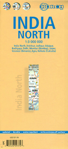
India North Borch Stanfords
£9.99
Archived Product
India South Stanfords
£9.50
Archived Product
India South Handbook Stanfords
£15.99
Archived Product

India South Handbook Stanfords
£14.99
Vouchers
No voucher codes found.
Do you know a voucher code for this product or supplier? Add it to Insights for others to use.
Do you know a voucher code for this product or supplier? Add it to Insights for others to use.
 Denmark