
 United Kingdom
 France
 Germany
 Netherlands
 Sweden
 USA
USA
 Italy
Italy
 Spain
Spain
More From Contributor

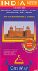


India Road Edition Wall Map
India Road Edition Wall Map at 1:2, 000, 000 from Gizi Map, size 86 x 124cm (34” x 49” approx). Coverage includes the whole of Nepal and Bangladesh plus large sections of Burma/Myanmar, Pakistan and Afghanistan. The eastern states of India, the Maldives, and the Andaman and Nicobar Islands are shown on insets.The map presents the region’s road and rail networks on a base showing the topography by relief shading, with plenty of names of mountain and hill ranges, peak heights, etc. Distances are marked on main roads and symbols indicate various places of interest. Also shown are internal administrative boundaries and names of the states, and in the north ceasefire lines and disputed borders; a separate inset shows an administrative map of the country with states in different
colours. Where appropriate, the map shows both current Indian city names and their historical versions (Lakhnau/Lucknow, Varanasi/Benares, Vadaroda/Baroda, etc). Lines of latitude and longitude are drawn at 2° intervals. The index is on the reverse. Map legend includes English.Please note: this title is also available in a folded format. The same map but with altitude colouring as the background is also available as a folded map or a wall map.
colours. Where appropriate, the map shows both current Indian city names and their historical versions (Lakhnau/Lucknow, Varanasi/Benares, Vadaroda/Baroda, etc). Lines of latitude and longitude are drawn at 2° intervals. The index is on the reverse. Map legend includes English.Please note: this title is also available in a folded format. The same map but with altitude colouring as the background is also available as a folded map or a wall map.
Product Description
Reviews/Comments
Add New
Vouchers
No voucher codes found.
Do you know a voucher code for this product or supplier? Add it to Insights for others to use.
Do you know a voucher code for this product or supplier? Add it to Insights for others to use.
 Denmark