
 United Kingdom
 France
 Germany
 Netherlands
 Sweden
 USA
USA
 Italy
Italy
 Spain
Spain
More From Contributor

Hull Hessle Road 1890 (Colour Edition)
Hull Hessle Road 1890 in a fascinating series of reproductions of old Ordnance Survey plans in the Alan Godfrey Editions, ideal for anyone interested in the history of their neighbourhood or family. Selected towns in Great Britain and Ireland are covered by maps showing the extent of urban development in the last decades of the 19th and early 20th century.In this title: two versions have been published for this area, with the 1890 version in full colour, taken from the beautiful hand-coloured 1st Edition OS map. The maps cover the southern area of Hull along Hessle Road and including several of the docks. Coverage stretches from Hawthorn Avenue eastward to the Albert Dock Basin, and from Woodcock Street southward to the Humber. Features include Holy Trinity Burial Ground, tramways and
depot, St Andrew's Dock, William Wright Dock with graving dock, Albert Dock, Neptune Street station, many warehouses and sidings with full track layout given, St James church, Billingsgate goods station, Subway Junction, St Barnabas church, wagon works, etc. Adjacent sheet 240.07 is included as an inset. On the reverse are selections of directory entries; on the 1890 map including the St Andrew's Dock entry. About the Alan Godfrey Editions of the 25
depot, St Andrew's Dock, William Wright Dock with graving dock, Albert Dock, Neptune Street station, many warehouses and sidings with full track layout given, St James church, Billingsgate goods station, Subway Junction, St Barnabas church, wagon works, etc. Adjacent sheet 240.07 is included as an inset. On the reverse are selections of directory entries; on the 1890 map including the St Andrew's Dock entry. About the Alan Godfrey Editions of the 25
Product Description
Reviews/Comments
Add New
Intelligent Comparison
Archived Product
Hull Hessle Road 1890 (Colour Edition) Stanfords
£4.50
Archived Product
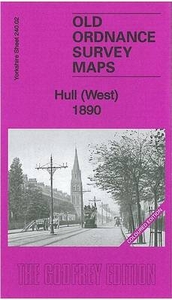
Hull West 1890 (Colour Edition) Stanfords
£4.50
Archived Product
Hull East 1890 (Colour Edition) Stanfords
£4.50
Archived Product
Hereford 1885 (Colour Edition) Stanfords
£3.50
Archived Product
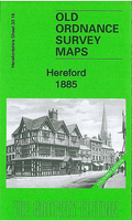
Hereford 1885 (Colour Edition) Stanfords
£4.50
Archived Product
Barnsley 1890 (Colour Edition) Stanfords
£4.50
Archived Product
Burslem 1877 (Colour Edition) Stanfords
£4.50
Archived Product

Dudley West 1881 (Colour Edition) Stanfords
£4.50
Vouchers
No voucher codes found.
Do you know a voucher code for this product or supplier? Add it to Insights for others to use.
Do you know a voucher code for this product or supplier? Add it to Insights for others to use.
 Denmark