
 United Kingdom
 France
 Germany
 Netherlands
 Sweden
 USA
USA
 Italy
Italy
 Spain
Spain
More From Contributor


Horley 1912
Horley in 1912 in a fascinating series of reproductions of old Ordnance Survey plans in the Alan Godfrey Editions, ideal for anyone interested in the history of their neighbourhood or family. Horley station, on the London-Brighton line, opened in 1841 and the map shows the village that grew up around it. The railway runs north-south through the map, and the station is almost in the centre; housing development is shown to the north and west, as far as Horley Street. A few houses are also being built to the east near the Balcombe Road. To the south-west is Gatwick manor house, and the northern part of Gatwick Race Course, today lost beneath the airport. A directory of Horley is on the reverse.About the Alan Godfrey Editions of the 25” OS SeriesSelected towns in Great Britain and
Ireland are covered by maps showing the extent of urban development in the last decades of the 19th and early 20th century. The plans have been taken from the Ordnance Survey mapping and reprinted at about 15 inches to one mile (1:4, 340). On the reverse most maps have historical notes and many also include extracts from contemporary directories. Most maps cover about one mile (1.6kms) north/south, one and a half miles (2.4kms) across; adjoining sheets can be combined to provide wider coverage.FOR MORE INFORMATION AND A COMPLETE LIST OF ALL AVAILABLE TITLES PLEASE CLICK ON THE SERIES LINK.
Ireland are covered by maps showing the extent of urban development in the last decades of the 19th and early 20th century. The plans have been taken from the Ordnance Survey mapping and reprinted at about 15 inches to one mile (1:4, 340). On the reverse most maps have historical notes and many also include extracts from contemporary directories. Most maps cover about one mile (1.6kms) north/south, one and a half miles (2.4kms) across; adjoining sheets can be combined to provide wider coverage.FOR MORE INFORMATION AND A COMPLETE LIST OF ALL AVAILABLE TITLES PLEASE CLICK ON THE SERIES LINK.

Product Description
Reviews/Comments
Add New
Intelligent Comparison
Archived Product

Hornsey 1912 Stanfords
£3.50
Archived Product

Wordsley 1901 Stanfords
£3.50
Archived Product
Wordsley 1901 Stanfords
£2.95
Archived Product
Warley 1902 Stanfords
£3.50
Archived Product
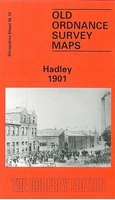
Hadley 1901 Stanfords
£3.50
Archived Product

Morley 1906 Stanfords
£3.50
Archived Product

Purley 1910 Stanfords
£3.50
Vouchers
No voucher codes found.
Do you know a voucher code for this product or supplier? Add it to Insights for others to use.
Do you know a voucher code for this product or supplier? Add it to Insights for others to use.
 Denmark