
 United Kingdom
 France
 Germany
 Netherlands
 Sweden
 USA
USA
 Italy
Italy
 Spain
Spain
More From Contributor


Harz Regional Park: Western Part
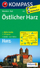
One of the titles in a series of detailed maps of selected areas of Lower Saxony, with cartography of the German topographic survey. Overprint highlights numerous hiking paths, including those suitable for wheelchairs, and cycling routes, indicating their waymarking. Road network is also annotated with symbols showing various sightseeing routes.An extensive range of symbols mark different types of accommodation, sport and leisure facilities, and numerous places of interest. All the maps have a UTM grid. Map legends are in German only. Some titles come with a separate booklet, in German, providing more information on the area, including opening hours, contact details, etc.

Product Description
Reviews/Comments
Add New
Intelligent Comparison
Archived Product

Bavarian Forest Regional Park: Western Part Stanfords
£11.50
Archived Product
Bavarian Forest Regional Park: Western Part Stanfords
£8.25
Archived Product

Fichtelgebirge Regional Park: Western Part Stanfords
£8.25
Archived Product
Spessart Regional Park: Northern Part Stanfords
£12.50
Archived Product
Spessart Regional Park: Southern Part Stanfords
£8.25
Archived Product
Steigerwald Regional Park: Southern Part Stanfords
£8.25
Archived Product
Bavarian Forest Regional Park: Southern Part Stanfords
£8.25
Archived Product

Oberpfälzer Wald Regional Park: Eastern Part Stanfords
£11.50
Vouchers
No voucher codes found.
Do you know a voucher code for this product or supplier? Add it to Insights for others to use.
Do you know a voucher code for this product or supplier? Add it to Insights for others to use.
 Denmark