More From Contributor
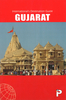
£6.95
Topographic coverage of mainland Spain at 1:50, 000 in the MTN50 (Mapa Topográfico Nacional) series from the Centro Nacional de Información Geografica, the country’s civilian survey organization. The maps have contours at 20m intervals, enhanced by relief shading, plus colouring and/or graphics to show different types of terrain, vegetation or land use. Boundaries of national parks & other protected areas are marked. In addition to all the usual information featured on topographic mapping at this scale, detailed presentation of the road & rail networks, rural tracks & paths, etc, the maps also show campsites & mountain refuges. On more recent editions some GRs, the official long-distance hiking routes, are also marked (although not as clearly as on hiking maps from other publishers). Each map covers 29.5x 18.5 km (with adjustments in the border or coastal areas). The maps have a 1-km UTM grid, plus margin ticks for latitude & longitude at 1` intervals. Map legend is in Spanish only.HOW TO CHOOSE THE RIGHT 50K MAP: all the titles in CNIG’s 200K Provincial Road Maps series at 1:200, 000 are overprinted with the grid for the 1:50, 000 maps & can be used to see the area covered by each 50K title. TO SEE THE LIST OF TITLES IN THIS SERIES PLEASE CLICK ON THE SERIES LINK.PLEASE NOTE
- MAP TITLES: the grids shown on our website serve both the civilian & the military 1:50, 000 topographic series. Although the areas covered by maps in both series are identical (apart from some border or coastal sheets), occasionally map titles differ – only one title is shown on the grid, usually the military one. In Galicia, the Basque country & in the Catalan speaking areas the tendency now is to use local place names rather than the often better known Castilian ones. Where possible, both versions are included in our titles. Map titles listed on our website are based on information received by us at the time of publication, but sometimes maps arrive showing a completely different title! As long as the map number is as ordered, the correct map has been supplied.
...
Archived Product
£15.95
Guizhou in the Odyssey Guides series; aimed at travellers particularly interested in the culture & history of their destination; the guides focus on the atmosphere, customs, & distinctive character of a country, region or city. As the only English language publisher based in China, Odyssey Guides specialize in Asian destinations, relying on the expertise of local writers. This gives readers more of an insider ...
Archived Product
£6.25
Gujarat in a series of locally produced administrative maps of Indian states, each with a booklet providing a guide to the area. The maps show the division of each state into districts & have more small towns & villages than on more general maps of India available from other publishers. Presentation is now considerably enhanced with the districts shown in different colours. The maps indicate each district ...
Archived Product
£4.50
Gujarat in a series of waterproof & tear-resistant maps from Bharat Graphics, showing local districts in different colours & indicating both administrative headquarters of each district & of its subdivisions, the tehsils (or tahsils, tahasils, talukas, taluks, taluqs). Roads are classified as national or state highways & other roads, some with driving distances. Railway lines are also marked & some titles have symbols indicating places of interest or rest houses. Maps of states in mountainous areas show names of main valleys, on other titles there is no topographic information. The maps have no geographical coordinates. Some titles include insets with enlargements of popular areas or street plans, & distance tables. All the maps are indexed & have a small booklet providing a basic guide to the state district by district. The maps are printed on a waterproof & tear-resistant paper. Please note: the various series of state maps of India often show different small villages, supplementing each other to provide a more detail picture of each state. ...
Archived Product
£7.50
Indian state of Gujarat, on road map from the Delhi-based International Publications, showing many small towns & villages. Please note that, unlike most other titles in this series, this one comes without an accompanying booklet. Additional features around the main map include a physical maps of the state, plus small maps showing annual rainfall, cash crops & industry, plus a distance chart & a facts-&-figures table. Unless indicated to the contrary in the individual description, maps in this series present the state with its constituent districts in different colours & also show the division of districts into talukas. Town symbols indicate both district & taluka headquarters. Road network

Includes::
many local roads, some with driving distances, although sometimes locations are marked without road access to them shown on the map. Railway lines are included & local airports are marked. Symbols indicate various locations of interest, including historical sites, wildlife sanctuaries, beaches, etc. In many titles additional panels around the main map and/or in the accompanying booklet provide more information: enlargements with more detailed presentation of the road network, street plans of main cities, etc. To see the list of titles in this series please click on the series link.

...
Archived Product
£4.95
Road atlas of the state with maps arranged by administrative districts. Road information gives distances but does not indicate the type of road surface. The maps show railway lines, places of interest such as hill stations, beaches, historical & religious centres, etc. The atlas also contains rather basic street plans of main towns, indicating important public buildings, monuments, etc. Brief descriptions of each district include details of population, literacy, etc. ...
Archived Product
£17.95
Gujranwala on a large indexed plan with names of districts, colonies & main streets. The plan names various public buildings, industrial & agricultural establishments, etc. & marks locations of religious buildings of various denominations, hotels & rest houses & petrol stations, etc. On the reverse is index, details of railway connections to the city, lists of hotels & restaurants, etc., & dialing codes for various Pakistani towns. ...
Archived Product
£12.99
This landmark book uncovers for the first time in detail one of the greatest horrors of the twentieth century: the vast system of Soviet camps that were responsible for the deaths of countless millions. ” Gulag” is the only major history in any language to draw together the mass of memoirs & writings on the Soviet camps that have been published in Russia & the West. Using these, as well as her own original research in NKVD archives & interviews with survivors, Anne Applebaum has written a fully documented history of the camp system: from its origins under the tsars, to its colossal expansion under Stalin`s reign of terror, its zenith in the late 1940s & eventual collapse in the era of glasnost. It is a gigantic feat of investigation, synthesis & moral reckoning. ...
Archived Product
£9.95
The monuments of Gulbarga, Bidar & Bijapur in northern Karnataka, once part of a vibrant culture that flourished under the Bahmani & Adil Shahi sultans during the 14th to 17th centuries, are among the less visited sites within the state but still include many interesting temples & other monuments. This illustrated guide published in cooperation with the Deccan Heritage Foundation, fill a useful gap with its informative text, numerous colour photos, & site plans. ...
Archived Product
£12.99
The Gulf Country spanning the western coastline of Queensland & the north-eastern part of Northern Territory on a GPS compatible map at 1:1, 500, 00 from Westprint, with on the reverse descriptions of the region’s 34 best sights plus other useful tourist information. Coverage extends from the south-western coast of Cape York to Katherine in the north-western corner of the map, & south to Mount Isa on the Barkly Highway. Other main routes include the Stuart Highway between the Davenport Range & Katherine, the Great Top Road, the Tablelands Highway, etc. Road network indicates unsealed routes, 4WD tracks, private tracks requiring entry permits, driving distances on most routes, grids & gates, etc. 21 locations are annotated with their GPS waypoints & symbols indicate fuel supplies, campsites/caravan parks, rest areas, Desert Parks Pass Agency offices, etc, Also marked are routes of Australia’s early explorers. Topography is indicated by relief shading, with colouring to national parks/protected areas & Aboriginal Lands. Numerous small rivers, creeks & lakes are named. Several locations are annotated with brief descriptions. In addition to the GPS waypoints the map has latitude & longitude lines at 1º intervals, with margin ticks at 10’. On the reverse are tourist tips, including description of 34 recommended sights grouped along the Stuart Highway, the Great Top Road & the Barkly Highway. ...
Archived Product

Gujarat Road Atlas

Road atlas of the state with maps arranged by administrative districts. Road information gives distances but does not indicate the type of road surface. The maps show railway lines, places of interest such as hill stations, beaches, historical and religious centres, etc. The atlas also contains rather basic street plans of main towns, indicating important public buildings, monuments, etc. Brief descriptions of each district include details of population, literacy, etc.
RIP - This product is no longer available on our network. It was last seen on 25.09.2019

This page now acts as a permanent archive for this product. Add more information using the comments box below to ensure it can still be found by future generations.

Use our search facility to see if it is available from an alternative contributor.
  • External links may include paid for promotion
  • Availability: Out Of Stock
  • Supplier: Stanfords
  • SKU: XL00000066437
Availability: In Stock
£4.95

Product Description

Road atlas of the state with maps arranged by administrative districts. Road information gives distances but does not indicate the type of road surface. The maps show railway lines, places of interest such as hill stations, beaches, historical & religious centres, etc. The atlas also contains rather basic street plans of main towns, indicating important public buildings, monuments, etc. Brief descriptions of each district include details of population, literacy, etc.

Reviews/Comments

Add New

Price History

Vouchers

No voucher codes found.
Do you know a voucher code for this product or supplier? Add it to Insights for others to use.

Facebook

Jargon Buster

Road - a manmade lane or a path that is used to speed up travel.

Supplier Information

Stanfords
Stanfords was established in 1853 and opened their iconic Covent Garden flagship store in 1901. They have become the top retailer of maps, travel books and accessories in the UK and arguably offer the largest selection of maps and travel books worldwide. Famous names such as Captain Robert Falcon Scott, Ranulph Fiennes and Michael Palin have purchased from Stanfords. They now have a shop in Bristol and both stores together with other venues operate a calendar of events including talks, book signings and exhibitions. As a specialist map retailer, the map selection is comprehensive and includes road maps, street maps and walking maps from worldwide destinations, as well as a selection of world atlases and wall maps. Books include travel guides and travel literature. Stanfords also stock globes, from miniatures made of blue marble to magnificent floor-standing globes. The website features a selection of interesting articles on travel topics.
Page Updated: 2023-11-12 20:15:36

Community Generated Product Tags

Oh No! The productWIKI community hasn't generated any tags for this product yet!
Menu