
 United Kingdom
 France
 Germany
 Netherlands
 Sweden
 USA
USA
 Italy
Italy
 Spain
Spain
More From Contributor

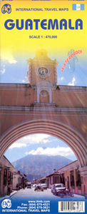
Guatemala ITMB
Indexed, double-sided map, printed on waterproof and tear-resistant paper, with street plans of Guatemala City and Antigua, plus an enlargement of the environs of the capital. The country is divided north/south with a generous overlap between the two sides. Elevation colouring with spot heights indicates the topography, with sand and swamp areas, as well as active volcanoes also marked. Road network includes seasonal tracks, and indicates intermediate distances on major and some minor roads plus locations of selected petrol stations. Railways, local airports and landing strips, ferry routes on Lake Izabal, plus the country’s local administrative boundaries with names of the provinces are also shown. National parks and biosphere reserves are clearly highlighted, with symbols
showing archaeological sites, waterfalls, caves, mines, wells, etc. Latitude & longitude lines are drawn at 30’ intervals.The map has an extensive index of place names, with each side indexed separately. Insets show street plans of Guatemala City and Antigua, highlighting selected accommodation, shopping centres, bus terminals, places of interest, etc. Also included is an enlargement of the environs of the capital, including the volcanoes (Acatenango, de Fuego, and de Agua) lying to the south west.
showing archaeological sites, waterfalls, caves, mines, wells, etc. Latitude & longitude lines are drawn at 30’ intervals.The map has an extensive index of place names, with each side indexed separately. Insets show street plans of Guatemala City and Antigua, highlighting selected accommodation, shopping centres, bus terminals, places of interest, etc. Also included is an enlargement of the environs of the capital, including the volcanoes (Acatenango, de Fuego, and de Agua) lying to the south west.

Product Description
Reviews/Comments
Add New
Intelligent Comparison
Archived Product
Guatemala Stanfords
£11.99
Archived Product
Guatemala Stanfords
£8.99
Archived Product

Guatemala Stanfords
£14.99
Archived Product

Guatemala Stanfords
£14.99
Archived Product
Australia ITMB Stanfords
£9.99
Vouchers
No voucher codes found.
Do you know a voucher code for this product or supplier? Add it to Insights for others to use.
Do you know a voucher code for this product or supplier? Add it to Insights for others to use.
 Denmark