More From Contributor

£4.99
Guatemala City & Antigua in the Moon Spotlight guide series; covering a range of specific local cities, districts, areas & regions in North, Central & South America & targeted at those seeking to travel to a specific area within a country. Each of the guides has been extracted in full from the relevant country Moon Handbook & individual titles focus on a particular city, region or notable area of the destination. Many of the guides in the series are unique in their coverage, although are limited in putting the destination into its wider geographical context that a more comprehensive guide would provide. Stylistically, Moon ...
Archived Product
£8.99
Discover black sand beaches on the Pacific coast, a lake crowned by volcanoes & an ancient civilization that came to an abrupt end, leaving its history hidden within the ruins of jungle-clad temples. Travel from beautiful colonial cities & sleepy villages, to deserted beaches & lush rainforests. Footprint Guatemala covers all the top attractions in this colourful country, plus lesser-known sights off the beaten track. This new edition of features enhanced layout both inside & out, including an inspirational colour section, two-colour text, a highlights map, & an easy-to-locate contents page & practicalities section. This guide provides recommendations for all budgets on where to eat, sleep & sample tequila, as well as the low-down on the region`s best fiestas & adventure activities. Essentials section with practical advice on getting there & around. Highlights map so you know what not to miss. Comprehensive listings including where to eat, sleep & have fun. Detailed street maps for Guatemala City & other important towns & sights. Slim enough to fit in your pocket. Loaded with advice & information, this concise Footprint guide will help you get the most out of Guatemala without weighing you down. ...
Archived Product
£7.99
Despite the arrival of the  New Dawn` as prophesised by the Maya, Guatemala is still a country beset with social tension & disparities in wealth. Topics covered include: History: From the classic Maya to the Colonial period; Politics: The long night of military rule, human rights & the peace process; Economy & Society: The wealth of the l&, the private sector & development alternatives; Religion & culture: Religious diversity, Mayan identity & US influence. About this series: Given the turbulent history of many Central American & Latin American countries, travellers need as much information as they can get in order make the most of a visit. These illustrated titles offer up-to-date coverage of the main historical, economic, political, social & the environmental issues affecting a country. Published by the Latin America Bureau, an independent research group working to broaden public understanding of issues of human rights & social & economic justice in Latin America & the Caribbean. ...
Archived Product
£9.99
Indexed, double-sided map, printed on waterproof & tear-resistant paper, with street plans of Guatemala City & Antigua, plus an enlargement of the environs of the capital. The country is divided north/south with a generous overlap between the two sides. Elevation colouring with spot heights indicates the topography, with sand & swamp areas, as well as active volcanoes also marked. Road network

Includes::
seasonal tracks, & indicates intermediate distances on major & some minor roads plus locations of selected petrol stations. Railways, local airports & landing strips, ferry routes on Lake Izabal, plus the country’s local administrative boundaries with names of the provinces are also shown. National parks & biosphere reserves are clearly highlighted, with symbols showing archaeological sites, waterfalls, caves, mines, wells, etc. Latitude & longitude lines are drawn at 30’ intervals. The map has an extensive index of place names, with each side indexed separately. Insets show street plans of Guatemala City & Antigua, highlighting selected accommodation, shopping centres, bus terminals, places of interest, etc. Also included is an enlargement of the environs of the capital, including the volcanoes (Acatenango, de Fuego, & de Agua) lying to the south west.

...
Archived Product
£4.99
Guatemala's Western Highlands in the Moon Spotlight guide series; covering a range of specific local cities, districts, areas & regions in North, Central & South America & targeted at those seeking to travel to a specific area within a country. Each of the guides has been extracted in full from the relevant country Moon Handbook & individual titles focus on a particular city, region or notable area of the destination. Many of the guides in the series are unique in their coverage, although are limited in putting the destination into its wider geographical context that a more comprehensive guide would provide. Stylistically, Moon ...
Archived Product
£19.50
Central Gauteng conurbation, including Johannesburg & Soweto, in an A4, spiral-bound street atlas from South Africa’s leading map publishers Map Studio. The atlas provides continuous mapping at 1:20, 000 of the area shown on our coverage image, with central Johannesburg shown in greater detail at 1:12, 500. The maps show the area with names of districts & suburbs & are annotated with an extensive range of symbols indicating various public buildings & cultural institutions, hotels & other accommodation, shopping centres, embassies & consulates, various places of interest, etc. Map legend with all the explanatory signs is conveniently placed under each set of double pages for easy reference. The atlas has an extensive street index & also

Includes::
a route planning map of the area with names of intersections, plus plans of the country’s international airports in Cape Town, Durban & Johannesburg.

...
Archived Product
£17.99
Topographic mapping from Mexico’s national survey agency, Instituto Nacional de Estadística, Geografía e Informática. The maps have contours at 20m intervals with relief shading & indicate various types of terrain & vegetation, e.g. dense vegetation, cultivated areas, swamps, sand dunes, salt pans, etc. UTM grid is at 10km intervals, with latitude & longitude shown by margin ticks at intervals of 5`. Map legend is in Spanish only. To see the other titles in this series please click on the series link. ...
Archived Product
£7.95
Map No. 664, Gubbio
- Fabriano, from Kompass in a series of walking maps of selected areas of Italy at 1:50, 000, with hiking
...
Archived Product
£6.50
Topographic coverage of mainland Spain at 1:25, 000 published by the Centro Nacional de Información Geograficá, the country’s civilian survey organization. The maps have contours at 10m intervals & colouring and/or graphics to show different types of vegetation or land use. Boundaries of national parks & other protected areas are marked. In addition to all the usual information shown on topographic maps at this scale, detailed presentation of the road & rail networks, rural tracks & paths, etc, the maps also show campsites. The maps have a 1-km UTM grid, with margin ticks for latitude & longitude at 1` intervals. Map legend is in Spanish only.PLEASE NOTE: our grid for the whole of Spain is in preparation
- in the meantime, for areas other than those shown on the attached grid please use CNIG’s topographic survey at 1:50, 000 by searching for ‘SI00000832’. Each 25K map covers one quarter of the corresponding 50K map, with the numbering system: I = NW quarter, II = NE quarter, III = SW quarter & IV = SE quarter. CNIG maps in the Provincial Road Maps series at 1:200, 000 are overprinted with the grid for the 1:50, 000 survey & can be used to see the area covered by each 50K or 25K title in more detail. To see the list of titles in this series please click on the series grid
- for map numbers not yet listed on our website please contact us by email.

...
Archived Product
£12.99
Topographic survey of France at 1:25, 000 in IGN`s excellent TOP25 / Série Bleue series. All the maps are GPS compatible, with a 1km UTM grid plus latitude & longitude lines at 5’ intervals. Contours are at 5m intervals except for mountainous areas where the maps have contours at 10m intervals, vividly enhanced by hill shading & graphics for rocky terrain. Colouring with graphics indicates different types of vegetation or land use (deciduous or coniferous forests, moors, orchards, vineyards, etc). PLEASE NOTE: coverage of France at this scale is currently being revised – the format & the presentation of each title are indicated by the letters at the end of its Sheet Reference number (e.g. 0416ET, 3531ETR, 1923SB, etc.)MAPS WITH FULL TOURIST OVERPRINT & AN ENGLISH MAP LEGEND: all TOP25 maps & the SB editions of Série Bleue have an overprint highlighting waymarked walking trails including long-distance GR routes &, where appropriate, ski routes. Symbols indicate campsites, gîtes d’etape, refuges, equestrian centres & other recreational facilities or sites, tourist information centres, cultural heritage, etc. Towns & locations of particular interest are highlighted.- ET or OT = single-sided TOP25 map covering approx. 29x 21 km / 18x 13 miles.- ETR or OTR = waterproof & tear resistant TOP25 map covering the same area as the corresponding ET or OT number, but double-sided, printed on a smaller size sheet with a good overlap between the sides.- SB = Série Bleue map with full tourist overprint; these maps, first introduced in summer 2014, each cover approx. 29x 24km / 18x 15 miles.SÉRIE BLEUE maps with numbers ending in E (Est) or O (Ouest): most editions now indicate the GR routes, but do not show any other tourist information. Map legend is in French only. Each map covers approx. 14x 20km / 9x 12 miles. ...
Archived Product

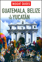
Guatemala, Belize And The Yucatan Insight Guide

Guatemala, Belize and The Yucatan in the Insight Guide series is dedicated to exploring the destination in detail with a selection of glossy illustrations. Extensive introductory sections explore the region’s history and culture and there are also short articles written by locals about distinctive local issues. Selective photo-features illustrate the variety of the region. The ‘Places’ section is organised by geographically and provides details of the area including places to visit, suggestions for tours and other activities. Each regional section has its own listings of the best restaurants, bars and cafes. Essential practical information is provided in the Travel Tips chapter on accommodation, shopping and local activities. A useful location finder and travel tip index with
relevant page numbers are given on the inside covers..
RIP - This product is no longer available on our network. It was last seen on 25.09.2019

This page now acts as a permanent archive for this product. Add more information using the comments box below to ensure it can still be found by future generations.

Use our search facility to see if it is available from an alternative contributor.
  • Availability: Out Of Stock
  • Supplier: Stanfords
  • SKU: 9781780051093
Availability: In Stock
£16.99

Product Description

Guatemala, Belize & The Yucatan in the Insight Guide series is dedicated to exploring the destination in detail with a selection of glossy illustrations. Extensive introductory sections explore the region’s history & culture & there are also short articles written by locals about distinctive local issues. Selective photo-features illustrate the variety of the region. The ‘ Places’ section is organised by geographically & provides details of the area including places to visit, suggestions for tours & other activities. Each regional section has its own listings of the best restaurants, bars & cafes. Essential practical information is provided in the Travel Tips chapter on accommodation, shopping & local activities. A useful location finder & travel tip index with relevant page numbers are given on the inside covers..

Reviews/Comments

Add New

Intelligent Comparison

Oooops!
We couldn't find anything!
Perhaps this product's unique.... Or perhaps we are still looking for comparisons!
Click to bump this page and we'll hurry up.

Price History

Vouchers

No voucher codes found.
Do you know a voucher code for this product or supplier? Add it to Insights for others to use.

Facebook

Jargon Buster

History - Anything that happens in the past. An acedemic subject.
Accommodation - A room in which someone can live in, for example in a hotel
Practical - Weather a task is easy to carry out and realistically succeed.
illustrations - Pictures typically in books and newspapers.
Regional - An adjective to describe a set geographic area.
Glossy - Something that is smooth and shiny in appearance.

Supplier Information

Stanfords
Stanfords was established in 1853 and opened their iconic Covent Garden flagship store in 1901. They have become the top retailer of maps, travel books and accessories in the UK and arguably offer the largest selection of maps and travel books worldwide. Famous names such as Captain Robert Falcon Scott, Ranulph Fiennes and Michael Palin have purchased from Stanfords. They now have a shop in Bristol and both stores together with other venues operate a calendar of events including talks, book signings and exhibitions. As a specialist map retailer, the map selection is comprehensive and includes road maps, street maps and walking maps from worldwide destinations, as well as a selection of world atlases and wall maps. Books include travel guides and travel literature. Stanfords also stock globes, from miniatures made of blue marble to magnificent floor-standing globes. The website features a selection of interesting articles on travel topics.
Page Updated: 2023-11-12 20:15:36

Community Generated Product Tags

Oh No! The productWIKI community hasn't generated any tags for this product yet!
Menu