
 United Kingdom
 France
 Germany
 Netherlands
 Sweden
 USA
USA
 Italy
Italy
 Spain
Spain
More From Contributor


France Northern
Northern France on a single-sided, indexed road map at 1:800, 000 from Insight. This large map includes many places of interest, an enlarged road map for the Paris area and a street plan of Paris for more detail.The network of main roads is displayed, with distinctions between motorways (with junctions), toll motorways, dual carriageways, main and secondary roads. Mountain passes are displayed and also gradients for steep ascents. Markers indicate distances between selected points and symbols indicate filling stations, restaurants and motels en route. Airports, major ports and ferry terminals are marked, and the legend distinguishes between standard and high speed routes on the rail network. Ferry routes are marked for major destinations. Major towns and cities are displayed, as
are many smaller towns. Regions are named and demarcated, but administrative departments do not appear on the map.Mountain ranges are named and highlighted with relief shading, and spot heights are shown for the main peaks. Main lakes and rivers are shown.Many places of interest are annotated on the map, such as: museums, heritage sites, ruins and castles; churches, cathedrals and monasteries; national parks, nature reserves, sailing areas and beach resorts; and viewpoints, hiking areas, gorges, mountain resorts and ski resorts. Some long-distance walking routes are highlighted on the map, specifically the pilgrim's route to Santiago de Compostella via Tours.The map itself, excluding the legend and insets, measures 127 x 71 cm (approximate). It reaches as far south as beyond
Poitiers and Lake Geneva. Also covers southern England (including the main Channel ports), the Channel Islands, Belgium to Antwerp, Germany to Cologne and Frankfurt, and a large part of western Switzerland. (See adjoining image for coverage.)An enlarged overview of Paris and its suburbs at 1:200, 000 shows more detail for rail and road networks, and places of interest. Extends to cover Charles de Gaulle and Orly airports, Disneyland Resort and Versailles.Also includes street plans of central Paris at 1:17, 500 (approximate), with detail of main streets (including one-way streets), public transport, districts and many places of interest.An index booklet lists places, streets (for the city plans) and main places of interest.
Product Description
Reviews/Comments
Add New
Intelligent Comparison
Archived Product
France Northern Stanfords
£6.99
Archived Product
France Southern Stanfords
£5.99
Archived Product
France Southern Stanfords
£6.99
Archived Product
France North-West Stanfords
£7.50
Archived Product
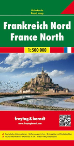
France North F&B Stanfords
£10.99
Archived Product
Spain Northern Stanfords
£5.99
Archived Product
Spain Northern Stanfords
£6.99
Archived Product
France North-East Stanfords
£7.50
Vouchers
No voucher codes found.
Do you know a voucher code for this product or supplier? Add it to Insights for others to use.
Do you know a voucher code for this product or supplier? Add it to Insights for others to use.
 Denmark