More From Contributor
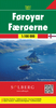
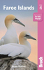
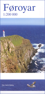
£3.50
Farnworth in 1908 in a fascinating series of reproductions of old Ordnance Survey plans in the Alan Godfrey Editions, ideal for anyone interested in the history of their neighbourhood or family. The map covers much of the Lancashire town of Farnworth. Coverage stretches from Dixon Green eastward to Clamourclough Mill, & from Bentley Street southward to Lark Hill. Features include Farnworth station, tramways & depot, Farnworth Park, Darley Hall, Darley Hall Pottery, St John`s church, Limefield Mill, Clamourclough Tunnel, Pandora Mills, Causeway Mills, Egyptian Mills, Oak Mills, Drake Mill, Marvels Brow Oil Works, Market Place, Dixon Green Mill, New Bury, Century Mill, Harrowby Mills, Albert Mills, numerous smaller mills, etc. A Farnworth commercial directory, entries A to R, is on the reverse. About the Alan Godfrey Editions of the 25” OS Series: Selected towns in Great Britain & Ireland are covered by maps showing the extent of urban development in the last decades of the 19th & early 20th century. The plans have been taken from the Ordnance Survey mapping & reprinted at about 15 inches to one mile (1:4, 340). On the reverse most maps have historical notes & many also include extracts from contemporary directories. Most maps cover about one mile (1.6kms) north/south, one & a half miles (2.4kms) across; adjoining sheets can be combined to provide wider coverage.FOR MORE INFORMATION & A COMPLETE LIST OF ALL AVAILABLE TITLES PLEASE CLICK ON THE SERIES LINK. ...
Archived Product
£17.99
Topographic survey of Portugal at 1:50, 000 from the Instituto Geográfico do Exército, the country’s military survey organisation. The maps have contours at 20m intervals & in addition to the standard features shown on topographic mapping at this scale also indicate various types of terrain or vegetation (s&, terraces, rocks, woodlands, vineyards, etc). Each sheet covers an area of 32 x 20km (20 x 12.5 miles approx). The maps have a 1-km UTM grid plus latitude & longitude coordinates for the map corners. Map legend & a glossary of terms used on the maps include English.EDITION DATES: most titles in this series date from 1990s or later. To see all the titles in this series please click on the series link. ...
Archived Product
£17.99
Topographic survey of Portugal at 1:100, 000 from the Instituto Geográfico Português, the country’s civilian survey organisation. The maps have contours at 50m intervals & in addition to the standard features shown on topographic mapping at this scale also indicate various types of vegetation (vineyards, olive groves, etc). Each sheet covers an area of 64 x 40km (40 x 25 miles approx). The maps have latitude & longitude margin ticks at 1’ intervals, plus show UTM coordinates for the map corners. Map legend is in Portuguese only.PLEASE NOTE
- EDITION DATES: some sheets at this scale date back to the 1950s or 1960s. For more recent editions please see IGP’s 1:25, 000 series where each 50K map is divided into four quarters. To see all the titles in the 1:100, 000 series please click on the series link.
...
Archived Product
£17.99
Topographic survey of Portugal at 1:50, 000 from the Instituto Geográfico Português, the country’s civilian survey organisation. The maps have contours at 25m intervals & in addition to the standard features shown on topographic mapping at this scale also indicate various types of vegetation (vineyards, olive groves, etc). Each sheet covers an area of 32 x 20km (20 x 12.5miles approx). The maps have latitude & longitude margin ticks at 1’ intervals & UTM coordinates for the map corners – each sheet also shows conversion details from BBLx (Bessel-Bonnie system, Datum Lisbon) to UTM. Map legend is in Portuguese only.EDITION DATES: most titles in this series have now been updated in the 1990s or later. To see all the titles in this series please click on the series link. ...
Archived Product
£25.00
We are able to source a wide range of courtesy flags. Flags are available in many sizes & can be sewn or printed on 100% Ministry Of Defence Standard Woven & Knitted Polyester. Flags are supplied with rope & toggle. If you would like more information, have a custom size request or cannot find a desired product, please email us at maritime@stanfords.co.uk. We will be glad to help! ...
Archived Product
£45.00
During his first trip to Iceland in 1991, the Swiss Photographer Marco Paoluzzo stayed on the Faroe Isles for two days. He was immediately mesmerised by the solitary group of islands in the North Atlantic. More birds & sheep than people live on the isles that can be found over 1300 kilometres off the Danish coast. It rains over 300 days a year there yet the climate by no means affects the magic of the sinister & mysterious scenery. Each time the photographer visited the isles, he came closer to their essence & unspoiled wild beauty. He discovered a place beyond time, a refuge where you can dream & enjoy life, a spot that offers peace & a space that seems to stretch forever. ...
Archived Product
£16.99
Faeroe Islands at 1:100, 000 on a large, indexed map from Freytag & Berndt with excellent presentation of their topography through contours at 50m intervals enhanced by relief shading, places of interest & ferry connections, etc, plus a street plan of Tórshavn. The map, published by F&B in cooperation with the locally based Henrik Solberg, shows all the islands in their proper geographical locations rather than on separate panels. Topography is vividly presented by contours with hill shading, plus numerous spot heights. Car and/or passenger only ferry connections are marked. Road network

Includes::
country tracks & gives distances on main routes. The map also

Includes::
local footpaths & highlights several hiking trails. Symbols mark various facilities & places of interest including campsites, youth hostels & other tourist accommodation, picturesque towns, etc. Latitude & longitude lines are drawn at 5’ intervals. The index is next to the map. Map legend

Includes::
English. The map

Includes::
a street plan of Tórshavn, plus several colour photos.


...
Archived Product
£16.99
This English-language guide to the Faroe Islands, covers everything from succulent fish suppers to remote hideaways. The Bradt guide is ideal for visitors wishing to discover the 18 islands of this North Atlantic archipelago. Covering hands-on information about where to stay & eat, how to get around
- be it by mailboat, helicopter or hire car
- & what to see & do, this new fourth edition has been thoroughly updated &

Includes::
details of the amazing birdlife, where to walk some of Europe`s least-known hiking trails, & how to make the most of village life among the turf-roofed houses. Also included are details of how to reach even the remotest corners by bus using a travelcard, the latest information on falling seabird numbers in the North Atlantic, & details of where to go sea angling, rapelling & horse riding. Suggestions for using the island of Suduroy are detailed, plus updated reviews of all accommodation, eating & drinking options. Fourteen clear & easy-to-use maps are also featured.


...
Archived Product
£1.99
The perfect patriotic accessory to wave the Jubilee Festival in with, these Union Jack flags will make a great addition to your street party or day out on the town. The first choice accessory this summer for the urbane street partier rather than the last refuge of a scoundrel... ...
Archived Product
£35.00
Official charts for the Faroe Islands produced by the Danish Hydrographic Office. The charts are ordered upon customer dem&, therefore please contact us if you require the charts urgently. For any further information, you can contact maritime@stanfords.co.uk. ...
Archived Product

Faroe Islands

Indexed map of the Faeroe Islands with hill shading and spot heights to show the topography. Main local paths are included and driving distances are marked on roads. Car and passenger ferry routes between the islands are shown and symbols mark locations of local airports and heliports, tourist information offices, campsites and youth hostels.The map has a UTM grid with margin ticks for latitude and longitude at 20` and 30` intervals respectively and an index of place names including geographical features. Map legend includes English.
RIP - This product is no longer available on our network. It was last seen on 18.11.2022

This page now acts as a permanent archive for this product. Add more information using the comments box below to ensure it can still be found by future generations.

Use our search facility to see if it is available from an alternative contributor.
  • External links may include paid for promotion
  • Availability: Out Of Stock
  • Supplier: Stanfords
  • SKU: 2131858000008
Availability: In Stock
£9.99

Product Description

Indexed map of the Faeroe Islands with hill shading & spot heights to show the topography. Main local paths are included & driving distances are marked on roads. Car & passenger ferry routes between the islands are shown & symbols mark locations of local airports & heliports, tourist information offices, campsites & youth hostels. The map has a UTM grid with margin ticks for latitude & longitude at 20` & 30` intervals respectively & an index of place names including geographical features. Map legend

Includes::
English.

Reviews/Comments

Add New

Price History

Vouchers

No voucher codes found.
Do you know a voucher code for this product or supplier? Add it to Insights for others to use.

Facebook

Jargon Buster

Car - A machine used for transport which runs on roads

Supplier Information

Stanfords
Stanfords was established in 1853 and opened their iconic Covent Garden flagship store in 1901. They have become the top retailer of maps, travel books and accessories in the UK and arguably offer the largest selection of maps and travel books worldwide. Famous names such as Captain Robert Falcon Scott, Ranulph Fiennes and Michael Palin have purchased from Stanfords. They now have a shop in Bristol and both stores together with other venues operate a calendar of events including talks, book signings and exhibitions. As a specialist map retailer, the map selection is comprehensive and includes road maps, street maps and walking maps from worldwide destinations, as well as a selection of world atlases and wall maps. Books include travel guides and travel literature. Stanfords also stock globes, from miniatures made of blue marble to magnificent floor-standing globes. The website features a selection of interesting articles on travel topics.
Page Updated: 2023-11-12 20:15:36

Community Generated Product Tags

Oh No! The productWIKI community hasn't generated any tags for this product yet!
Menu