
 United Kingdom
 France
 Germany
 Netherlands
 Sweden
 USA
USA
 Italy
Italy
 Spain
Spain
More From Contributor


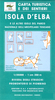

Elba
Elba on a detailed map from Litografia Artistica Cartografica, with an indexed street plan of Portoferraio. The map offers a nice balance between clarity of road detail for exploring the island by car, tourist information, and a topographic base with overprint for waymarked hiking routes.Road network, including local country roads and tracks, is easy to see against the relief shading. A very wide range of symbols provide tourist information, including campsites and camper parks, beaches and scuba diving sites, numerous other sport and recreational facilities, archaeological sites, museums and monuments, etc.For hikers map has contours at 20m intervals and an overprint highlighting waymarked walking trails, indicating their official numbering. For GPS users the map has a 1km UTM
grid. A large inset shows a street plan of Portoferraio with an index listing both streets and places of interest, including the museum devoted to Elba’s most famous prisoner. On the reverse are notes about the island with recommendations of what to see, plus a long list of local hotels.Map legend and the notes include English.
grid. A large inset shows a street plan of Portoferraio with an index listing both streets and places of interest, including the museum devoted to Elba’s most famous prisoner. On the reverse are notes about the island with recommendations of what to see, plus a long list of local hotels.Map legend and the notes include English.

Product Description
Reviews/Comments
Add New
Intelligent Comparison
Archived Product
Elba Stanfords
£8.50
Archived Product
Elba Stanfords
£7.95
Archived Product
Elba Stanfords
£9.95
Vouchers
No voucher codes found.
Do you know a voucher code for this product or supplier? Add it to Insights for others to use.
Do you know a voucher code for this product or supplier? Add it to Insights for others to use.
 Denmark