
 United Kingdom
 France
 Germany
 Netherlands
 Sweden
 USA
USA
 Italy
Italy
 Spain
Spain
More From Contributor


Croatia
Croatia at 1:300, 000 on an indexed road map with topographic and tourist information, printed on light, waterproof and tear-resistant plastic paper. The map, published by Rough Guides with cartography from the highly acclaimed World Mapping Project by the German publishers Reise Know-How, is double-sided to provide the best balance between a good scale and a convenient size sheet.The map covers the country in three panels: the Adriatic coast from Trieste to Sibenik and on the reverse from Sibenik to the Montenegro border, plus north-eastern Croatia with Zagreb. All three panels are printed with the north-east at the top, so that the coastline runs across the map. Altitude colouring with contours and peak heights presents the country
Product Description
Reviews/Comments
Add New
Intelligent Comparison
Archived Product
Croatia Stanfords
£5.99
Archived Product
Croatia Stanfords
£11.99
Archived Product
Croatia Stanfords
£11.19
Archived Product
Croatia Stanfords
£14.99
Archived Product
Croatia Stanfords
£13.99
Archived Product
Croatian Stanfords
£3.99
Archived Product
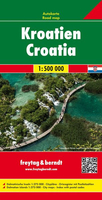
Croatia F&B Stanfords
£10.99
Archived Product
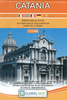
Catania Stanfords
£10.99
Vouchers
No voucher codes found.
Do you know a voucher code for this product or supplier? Add it to Insights for others to use.
Do you know a voucher code for this product or supplier? Add it to Insights for others to use.
 Denmark