
 United Kingdom
 France
 Germany
 Netherlands
 Sweden
 USA
USA
 Italy
Italy
 Spain
Spain
More From Contributor

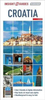
Croatia F&B
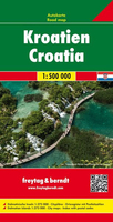
Croatia at 1:500, 000 on an indexed road map from Freytag & Berndt, with more detailed mapping of popular coastal areas and 15 city centre street plans of its main towns and resorts. Bosnia-Herzegovina and most of Slovenia and Montenegro are included in the coverage.The main map is at 1:500, 000 and shows the region’s topography by relief shading with plenty of names of mountain ranges. Colouring indicates forested areas and national parks are marked. Road network includes small local roads, many with driving distances, gives gradient marking on steep roads and highlights scenic routes. Ferry routes and railway lines are included and local airports are marked. Symbols mark various places of interest. Latitude and longitude lines are drawn at 30’ intervals. The accompanying index is
in a separate booklet attached to the map cover. The booklet also includes city centre street plans of Croatia’s 15 main cities: Dubrovnik, Karlovac, Opatija, Osijek, Pula, Rijeka, Rovinj, Slavonski Brod, Sibenik, Split, Trojor, Umag, Varazdin, Zadar and Zagreb.The map also has four large panels covering the most popular sections of Croatia’s Adriatic coast at 1:275, 000, providing more detailed coverage of the coast and the numerous islands. This mapping has latitude and longitude lines at 15’ intervals.Multilingual map legend includes English.
in a separate booklet attached to the map cover. The booklet also includes city centre street plans of Croatia’s 15 main cities: Dubrovnik, Karlovac, Opatija, Osijek, Pula, Rijeka, Rovinj, Slavonski Brod, Sibenik, Split, Trojor, Umag, Varazdin, Zadar and Zagreb.The map also has four large panels covering the most popular sections of Croatia’s Adriatic coast at 1:275, 000, providing more detailed coverage of the coast and the numerous islands. This mapping has latitude and longitude lines at 15’ intervals.Multilingual map legend includes English.

Product Description
Reviews/Comments
Add New
Intelligent Comparison
Archived Product
Croatia Stanfords
£5.99
Archived Product
Croatia Stanfords
£11.99
Archived Product
Croatia Stanfords
£11.19
Archived Product
Croatia Stanfords
£4.79
Archived Product
Croatia Stanfords
£14.99
Archived Product
Croatia Stanfords
£13.99
Archived Product

Carinthia F&B Stanfords
£10.99
Archived Product
Croatian Stanfords
£3.99
Vouchers
No voucher codes found.
Do you know a voucher code for this product or supplier? Add it to Insights for others to use.
Do you know a voucher code for this product or supplier? Add it to Insights for others to use.
 Denmark