
 United Kingdom
 France
 Germany
 Netherlands
 Sweden
 USA
USA
 Italy
Italy
 Spain
Spain
More From Contributor


Crewe East 1908
Crewe East 1908 in a fascinating series of reproductions of old Ordnance Survey plans in the Alan Godfrey Editions, ideal for anyone interested in the history of their neighbourhood or family. Three maps have been published for Crewe, including the town, the railway station and much of the railway works. The 1874 version is double sided. The main map covers the town, with coverage from Beech Street southward to Nantwich Road, and westward to Coppenhall Heys. Features include the LNWR Steel Works, Old Works, The Valley, Market Square area, engine sheds etc. On the reverse is the western part of sheet 56.08, extending coverage eastward to include the railway station, Manchester Bridge and Crewe-gate Farm.For 1908 the town in covered by two maps. Sheet 56.07 - Crewe covers the town
centre, stretching from Beech Street southward to Nantwich Road, and westward to Queen`s Park. Features include LNWR Crewe Works and much of Central and South Wards. Sheet 56.08 Crewe East covers the railway station area and gives extended coverage east to Crewe Green. Please note that the two 1908 maps also include sections of the early 1874 maps on the reverse.About the Alan Godfrey Editions of the 25” OS Series:Selected towns in Great Britain and Ireland are covered by maps showing the extent of urban development in the last decades of the 19th and early 20th century. The plans have been taken from the Ordnance Survey mapping and reprinted at about 15 inches to one mile (1:4, 340). On the reverse most maps have historical notes and many also include extracts from contemporary
directories. Most maps cover about one mile (1.6kms) north/south, one and a half miles (2.4kms) across; adjoining sheets can be combined to provide wider coverage.FOR MORE INFORMATION AND A COMPLETE LIST OF ALL AVAILABLE TITLES PLEASE CLICK ON THE SERIES LINK.

Product Description
Reviews/Comments
Add New
Intelligent Comparison
Archived Product

Crewe 1908 Stanfords
£3.50
Archived Product
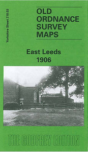
Leeds East 1906 Stanfords
£3.50
Archived Product
Cirencester East 1920 Stanfords
£3.50
Archived Product

Crete East Stanfords
£12.95
Archived Product

Dundee East 1901 Stanfords
£3.50
Vouchers
No voucher codes found.
Do you know a voucher code for this product or supplier? Add it to Insights for others to use.
Do you know a voucher code for this product or supplier? Add it to Insights for others to use.
 Denmark