
 United Kingdom
 France
 Germany
 Netherlands
 Sweden
 USA
USA
 Italy
Italy
 Spain
Spain
More From Contributor


Cape Cod Day By Day
Cape Cod in the Frommer's Day By Day series is a pocket-sized guide ideal for short trips, covering a variety of budgets. The best sights of each destination are listed in convenient full-day tours for one, two or three days such as: thematic tours for interests including art, architecture and history are described, allowing you to get the most out of your time; walking tours take you around each destination
Product Description
Reviews/Comments
Add New
Intelligent Comparison
Archived Product
Cape Town Day By Day Stanfords
£8.99
Archived Product
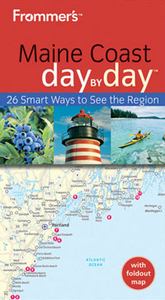
Maine Coast Day By Day Stanfords
£8.99
Archived Product
Cuba Day By Day Stanfords
£8.99
Archived Product
Crete Day By Day Stanfords
£8.99
Archived Product
Japan Day By Day Stanfords
£18.99
Archived Product
Seoul Day By Day Stanfords
£9.99
Archived Product
Budapest Day By Day Stanfords
£9.99
Archived Product
Cyprus Day By Day Stanfords
£8.99
Vouchers
No voucher codes found.
Do you know a voucher code for this product or supplier? Add it to Insights for others to use.
Do you know a voucher code for this product or supplier? Add it to Insights for others to use.
 Denmark