More From Contributor
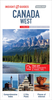
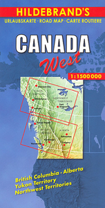
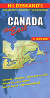
£36.95
Canada Recreational Atlas from Map Art in A4 paperback format, with the maps annotated by colour-coded numbered boxes referring to extensive lists of national & provincial parks, conservation areas, campgrounds, golf courses, skiing areas & other attractions. Main canoe routes are also highlighted. The opening section presents the whole of Canada at 1:6, 000, 000 with the overprint showing recreational locations in the more remote parts of the country not covered by more detailed mapping: Yukon, Northwest Territories, Nunavut, northern parts of Ontario & Quebec, & Labrador. The rest of the country is covered at more detailed scales as indicated below. Enlargements at scales varying from 1:250, 000 to 1:100, 000 show environs of 51 main towns. The final section of the atlas provides lists referred to by the overprint, arranged by province, with details of campgrounds, golf courses, national & provincial parks, conservation areas, skiing areas, plus the canoe routes shown on the maps. Lists of camping grounds, parks & conservation areas indicate what facilities & recreational opportunities can be found there. All the lists provide relevant phone numbers. The atlas also has an extensive 11-page index of place names. Coverage of the southern provinces of Canada is provided at the following scales: British Columbia, Alberta, Saskatchewan & Manitoba at 1:2, 000, 000 North-western & north-central Ontario at 1:1, 725, 000, with the more densely populated areas of central, southern & eastern part of the province at 1:750, 000 Southern & eastern Quebec & the Atlantic Provinces at 1:800, 000, but with Newfoundland at 1:1, 000.000. Please note: following a number changes among Canadian cartographic publishers maps previously published by Map Art Publishing may now be available under one of the following imprints: Map Art, Canadian Cartographics Corporation or JDM G ...
Archived Product
£29.99
Attractive 109x 92cm map using altitude & bathymetric tinting to show the relief, complemented by some fine hill-shading in mountainous regions & spot heights for major peaks. Detail

Includes::
major roads, railways & ferries, regional bouidaries, national parks & the 200 mile offshore limit. Different symbols distinguish cities according to population size & identify province & territory capitals. Three inset thematic maps show drainage basins, physiographics regions & vegetation cover. Latitude & longitude lines are at 5° intervals. Coverage

Includes::
the north pole. Vertical near-side perspective projection.


...
Archived Product
£10.99
Assembled from satellite images data, this mostly cloud-free image shows Canada as if viewed from the air. It is enhanced with natural-looking colours to depict vegetation distribution, urban sprawl & other landscape variations. Printed on thick paper. ...
Archived Product
£9.99
Canada in the AA Spiral Guides series; comprising a selection of titles exploring a wide range of cities, regions & countries in a handy, spiral loose-leaf format. Fold-out flaps at the front & back of each title give an overview of the main regions covered, with page numbers so visitors can locate their destination easily. Each guide explores the destination geographically by region or area & provides the essential information for the main sites & attractions in addition to a recommended tour of each area by car. An introductory section - ...
Archived Product
£8.99
Western Canada at 1:1, 500, 000 on a large, double-sided map from Hildebrand providing coverage of Alberta & British Columbia including the Canadian Rockies, with most of Yukon & Northwest Territories. Locations of interest are prominently highlighted & numerous topographical features are named. The map presents the region’s road network indicating winter roads & providing driving distances on many local routes. Railway lines are included & local airports are marked. Locations of particular interest are prominently highlighted & the map shows numerous campsites. Topography of this mountainous region is indicated by relief shading with plenty for names of topographic

Features:
mountain ranges, peaks (heights in metres), rivers & lakes. Latitude & longitude lines are drawn at intervals of 1° & the time zone boundary is marked. Map legend

Includes::
English.


...
Archived Product
£9.99
Western Canada in a series of three indexed, waterproof & tear-resistant road maps of the country with topographic & tourist information. The maps, published by Reise Know-How as part of their highly acclaimed World Mapping Project, are double-sided to provide the best balance between a good scale & a convenient size sheet. The area is divided north/south, with a good overlap between the two sides. Coverage on the north side extends beyond 70º of latitude & 110º of longitude to include the western end of the Northwest Passage & most of the Northwest Territories. The southern side extends eastwards to cover virtually all of Alberta with Calgary, Edmonton & the Banff & Jasper National Parks. The map has altitude colouring with spot heights & plenty of names of mountain & hill ranges, plateaux, peaks, passes, rivers & lakes. National & provincial parks & other protected areas are highlighted. Road network indicates unpaved sections of main & secondary routes,

Includes::
minor roads & tracks, & shows winter roads. Intermediate distances are given on main routes. Railway lines & ferry connections are also shown. Symbols mark locations of various places of interest including natural sites & UNESCO World Heritage areas, selected campsites & refuges, bird sanctuaries, ski areas, etc. The map has a grid with latitude & longitude at intervals of 2º, plus an index of localities. Map legend

Includes::
English. *” World Mapping Project”* is an extensive series of maps at varying scales, aiming to provide coverage of countries & regions worldwide using clear, well presented cartography with both topographic & tourist information.* Sample of cartography:* Some elements of the cartography e.g. minor roads & contours are printed relatively faintly compared with other information such as major roads. Although clearly legible on the map, the lower contrast of these details has made them less obvious on the reproduction of the cartography presented here.


...
Archived Product
£6.99
Western Canada with the whole of Alaska on an overview map at 1:4, 000, 000 from Insight Guides, with extensive index including places of interest, plus street plans central Vancouver & Anchorage & a map of Vancouver with its suburbs. Coverage

Includes::
the whole of Alberta & most of Saskatchewan, extending south to take in most of Washington State & Idaho, plus the whole of Montana. In the north the map covers the whole of Yukon & Alaska, with the Aleutian Islands shown as an inset. Topography is shown by relief shading, spot heights & names of mountain ranges, plateaux, etc; a very impressive number of rivers & lakes are named on the map. Road network

Includes::
selected local roads, with driving distances shown on main routes. Railways & local airports in remote areas are included &, where appropriate, ferry routes are marked. Symbols mark various places of interest, including a wide range of protected areas & natural features, Indian reservations, historical sites, etc. Latitude & longitude lines are drawn at intervals of 2


...
Archived Product
£5.99
Canada West in the Essential Guides Series from the AA, exploring the best places to see & things to do in a range of popular destinations. Each illustrated, pocket-sized guide is divided into five sections
- the essence of the area, planning your trip, the best places to see, best things to do & an exploration of notable highlights, organised by area. An introductory chapter profiles each destination &

Includes::
notes on local cuisine & recommendations for short breaks. A planning section advises on pre-trip preparations & getting there & around as well as outlining useful language tips & what


...
Archived Product
£6.99
This detailed travel map is all you need to plan your route & navigate your way around Canada West, & also

Includes::


...
Archived Product
£7.99
Marco Polo Pocket Guide Canada West: the Travel Guide with Insider Tips Explore Western Canada with this handy, pocket-sized, authoritative guide, packed with Insider Tips. Discover boutique hotels, authentic restaurants, the region`s trendiest places, & get tips on shopping & what to do on a limited budget. There are plenty of ideas for travel with kids, & a summary of all the festivals & events that take place. Let Marco Polo show you all this wonderful part of Canada has to offer... If you love the outdoors then Western Canada is your dream destination. Here you can watch a family of bears on the shores of a fjord, enjoy the silence of the mighty Yukon River, camp with cowboys in the vast prairies or go rafting through wild river rapids. & coupled with this breath-taking, unspoilt, pristine landscape is Vancouver, a young, vibrant city with captivating charm & casual, European flair, a dynamic metropolis set against a dramatic backdrop of dark green mountains... This is Canada West! Your Marco Polo Canada West Pocket Guide
Includes:: Insider Tips
- we show you the hidden gems & little-known secrets that offer a real insight into the region. Discover Fort Langley, the backdrop for many Hollywood movies, relax after a long walk in natural hot springs or stay in a rustic pioneer lodge. Best of
- find the best things to do for free, the best `only in` Canada West experiences, the best things to do if it rains & the best places to relax & spoil yourself. Sightseeing
- all the top sights are organised by area so you can easily plan your trip. Discovery Tours
- specially tailored tours that will get you to the heart of Canada West. Experience all of Western Canada`s unique character with these personal tours. See the prairies in Calgary, the ice-covered peaks of the Rockies, the lake districts of British Columbia & the Pacific coast in Vancouver. Canada West in full-colour
- Marco Polo Pocket Guide Canada West

Includes::
full-colour photos throughout the guide bringing the region to life offering you a real taste of what you can see & enjoy on your trip. Touring App
- download any of the Discovery Tours to your smartphone, complete with the detailed route description & map exactly as featured in the guide, free of charge. The maps can be used offline too, so no roaming charges. The perfect navigational tool with distance indicators & landmarks highlighting the correct direction to travel in as well as GPS coordinates along the way. Enjoy stress-free sightseeing & never get lost again! Road Atlas & pull-out map
- we`ve included a detailed road atlas & a handy, pull-out map so you can pop the guide in your bag for a full-on sightseeing day or head out with just the map to enjoy your Discovery Tour. A small city map of downtown Vancouver is also included. Trust Marco Polo Pocket Guide Canada West to show you around the western provinces of Canada. The comprehensive coverage & unique insights will ensure you experience everything Canada West has to offer & more. The special tips, personal insights & unusual experiences will help you make the most of your trip
- just arrive & enjoy.


...
Archived Product

Canada West

Canada on a large overview map at 1:4, 000, 000 from Insight Guides, with extensive index including places of interest, plus 12 additional panels providing street plans and more detailed road coverage of the main urban areas.On one side is a clear map of the whole country, including the islands beyond the Northwest Passage, with just the northern part of Nunavut shown as an inset. Coverage of the adjoining regions of USA extends beyond New York, Chicago and the northern boundary of California. Topography is shown by relief shading and spot heights, with markings for marshlands and a very impressive number of rivers and lakes named on the map. Provincial boundaries are clearly marked, but time zones are not indicated.Road network includes selected local roads, with driving distances
shown on main and many local routes. Railways and local airports in remote areas are included and, where appropriate, ferry routes are marked. A wide range of symbols mark various places of interest, including numerous Indian reservations. Latitude and longitude lines are drawn at intervals of 2
RIP - This product is no longer available on our network. It was last seen on 25.09.2019

This page now acts as a permanent archive for this product. Add more information using the comments box below to ensure it can still be found by future generations.

Use our search facility to see if it is available from an alternative contributor.
  • External links may include paid for promotion
  • Availability: Out Of Stock
  • Supplier: Stanfords
  • SKU: 9789812589156
Availability: In Stock
£5.99

Product Description

Canada on a large overview map at 1:4, 000, 000 from Insight Guides, with extensive index including places of interest, plus 12 additional panels providing street plans & more detailed road coverage of the main urban areas. On one side is a clear map of the whole country, including the islands beyond the Northwest Passage, with just the northern part of Nunavut shown as an inset. Coverage of the adjoining regions of USA extends beyond New York, Chicago & the northern boundary of California. Topography is shown by relief shading & spot heights, with markings for marshlands & a very impressive number of rivers & lakes named on the map. Provincial boundaries are clearly marked, but time zones are not indicated. Road network

Includes::
selected local roads, with driving distances shown on main & many local routes. Railways & local airports in remote areas are included &, where appropriate, ferry routes are marked. A wide range of symbols mark various places of interest, including numerous Indian reservations. Latitude & longitude lines are drawn at intervals of 2

Reviews/Comments

Add New

Price History

Vouchers

No voucher codes found.
Do you know a voucher code for this product or supplier? Add it to Insights for others to use.

Facebook

Jargon Buster

New York - A United States State. Commonly known as the Big Apple
Railways - A set of tracks that have been laid for the purpose of trains to travel up and down them
Network - A link and communication between things. Often computers or people.
Large - something that takes up more space than normal.
Road - a manmade lane or a path that is used to speed up travel.
Wide - Something with a large width.

Supplier Information

Stanfords
Stanfords was established in 1853 and opened their iconic Covent Garden flagship store in 1901. They have become the top retailer of maps, travel books and accessories in the UK and arguably offer the largest selection of maps and travel books worldwide. Famous names such as Captain Robert Falcon Scott, Ranulph Fiennes and Michael Palin have purchased from Stanfords. They now have a shop in Bristol and both stores together with other venues operate a calendar of events including talks, book signings and exhibitions. As a specialist map retailer, the map selection is comprehensive and includes road maps, street maps and walking maps from worldwide destinations, as well as a selection of world atlases and wall maps. Books include travel guides and travel literature. Stanfords also stock globes, from miniatures made of blue marble to magnificent floor-standing globes. The website features a selection of interesting articles on travel topics.
Page Updated: 2023-11-12 20:15:36

Community Generated Product Tags

Oh No! The productWIKI community hasn't generated any tags for this product yet!
Menu