
 United Kingdom
 France
 Germany
 Netherlands
 Sweden
 USA
USA
 Italy
Italy
 Spain
Spain
More From Contributor


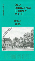
Calne 1899
Calne in 1899 in a fascinating series of reproductions of old Ordnance Survey plans in the Alan Godfrey Editions, ideal for anyone interested in the history of their neighbourhood or family. Calne became a borough in 1086 and was a prosperpous cloth town in the middle ages, but by the 1890s it was better known for bacon. The town had its own railway branch, shown here with station and Black Dog Siding, and other features include The Strand, workhouse, bacon factory, St Mary`s church, etc. To the west of Calne, vast areas of fields dominate the landscape, which the River Marden and the Wilts & Berks Canal cut through on their way to the heart of the town. Along with Kingsbury Green, all the schools, hospitals, allotments and the town centre are marked on to give you a true
impression of what the town felt like in 1899. On the reverse is a commercial directory and the Calne Branch train timetable.About the Alan Godfrey Editions of the 25” OS SeriesSelected towns in Great Britain and Ireland are covered by maps showing the extent of urban development in the last decades of the 19th and early 20th century. The plans have been taken from the Ordnance Survey mapping and reprinted at about 15 inches to one mile (1:4, 340). On the reverse most maps have historical notes and many also include extracts from contemporary directories. Most maps cover about one mile (1.6kms) north/south, one and a half miles (2.4kms) across; adjoining sheets can be combined to provide wider coverage.FOR MORE INFORMATION AND A COMPLETE LIST OF ALL AVAILABLE TITLES PLEASE CLICK ON THE
SERIES LINK.

Product Description
Reviews/Comments
Add New
Intelligent Comparison
Archived Product
Olney 1899 Stanfords
£3.50
Archived Product

Sale 1897 Stanfords
£3.50
Archived Product
Bala 1899 Stanfords
£3.50
Vouchers
No voucher codes found.
Do you know a voucher code for this product or supplier? Add it to Insights for others to use.
Do you know a voucher code for this product or supplier? Add it to Insights for others to use.
 Denmark