More From Contributor

£12.99
In its heyday the Bristol Channel was a thriving estuary where ships of all descriptions were to be seen, ranging from elegant passenger & cargo liners to the utilitarian tugs & dredgers, each one fulfilling its own essential function in pursuit of the continuing flow of commerce. The post-war years, however, brought about a slow but steady decline, which accelerated during the 1960s & has left the Channel a shadow of its former self. During this period ships themselves were changing & the variety of vessels seen in the Channel was also changing. Steam was rapidly being replaced by diesel, container vessels were slowly taking over from the general cargo ship & larger specialised vessels were rapidly coming in to service. ” Bristol Channel Shipping Remembered” is a nostalgic tour of the Bristol Channel, from Bristol down to its westerly limits & then eastwards along the coast of South Wales to Newport, & shows us some of these once familiar scenes that have become little more than just memories of this great waterway. ...
Archived Product
£12.99
Through the medium of old photographs, programmes & advertisements, this book provides a fascinating look at the history of cinema-going in the city of Bristol & its suburbs during the last century. From mobile cinemas to penny gaffs, this A-Z of cinemas in Bristol chronicles the places frequented by Bristolians over the years, including the ABC on Whiteladies Road, the Magic Box in Stokes Croft & the Picture House in Knowle. ...
Archived Product
£14.99
Bristol City Docks Through Time is a unique insight into the illustrious history of this part of the country. Reproduced in full colour, this is an exciting examination of Bristol`s docks, & what they meant to the people of this area throughout the 19th & into the 20th Century. Looking beyond the exquisite exterior of these well-kept photos, readers can see the historical context in which they are set, & through the author`s factual captions for every picture, & carefully-selected choice of images, the reader can achieve a reliable view of this area`s history. There is something for everyone here, whether they have lived in Bristol all their lives, or whether they are just visiting this fabulous city & its docks. Bristol City Docks Through Time also shows how photography has continually evolved to keep up with an ever changing society. ...
Archived Product
£3.50
Bristol Clifton Down in 1902 in a fascinating series of reproductions of old Ordnance Survey plans in the Alan Godfrey Editions, ideal for anyone interested in the history of their neighbourhood or family. The map covers the north-western part of Clifton, including the Clifton Suspension Bridge. Coverage stretches from Norland House & Canynge Road westward to Holy Trinity church at Abbots Leigh. Features include Observatory, railway with Hotwells station, River Avon, part of Portishead line, Clifton Grand Spa, Leighwoods, Nightingale Valley, Stokeleigh Camp, quarries, St Vincent`s Rocks, Lower Farm, Leigh Woods. On the reverse are street directory entries for Caledonian Place, Canynge Road, Clifton Down, Royal York Crescent, Sion Hill, Victoria Street & West Mall. About the Alan Godfrey Editions of the 25” OS Series Selected towns in Great Britain & Ireland are covered by maps showing the extent of urban development in the last decades of the 19th & early 20th century. The plans have been taken from the Ordnance Survey mapping & reprinted at about 15 inches to one mile (1:4, 340). On the reverse most maps have historical notes & many also include extracts from contemporary directories. Most maps cover about one mile (1.6kms) north/south, one & a half miles (2.4kms) across; adjoining sheets can be combined to provide wider coverage.FOR MORE INFORMATION & A COMPLETE LIST OF ALL AVAILABLE TITLES PLEASE CLICK ON THE SERIES LINK. ...
Archived Product
£9.99
Perhaps because Bristol's seven hills once occupied the debatable border land between Mercia & Wessex, Bristolians have always taken an energetic & innovative approach to life. Home of the second largest Norman castle in the kingdom, Bristol was also a West Country holding of the Crusader Knights & a gateway to the New World. Over more than 700 years of endeavour, Bristol has been home to world-famous explorers, artists, inventors, entrepreneurs, pirates, merchants, politicians, divines, patriots & generals. Bristol Curiosities is a voyage of discovery that explores the curious events & even more curious people who made Bristol the successful city it has become over the millennia. From the immigrants whose activities enabled Bristol to claim the name ' Cradle of America', to the 'left-handed giant', city sledges, hidden bridges, strange trades, early recycling efforts & the storing of hundreds of thousands of smoking pipes, Bristol is a city that astounds & delights with its eclectic & surprising history. ...
Archived Product
£12.99
When war was declared in 1914 the people of Bristol erupted in patriotic excitement
- but what was it like when the cheering died
...
Archived Product
£3.50
Bristol Keynsham in 1902 in a fascinating series of reproductions of old Ordnance Survey plans in the Alan Godfrey Editions, ideal for anyone interested in the history of their neighbourhood or family. The map covers most of the town, extending north-west to Durleypark. Features include the GWR with station, The Park, St John the Baptist church, Dragonshill Quarry, Fairfield Terrace, Temple Street, High Street, Albert Road (at foot of map), Color Works, Keynsham Bridge, Newnham Nursery, Durleyhill House, Lamb & Lark Hotel, abbey remains. A directory of Keynsham in 1902 is on the reverse. About the Alan Godfrey Editions of the 25” OS Series Selected towns in Great Britain & Ireland are covered by maps showing the extent of urban development in the last decades of the 19th & early 20th century. The plans have been taken from the Ordnance Survey mapping & reprinted at about 15 inches to one mile (1:4, 340). On the reverse most maps have historical notes & many also include extracts from contemporary directories. Most maps cover about one mile (1.6kms) north/south, one & a half miles (2.4kms) across; adjoining sheets can be combined to provide wider coverage.FOR MORE INFORMATION & A COMPLETE LIST OF ALL AVAILABLE TITLES PLEASE CLICK ON THE SERIES LINK. ...
Archived Product
£3.50
Bristol Kingswood in 1903 in a fascinating series of reproductions of old Ordnance Survey plans in the Alan Godfrey Editions, ideal for anyone interested in the history of their neighbourhood or family. The map covers the Kingswood area, east of Bristol. Coverage stretches from Albany Street & Lodge Road eastward to Tenniscourt Road, & from Gladstone Street & Hampden Street southward to Cockroad Bottom. Features include tramway & depot, New Cheltenham area, Kingswood Hill area, Warmley Hill area, Woodstock area, Kingswood Reformatory, Potters Wood area, boot & shoe factories, Lantern Bottom, Holy Trinity church, Kingswood Hill Iron Works, chapels, etc. A list of private residents from an 1894 directory is on the reverse. About the Alan Godfrey Editions of the 25” OS Series Selected towns in Great Britain & Ireland are covered by maps showing the extent of urban development in the last decades of the 19th & early 20th century. The plans have been taken from the Ordnance Survey mapping & reprinted at about 15 inches to one mile (1:4, 340). On the reverse most maps have historical notes & many also include extracts from contemporary directories. Most maps cover about one mile (1.6kms) north/south, one & a half miles (2.4kms) across; adjoining sheets can be combined to provide wider coverage.FOR MORE INFORMATION & A COMPLETE LIST OF ALL AVAILABLE TITLES PLEASE CLICK ON THE SERIES LINK. ...
Archived Product
£3.50
Bristol Knowle in 1902 in a fascinating series of reproductions of old Ordnance Survey plans in the Alan Godfrey Editions, ideal for anyone interested in the history of their neighbourhood or family. The map covers most of the village of Knowle, south of Bristol. Coverage stretches from Somerset Road southward to Hengrove House, & from Lower Knowle Farm eastward to West Town Farm. Features include Brislington station, Queen`s Dale Farm, Firfield House, Racecourse Cottages, St Martin`s church, House of Charity, Lower Knowle, Bear`s Bridge, Kingshill House, western edge of Brislington. On the reverse is a street directory for Wells Road, plus railway timetables for the Bristol-Radstock-Frome line in 1906 & 1929. About the Alan Godfrey Editions of the 25” OS Series Selected towns in Great Britain & Ireland are covered by maps showing the extent of urban development in the last decades of the 19th & early 20th century. The plans have been taken from the Ordnance Survey mapping & reprinted at about 15 inches to one mile (1:4, 340). On the reverse most maps have historical notes & many also include extracts from contemporary directories. Most maps cover about one mile (1.6kms) north/south, one & a half miles (2.4kms) across; adjoining sheets can be combined to provide wider coverage.FOR MORE INFORMATION & A COMPLETE LIST OF ALL AVAILABLE TITLES PLEASE CLICK ON THE SERIES LINK. ...
Archived Product
£12.99
Bristol has plenty to be proud of when it comes to famous people. Some were born in the city while others were drawn to it by its colourful heritage, adventurous spirit & vibrant atmosphere of culture & enterprise. A few names, like that of the explorer John Cabot, have been woven into the fabric of the city`s heritage. However, other people who helped to shape today`s rich environment are hardly remembered. Within the pages of this book you`ll meet the priest they called the ` Red Bishop`
- the princess that never was
- the inventor of a so-called `thrashing machine` for errant schoolchildren
- & the dog that became an advertising icon.


...
Archived Product

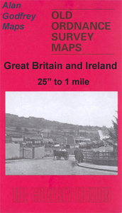
Bristol Fishponds 1902

Bristol Fishponds in 1902 in a fascinating series of reproductions of old Ordnance Survey plans in the Alan Godfrey Editions, ideal for anyone interested in the history of their neighbourhood or family. The map covers the Fishponds, Ridgeway, Upper Eastville and Mayfield Park areas of Bristol. Features include tramways, Midland Railway with Stapleton (later Fishponds) station, Kingswood Junction, Hollybrook Brick Works, Chester Park area, Atlas Locomotive Works, Weighing Machine Works, Clay Hill, brick works, Greenbank Cemetery, St Mary`s church, St John`s Mission Church, Ridgeway Park Cemetery, Ridgeway House, part of Eastville Park, Clay Bottom, etc. An 1894 directory of Fishponds is on the reverseAbout the Alan Godfrey Editions of the 25” OS SeriesSelected towns in
Great Britain and Ireland are covered by maps showing the extent of urban development in the last decades of the 19th and early 20th century. The plans have been taken from the Ordnance Survey mapping and reprinted at about 15 inches to one mile (1:4, 340). On the reverse most maps have historical notes and many also include extracts from contemporary directories. Most maps cover about one mile (1.6kms) north/south, one and a half miles (2.4kms) across; adjoining sheets can be combined to provide wider coverage.FOR MORE INFORMATION AND A COMPLETE LIST OF ALL AVAILABLE TITLES PLEASE CLICK ON THE SERIES LINK.
RIP - This product is no longer available on our network. It was last seen on 25.09.2019

This page now acts as a permanent archive for this product. Add more information using the comments box below to ensure it can still be found by future generations.

Use our search facility to see if it is available from an alternative contributor.
  • Availability: Out Of Stock
  • Supplier: Stanfords
  • SKU: 9781847846297
Availability: In Stock
£3.50

Product Description

Bristol Fishponds in 1902 in a fascinating series of reproductions of old Ordnance Survey plans in the Alan Godfrey Editions, ideal for anyone interested in the history of their neighbourhood or family. The map covers the Fishponds, Ridgeway, Upper Eastville & Mayfield Park areas of Bristol. Features include tramways, Midland Railway with Stapleton (later Fishponds) station, Kingswood Junction, Hollybrook Brick Works, Chester Park area, Atlas Locomotive Works, Weighing Machine Works, Clay Hill, brick works, Greenbank Cemetery, St Mary`s church, St John`s Mission Church, Ridgeway Park Cemetery, Ridgeway House, part of Eastville Park, Clay Bottom, etc. An 1894 directory of Fishponds is on the reverse About the Alan Godfrey Editions of the 25” OS Series Selected towns in Great Britain & Ireland are covered by maps showing the extent of urban development in the last decades of the 19th & early 20th century. The plans have been taken from the Ordnance Survey mapping & reprinted at about 15 inches to one mile (1:4, 340). On the reverse most maps have historical notes & many also include extracts from contemporary directories. Most maps cover about one mile (1.6kms) north/south, one & a half miles (2.4kms) across; adjoining sheets can be combined to provide wider coverage.FOR MORE INFORMATION & A COMPLETE LIST OF ALL AVAILABLE TITLES PLEASE CLICK ON THE SERIES LINK.

Reviews/Comments

Add New

Intelligent Comparison

Oooops!
We couldn't find anything!
Perhaps this product's unique.... Or perhaps we are still looking for comparisons!
Click to bump this page and we'll hurry up.

Price History

Vouchers

No voucher codes found.
Do you know a voucher code for this product or supplier? Add it to Insights for others to use.

Facebook

Jargon Buster

Contemporary - Modern era design
Contemporary - A design reference to indicate post war modern design
Locomotive - Or Loco is the powered vehicle at the front of a train
History - Anything that happens in the past. An acedemic subject.
Contemporary - An object that is living in the same time.
Junction - A point where two or more things come together, typically used to describe roads
Ideal - Something that satisfies a perfect criteria.
Family - A group of people that live together made up from parents and children.

Supplier Information

Stanfords
Stanfords was established in 1853 and opened their iconic Covent Garden flagship store in 1901. They have become the top retailer of maps, travel books and accessories in the UK and arguably offer the largest selection of maps and travel books worldwide. Famous names such as Captain Robert Falcon Scott, Ranulph Fiennes and Michael Palin have purchased from Stanfords. They now have a shop in Bristol and both stores together with other venues operate a calendar of events including talks, book signings and exhibitions. As a specialist map retailer, the map selection is comprehensive and includes road maps, street maps and walking maps from worldwide destinations, as well as a selection of world atlases and wall maps. Books include travel guides and travel literature. Stanfords also stock globes, from miniatures made of blue marble to magnificent floor-standing globes. The website features a selection of interesting articles on travel topics.
Page Updated: 2023-11-12 20:15:36

Community Generated Product Tags

Ridgeway rd fishponds bristol history (1 person tagged the product this way)
Menu