More From Contributor

£3.50
Bristol Brislington in 1902 in a fascinating series of reproductions of old Ordnance Survey plans in the Alan Godfrey Editions, ideal for anyone interested in the history of their neighbourhood or family. The map covers most of the village of Brislington, to the south-east of Bristol. Coverage stretches from Montrose Avenue & Bristol Hill eastward to the River Avon & The Batch. Features include tramway, Brislington House, Winash House, Emery`s Farm, Doncaster Farm, Hicks Gate Farm, Flowers Hill Farm, Brislington Hall, Oakenhill Farm, St Luke`s church, Assembly Rooms, Brislington Hill House, a short stretch of GWR railway etc. On the reverse are directories of Brislington & Hanham in 1894. About the Alan Godfrey Editions of the 25” OS Series Selected towns in Great Britain & Ireland are covered by maps showing the extent of urban development in the last decades of the 19th & early 20th century. The plans have been taken from the Ordnance Survey mapping & reprinted at about 15 inches to one mile (1:4, 340). On the reverse most maps have historical notes & many also include extracts from contemporary directories. Most maps cover about one mile (1.6kms) north/south, one & a half miles (2.4kms) across; adjoining sheets can be combined to provide wider coverage.FOR MORE INFORMATION & A COMPLETE LIST OF ALL AVAILABLE TITLES PLEASE CLICK ON THE SERIES LINK. ...
Archived Product
£18.00
High quality nautical chart for the Bristol Channel from Worms Head & Bull Point to Sharpness. Soundings are in metres, the projection is Mercator & positions are referred to European Datum (1950). The chart is water-resistant chart &

Includes::
a harbour plans for Porthcawl, The Mumbles, Avonmouth, Bridgwater Bay & Burnham-on-Sea, Watchet, Minehead, Swansea Marina & Penarth Marina.

...
Archived Product
£29.50
This colourful new edition of the Bristol Channel & Severn Cruising Guide is based on Peter Cumberlidge`s popular classic originally published by Stanford Maritime. This new book contains all the latest information on Bristol Channel & Severn marinas, harbours & anchorages. From Milford Haven up to Lydney on the north shore & from Sharpness down to St Ives on the south shore. The pilotage is clearly charted in Imray`s user-friendly style & lavish photography conveys the full atmosphere of this magnificent unspoilt cruising area. Peter Cumberlidge has included a fascinating sequence of features on the maritime history of these waters & suggests many places of interest to visit ashore. This new edition also covers the glorious inland Severn beyond Sharpness up to Gloucester, Tewkesbury, Worcester & Stourport. Peter Cumberlidge is a well known yachting & travel writer, contributing frequently to UK & European boating magazines. He has known the Bristol Channel since he was taken cruising here as a youngster & has a great sympathy for the timeless havens on both sides of the Channel. In praise of Bristol Channel & Severn Cruising Guide: ” Peter Cumberlidge`s authoritative & highly readable tone. A complete rewrite of his 1988 original covers nearly every creek, pill, river & harbour from Milford Haven to St Ives via Lydney & Bristol, including the fixed-mast canal route from Sharpness to Gloucester. It is beautifully illustrated throughout, with inspiring photographs & A superbly comprehensive set of harbour chartlets. Plenty of historical & cultural asides & a wealth of detail on shoreside attractions.”
- Yachting Monthly ” Although Peter Cumberlidge has sailed the Bristol Channel since childhood, many visits & research trips must have gone into the production of this outstanding pilot. Every marina, harbour, anchorage & creek, eastwards from a line Skomer Island to St Ives right up the Severn beyond Worcester to Stourport, is described in a standard way. First a summary (what it is), then tide times & heights, Port Control with VHF channels, tidal streams, a full description, approach, entry at night & finally berths & anchorages. There is useful passage information; in the upper reaches the tidal range is the world`s second greatest. There are many snippets of local interest, printed separately, ranging from Dylan Thomas to Berkeley Castle & Avon Hobblers. It is lavishly illustrated with excellent coloured photographs, many aerial. There are also some historic monochrome pictures & three reproductions of paintings from Tate St Ives. Anyone who knows Messrs Fecci`s fish & chip shop in Tenby, the Kitchen anchorage at Worm`s Head & that Swansea`s South West Inner Green Grounds buoy is called the ` Swigg` knows the channel well. With this guide, charts &, preferably, a boat that can take the ground, anywhere in this wide area could be visited”.
- JLC, Cruising

...
Archived Product
£12.99
In its heyday the Bristol Channel was a thriving estuary where ships of all descriptions were to be seen, ranging from elegant passenger & cargo liners to the utilitarian tugs & dredgers, each one fulfilling its own essential function in pursuit of the continuing flow of commerce. The post-war years, however, brought about a slow but steady decline, which accelerated during the 1960s & has left the Channel a shadow of its former self. During this period ships themselves were changing & the variety of vessels seen in the Channel was also changing. Steam was rapidly being replaced by diesel, container vessels were slowly taking over from the general cargo ship & larger specialised vessels were rapidly coming in to service. ” Bristol Channel Shipping Remembered” is a nostalgic tour of the Bristol Channel, from Bristol down to its westerly limits & then eastwards along the coast of South Wales to Newport, & shows us some of these once familiar scenes that have become little more than just memories of this great waterway. ...
Archived Product
£12.99
Through the medium of old photographs, programmes & advertisements, this book provides a fascinating look at the history of cinema-going in the city of Bristol & its suburbs during the last century. From mobile cinemas to penny gaffs, this A-Z of cinemas in Bristol chronicles the places frequented by Bristolians over the years, including the ABC on Whiteladies Road, the Magic Box in Stokes Croft & the Picture House in Knowle. ...
Archived Product
£3.50
Bristol Clifton Down in 1902 in a fascinating series of reproductions of old Ordnance Survey plans in the Alan Godfrey Editions, ideal for anyone interested in the history of their neighbourhood or family. The map covers the north-western part of Clifton, including the Clifton Suspension Bridge. Coverage stretches from Norland House & Canynge Road westward to Holy Trinity church at Abbots Leigh. Features include Observatory, railway with Hotwells station, River Avon, part of Portishead line, Clifton Grand Spa, Leighwoods, Nightingale Valley, Stokeleigh Camp, quarries, St Vincent`s Rocks, Lower Farm, Leigh Woods. On the reverse are street directory entries for Caledonian Place, Canynge Road, Clifton Down, Royal York Crescent, Sion Hill, Victoria Street & West Mall. About the Alan Godfrey Editions of the 25” OS Series Selected towns in Great Britain & Ireland are covered by maps showing the extent of urban development in the last decades of the 19th & early 20th century. The plans have been taken from the Ordnance Survey mapping & reprinted at about 15 inches to one mile (1:4, 340). On the reverse most maps have historical notes & many also include extracts from contemporary directories. Most maps cover about one mile (1.6kms) north/south, one & a half miles (2.4kms) across; adjoining sheets can be combined to provide wider coverage.FOR MORE INFORMATION & A COMPLETE LIST OF ALL AVAILABLE TITLES PLEASE CLICK ON THE SERIES LINK. ...
Archived Product
£9.99
Perhaps because Bristol's seven hills once occupied the debatable border land between Mercia & Wessex, Bristolians have always taken an energetic & innovative approach to life. Home of the second largest Norman castle in the kingdom, Bristol was also a West Country holding of the Crusader Knights & a gateway to the New World. Over more than 700 years of endeavour, Bristol has been home to world-famous explorers, artists, inventors, entrepreneurs, pirates, merchants, politicians, divines, patriots & generals. Bristol Curiosities is a voyage of discovery that explores the curious events & even more curious people who made Bristol the successful city it has become over the millennia. From the immigrants whose activities enabled Bristol to claim the name ' Cradle of America', to the 'left-handed giant', city sledges, hidden bridges, strange trades, early recycling efforts & the storing of hundreds of thousands of smoking pipes, Bristol is a city that astounds & delights with its eclectic & surprising history. ...
Archived Product
£3.50
Bristol Fishponds in 1902 in a fascinating series of reproductions of old Ordnance Survey plans in the Alan Godfrey Editions, ideal for anyone interested in the history of their neighbourhood or family. The map covers the Fishponds, Ridgeway, Upper Eastville & Mayfield Park areas of Bristol. Features include tramways, Midland Railway with Stapleton (later Fishponds) station, Kingswood Junction, Hollybrook Brick Works, Chester Park area, Atlas Locomotive Works, Weighing Machine Works, Clay Hill, brick works, Greenbank Cemetery, St Mary`s church, St John`s Mission Church, Ridgeway Park Cemetery, Ridgeway House, part of Eastville Park, Clay Bottom, etc. An 1894 directory of Fishponds is on the reverse About the Alan Godfrey Editions of the 25” OS Series Selected towns in Great Britain & Ireland are covered by maps showing the extent of urban development in the last decades of the 19th & early 20th century. The plans have been taken from the Ordnance Survey mapping & reprinted at about 15 inches to one mile (1:4, 340). On the reverse most maps have historical notes & many also include extracts from contemporary directories. Most maps cover about one mile (1.6kms) north/south, one & a half miles (2.4kms) across; adjoining sheets can be combined to provide wider coverage.FOR MORE INFORMATION & A COMPLETE LIST OF ALL AVAILABLE TITLES PLEASE CLICK ON THE SERIES LINK. ...
Archived Product
£12.99
When war was declared in 1914 the people of Bristol erupted in patriotic excitement
- but what was it like when the cheering died
...
Archived Product
£3.50
Bristol Keynsham in 1902 in a fascinating series of reproductions of old Ordnance Survey plans in the Alan Godfrey Editions, ideal for anyone interested in the history of their neighbourhood or family. The map covers most of the town, extending north-west to Durleypark. Features include the GWR with station, The Park, St John the Baptist church, Dragonshill Quarry, Fairfield Terrace, Temple Street, High Street, Albert Road (at foot of map), Color Works, Keynsham Bridge, Newnham Nursery, Durleyhill House, Lamb & Lark Hotel, abbey remains. A directory of Keynsham in 1902 is on the reverse. About the Alan Godfrey Editions of the 25” OS Series Selected towns in Great Britain & Ireland are covered by maps showing the extent of urban development in the last decades of the 19th & early 20th century. The plans have been taken from the Ordnance Survey mapping & reprinted at about 15 inches to one mile (1:4, 340). On the reverse most maps have historical notes & many also include extracts from contemporary directories. Most maps cover about one mile (1.6kms) north/south, one & a half miles (2.4kms) across; adjoining sheets can be combined to provide wider coverage.FOR MORE INFORMATION & A COMPLETE LIST OF ALL AVAILABLE TITLES PLEASE CLICK ON THE SERIES LINK. ...
Archived Product

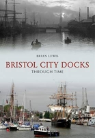
Bristol City Docks Through Time

Bristol City Docks Through Time is a unique insight into the illustrious history of this part of the country. Reproduced in full colour, this is an exciting examination of Bristol`s docks, and what they meant to the people of this area throughout the 19th and into the 20th Century. Looking beyond the exquisite exterior of these well-kept photos, readers can see the historical context in which they are set, and through the author`s factual captions for every picture, and carefully-selected choice of images, the reader can achieve a reliable view of this area`s history. There is something for everyone here, whether they have lived in Bristol all their lives, or whether they are just visiting this fabulous city and its docks. Bristol City Docks Through Time also shows how photography
has continually evolved to keep up with an ever changing society.
RIP - This product is no longer available on our network. It was last seen on 25.09.2019

This page now acts as a permanent archive for this product. Add more information using the comments box below to ensure it can still be found by future generations.

Use our search facility to see if it is available from an alternative contributor.
  • Availability: Out Of Stock
  • Supplier: Stanfords
  • SKU: 9781848683846
Availability: In Stock
£14.99

Product Description

Bristol City Docks Through Time is a unique insight into the illustrious history of this part of the country. Reproduced in full colour, this is an exciting examination of Bristol`s docks, & what they meant to the people of this area throughout the 19th & into the 20th Century. Looking beyond the exquisite exterior of these well-kept photos, readers can see the historical context in which they are set, & through the author`s factual captions for every picture, & carefully-selected choice of images, the reader can achieve a reliable view of this area`s history. There is something for everyone here, whether they have lived in Bristol all their lives, or whether they are just visiting this fabulous city & its docks. Bristol City Docks Through Time also shows how photography has continually evolved to keep up with an ever changing society.

Reviews/Comments

Add New

Intelligent Comparison

Oooops!
We couldn't find anything!
Perhaps this product's unique.... Or perhaps we are still looking for comparisons!
Click to bump this page and we'll hurry up.

Price History

Vouchers

No voucher codes found.
Do you know a voucher code for this product or supplier? Add it to Insights for others to use.

Facebook

Jargon Buster

History - Anything that happens in the past. An acedemic subject.
Colour - The categorised spectrum of light visable to humans
Set - a group of items usually related to one another. Some objects cannot function without the complete set of items.
Reliable - Something that is consistently good and can be trusted.
Exterior - The outer of something usually what is visible.

Supplier Information

Stanfords
Stanfords was established in 1853 and opened their iconic Covent Garden flagship store in 1901. They have become the top retailer of maps, travel books and accessories in the UK and arguably offer the largest selection of maps and travel books worldwide. Famous names such as Captain Robert Falcon Scott, Ranulph Fiennes and Michael Palin have purchased from Stanfords. They now have a shop in Bristol and both stores together with other venues operate a calendar of events including talks, book signings and exhibitions. As a specialist map retailer, the map selection is comprehensive and includes road maps, street maps and walking maps from worldwide destinations, as well as a selection of world atlases and wall maps. Books include travel guides and travel literature. Stanfords also stock globes, from miniatures made of blue marble to magnificent floor-standing globes. The website features a selection of interesting articles on travel topics.
Page Updated: 2023-11-12 20:15:36

Community Generated Product Tags

Oh No! The productWIKI community hasn't generated any tags for this product yet!
Menu