More From Contributor

£11.50
Topographic survey of France at 1:25, 000 in IGN`s excellent TOP25 / Série Bleue series. All the maps are GPS compatible, with a 1km UTM grid plus latitude & longitude lines at 5’ intervals. Contours are at 5m intervals except for mountainous areas where the maps have contours at 10m intervals, vividly enhanced by hill shading & graphics for rocky terrain. Colouring with graphics indicates different types of vegetation or land use (deciduous or coniferous forests, moors, orchards, vineyards, etc). PLEASE NOTE: coverage of France at this scale is currently being revised – the format & the presentation of each title are indicated by the letters at the end of its Sheet Reference number (e.g. 0416ET, 3531ETR, 1923SB, etc.)MAPS WITH FULL TOURIST OVERPRINT & AN ENGLISH MAP LEGEND: all TOP25 maps & the SB editions of Série Bleue have an overprint highlighting waymarked walking trails including long-distance GR routes &, where appropriate, ski routes. Symbols indicate campsites, gîtes d’etape, refuges, equestrian centres & other recreational facilities or sites, tourist information centres, cultural heritage, etc. Towns & locations of particular interest are highlighted.- ET or OT = single-sided TOP25 map covering approx. 29x 21 km / 18x 13 miles.- ETR or OTR = waterproof & tear resistant TOP25 map covering the same area as the corresponding ET or OT number, but double-sided, printed on a smaller size sheet with a good overlap between the sides.- SB = Série Bleue map with full tourist overprint; these maps, first introduced in summer 2014, each cover approx. 29x 24km / 18x 15 miles.SÉRIE BLEUE maps with numbers ending in E (Est) or O (Ouest): most editions now indicate the GR routes, but do not show any other tourist information. Map legend is in French only. Each map covers approx. 14x 20km / 9x 12 miles. ...
Archived Product
£7.99
Whether you're a local or a traveller, these 30 brightly coloured cards offer themed tours covering all interests u from beaches, live music, art & gardens, to sport, shopping, kid-friendly places, coffee & Greek treats. Each card features a themed tour on one side & a friendly map pinpointing the suggested pit stops on the other. Tours are designed to last around three hours (of course, the time involved depends on how long you linger in each place) & include one foodie stop. This means you can select one tour card if you have limited time, choose a couple of tour cards for your day's itinerary, or select a few cards & pick out places from each to visit. Even with a few cards in tow, their small & light format makes them easy to carry as you discover the city's secrets. Sample themed tours: The Sound of Music (Fortitude Valley) Arcades & Laneways (City centre) Brisneyland (South Bank) Bayside Bliss (Clontarf, Woody Point, Scotts Point, Redcliffe) ...
Archived Product
£8.99
Brisbane & Queensland in the Footprint Focus Guides, which are targeted at cities, regions & countries worldwide that have no, or very limited, coverage from other publishers. Widely recognised for their reliability & independent writing style, Footprint Focus guides all have the same layout. Smaller than their sister Handbooks, the Focus guides are intended to streamline the information contained so that you have more of what you need, without losing Footprint ...
Archived Product
£9.99
Indexed street plan of Brisbane with, on the reverse, an overview map of not just Queensl&, as indicated in the map title, but the whole of eastern Australia, plus a street plan of central Sydney. The plan of Brisbane covers the inner districts & provides a very clear picture of the city’s road & rail networks, particularly the access from streets onto the expressways & major routes. Railway stations & bus network stops are clearly marked, as well as Inner-City & City Cat ferry routes connections. Shopping areas are indicated by colour, with a wide range of symbols highlighting various facilities & places of interest, including numerous hotels. Also included is a diagram of the Trans-Link ferry routes & a road map of the Brisbane region showing access to the resorts of the Sunshine Coast & the Gold Coast. On the reverse a map at 1:3, 600, 000 shows the whole of eastern Australia, extending along the southern coast beyond Adelaide & inland to Alice Springs. Most of Tasmania is also included. While less detailed in its presentation of the road network &, in particular, lacking information on various facilities such as locations of fuel supplies, the map provides an overview picture of the main road & rail routes within that part of the country. The map highlights main national parks & various places of interest, showing the topography by altitude colouring. Latitude & longitude lines are drawn at 2º intervals & an index of localities is provided. Also included is a large plan of central Sydney, with similar presentation to the plan of Brisbane. ...
Archived Product
£7.99
Following the success of Hide & Seek Melbourne & Hide & Seek Sydney comes the third guidebook in this series. Hide & Seek Brisbane is a funky & compact guide to the city`s hidden treasures. From restaurants & shops to bars & outdoor activities, the book features 40 secret & intriguing places that you won`t find in any regular travel guide. & none of these places will burn a hole in your wallet. Written by a team of in-the-know Brisbanites, each of the 40 selected places features over a double-page spread with a review, images & a handy locator map. Blank pages at the back of the book allow readers to record their own secret Brisbane discoveries as they explore this wonderful city. Four main themes: ` Hit the Streets` (places to see/things to do) ` Treasure Trove` (shopping) ` Feeling Peckish?` (food) ` Night Owl` (bars, clubs & live music venues) ...
Archived Product
£7.99
Brisbane & The Gold Coast in the Pocket Guide series from Insight provides detailed commentary on a collection of itinerary based trips in a handy pocket format. Each guide has an historical & cultural introduction, profiling the growth of the region or city. There is also a large selection of localised & pedestrian friendly tour itineraries designed to take in the major sites, as well as a chapter on excursions to other destinations within easy reach. Further sections detail leisure activities including shopping, eating out, nightlife, festivals & local events with accompanying addresses & contact details where relevant. There is also practical guidance on transport, local services, language & accommodation. Each guide also has a large selection of colour photographs & a pull-out pocket map giving an overview of the region. ...
Archived Product
£9.99
Brisbane & Region in a series of maps from Hema presenting Australia’s main cities with three maps: a detailed street plan of the central area, a road map of the city with its outer suburbs, plus a map of the wider surrounding region for out-of-town excursions. The Brisbane map contains:- a street plan of city centre highlighting locations of 23 places of interest & over 40 hotels- a road map of Greater Brisbane (Bribie Island to Coomera & west to Ipswich) at 1:100, 000 with an index listing each location with its postcode- a regional road map at 1:300, 000 extending along the coast southwards to beyond the border with NSW to include the Gold Coast & northwards to Noosa Heads to cover the Sunshine Coast, plus inland to the New England Highway- also provided are diagrams of Brisbane`s suburban rail & ferry networks, plus a street plan of the Gold Coast resorts from Main Beach to Broadbeach with names of numerous hotels Both the suburban & the regional maps are indexed & show the road network indicating unsurfaced roads & tracks. Symbols mark roadside rest areas, campsites, accredited information centres, places of interest, etc. Topography is indicates by names of mountain ranges & selected peaks, plus rivers & lakes; national & state parks, conservation areas & reserves are all highlighted. The maps have a grid with latitude & longitude at intervals of 10’ & 30’ respectively. To see other titles in this series please click on the series link. ...
Archived Product
£9.99
Brisbane Suburbs & City Centre map from UBD Gregory’s, combining a detailed, indexed street plan of the centre with a map of the city with its suburbs & the surrounding area, plus extensive tourist information, Half of one side is taken by a detailed, indexed street plan at 1:5, 000 of the city centre (CBD) including the South Brisbane district with the Convention & exhibition centre. The plan shows one way streets, car parks, various facilities & places of interest, selected hotels, etc. Many individual buildings are named & streets are annotated with selected house numbers for easier identification of addresses. The rest of the page is filled with tourist information, including descriptions of “ The Best of Brisbane” sights, notes on eating out & getting around, lists of accommodation & city highlights, events & festivals, etc. On the reverse is an indexed road map at 1:100, 000 covering the city with its outer suburbs & the surrounding area. Coverage extends north beyond Redcliff, west to the D’ Anguilar National Park & Ipswich, & south to Beenleigh. The map gives names of various districts & suburbs, & shows main traffic arteries across them. National parks & other protected nature areas are prominently highlighted. To see a list of other street plans & directories from UBD Gregory`s please click on the series link. ...
Archived Product
£10.99
Highways connecting Brisbane, the Gold Coast & south-eastern Queensland with Cairns in a series of touring maps from Hema connecting Australia’s main centres of population along some of the country’s most spectacular routes. The map

Includes::
plans of central Brisbane & Cairns, tables of facilities in the national parks, etc. The map covers the coast Queensland from the Gold Coast & the border with New South Wales south of Brisbane northwards to Cairns & Cooktown, showing the Bruce Highway along the coast & the alternative routes further inl&. Coverage extends inland to Longreach to include the Capricorn Highway along the Tropic of Capricorn. In the Great Barrier Reef Coast Marine Park numerous coral reefs are named. Presentation of the road network distinguishes between sealed & unsealed roads &

Includes::
4WD tracks. Driving distances are marked on most roads & symbols indicate roadside fuel supplies & rest areas with or without overnight accommodation. The map also highlights seven tourist routes in the region, plus on a separate inset showing the area around Cairns Townsville & Cooktown also indicates 14 specially recommended tourist drives. Symbols indicate various facilities & places of interest including campsites & caravan parks, visitor centres, etc. Topography is shown by unobtrusive relief shading with plenty of names of mountain ranges, etc, plus graphics for swamps, saline flats, areas subject to inundation, etc, & colouring for forests. The map has a grid showing latitude & longitude at intervals of 1º. On the reverse there are brief descriptions of the 14 recommended tourist drives shown on the inset, detailed street plans of Brisbane & Cairns CBDs, descriptions of the region’s best touring itineraries & sights, a table showing facilities in the national parks, plus a list of contact details for further information. To see other titles in Hema’s City to City series of road maps please click on the series link.


...
Archived Product
£9.99
This new edition of UBD & Gregory`s Brisbane to Cairns Touring Map gives detailed coverage of the Queensland region between Brisbane & Cairns, highlighting the Bruce Highway & offering information on alternative routes.
Includes: visitor information & facilities chart for National parks.
...
Archived Product

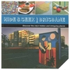
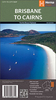
Brisbane And Its Region

Brisbane and its region in a series of waterproof and tear-resistant maps of Australian cities and their environs, with each title combining a selection of maps: the central area, the suburbs, and the wider environs. The map of the central part, more diagrammatic in style than found in most tourist street plans, shows one way streets and main buildings, with its short index listing some accommodation and main places of interest. The map of the city with its suburbs has an index listing all the suburbs, while the maps of the environs have indexes of the localities and highlight places of interest. No geographical coordinates are shown on the maps. Also included are diagrams of highway connections to Australia
RIP - This product is no longer available on our network. It was last seen on 25.09.2019

This page now acts as a permanent archive for this product. Add more information using the comments box below to ensure it can still be found by future generations.

Use our search facility to see if it is available from an alternative contributor.
  • External links may include paid for promotion
  • Availability: Out Of Stock
  • Supplier: Stanfords
  • SKU: 9781741171990
Availability: In Stock
£9.95

Product Description

Brisbane & its region in a series of waterproof & tear-resistant maps of Australian cities & their environs, with each title combining a selection of maps: the central area, the suburbs, & the wider environs. The map of the central part, more diagrammatic in style than found in most tourist street plans, shows one way streets & main buildings, with its short index listing some accommodation & main places of interest. The map of the city with its suburbs has an index listing all the suburbs, while the maps of the environs have indexes of the localities & highlight places of interest. No geographical coordinates are shown on the maps. Also included are diagrams of highway connections to Australia

Reviews/Comments

Add New

Price History

Vouchers

No voucher codes found.
Do you know a voucher code for this product or supplier? Add it to Insights for others to use.

Facebook

Jargon Buster

Waterproof - Resistant to water, usualy specified by depth in metres
Resistant - Something that can repel against something.
Accommodation - A room in which someone can live in, for example in a hotel

Supplier Information

Stanfords
Stanfords was established in 1853 and opened their iconic Covent Garden flagship store in 1901. They have become the top retailer of maps, travel books and accessories in the UK and arguably offer the largest selection of maps and travel books worldwide. Famous names such as Captain Robert Falcon Scott, Ranulph Fiennes and Michael Palin have purchased from Stanfords. They now have a shop in Bristol and both stores together with other venues operate a calendar of events including talks, book signings and exhibitions. As a specialist map retailer, the map selection is comprehensive and includes road maps, street maps and walking maps from worldwide destinations, as well as a selection of world atlases and wall maps. Books include travel guides and travel literature. Stanfords also stock globes, from miniatures made of blue marble to magnificent floor-standing globes. The website features a selection of interesting articles on travel topics.
Page Updated: 2023-11-12 20:15:36

Community Generated Product Tags

Oh No! The productWIKI community hasn't generated any tags for this product yet!
Menu