
 United Kingdom
 France
 Germany
 Netherlands
 Sweden
 USA
USA
 Italy
Italy
 Spain
Spain
More From Contributor


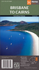

Brisbane Hema
Brisbane and Region in a series of maps from Hema presenting Australia’s main cities with three maps: a detailed street plan of the central area, a road map of the city with its outer suburbs, plus a map of the wider surrounding region for out-of-town excursions. The Brisbane map contains:- a street plan of city centre highlighting locations of 23 places of interest and over 40 hotels- a road map of Greater Brisbane (Bribie Island to Coomera and west to Ipswich) at 1:100, 000 with an index listing each location with its postcode- a regional road map at 1:300, 000 extending along the coast southwards to beyond the border with NSW to include the Gold Coast and northwards to Noosa Heads to cover the Sunshine Coast, plus inland to the New England Highway- also provided are diagrams of
Brisbane`s suburban rail and ferry networks, plus a street plan of the Gold Coast resorts from Main Beach to Broadbeach with names of numerous hotelsBoth the suburban and the regional maps are indexed and show the road network indicating unsurfaced roads and tracks. Symbols mark roadside rest areas, campsites, accredited information centres, places of interest, etc. Topography is indicates by names of mountain ranges and selected peaks, plus rivers and lakes; national and state parks, conservation areas and reserves are all highlighted. The maps have a grid with latitude and longitude at intervals of 10’ and 30’ respectively.To see other titles in this series please click on the series link.
Brisbane`s suburban rail and ferry networks, plus a street plan of the Gold Coast resorts from Main Beach to Broadbeach with names of numerous hotelsBoth the suburban and the regional maps are indexed and show the road network indicating unsurfaced roads and tracks. Symbols mark roadside rest areas, campsites, accredited information centres, places of interest, etc. Topography is indicates by names of mountain ranges and selected peaks, plus rivers and lakes; national and state parks, conservation areas and reserves are all highlighted. The maps have a grid with latitude and longitude at intervals of 10’ and 30’ respectively.To see other titles in this series please click on the series link.

Product Description
Reviews/Comments
Add New
Vouchers
No voucher codes found.
Do you know a voucher code for this product or supplier? Add it to Insights for others to use.
Do you know a voucher code for this product or supplier? Add it to Insights for others to use.
 Denmark