
 United Kingdom
 France
 Germany
 Netherlands
 Sweden
 USA
USA
 Italy
Italy
 Spain
Spain
More From Contributor


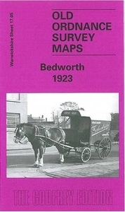
Bedworth 1923
Bedworth in 1923 in a fascinating series of reproductions of old Ordnance Survey plans in the Alan Godfrey Editions, ideal for anyone interested in the history of their neighbourhood or family. The map covers the village of Bedworth just north of Coventry, stretching from John Street and Thomas Street eastward to the Coventry Canal and Weston Lawn Farm, and from the Coventry Road northward to Marston Lane. Features include Coalpit Field, LMSR railway with Bedworth station, Coventry Canal, Bulkington Road area, Hosiery Works, Bedworth sewage Works, Bedworth Charity Colliery with tramways to railway and canal, All Saints church, Hat Manufactory, Mount Pleasant area, Springfield Hall, Market Place, almshouses, tramway, Hawkesbury & Bedworth Brick and Tile Works, old shafts
and coal workings, etc. On the reverse is a directory of Bedworth in 1921.About the Alan Godfrey Editions of the 25” OS Series:Selected towns in Great Britain and Ireland are covered by maps showing the extent of urban development in the last decades of the 19th and early 20th century. The plans have been taken from the Ordnance Survey mapping and reprinted at about 15 inches to one mile (1:4, 340). On the reverse most maps have historical notes and many also include extracts from contemporary directories. Most maps cover about one mile (1.6kms) north/south, one and a half miles (2.4kms) across; adjoining sheets can be combined to provide wider coverage.FOR MORE INFORMATION AND A COMPLETE LIST OF ALL AVAILABLE TITLES PLEASE CLICK ON THE SERIES LINK.
and coal workings, etc. On the reverse is a directory of Bedworth in 1921.About the Alan Godfrey Editions of the 25” OS Series:Selected towns in Great Britain and Ireland are covered by maps showing the extent of urban development in the last decades of the 19th and early 20th century. The plans have been taken from the Ordnance Survey mapping and reprinted at about 15 inches to one mile (1:4, 340). On the reverse most maps have historical notes and many also include extracts from contemporary directories. Most maps cover about one mile (1.6kms) north/south, one and a half miles (2.4kms) across; adjoining sheets can be combined to provide wider coverage.FOR MORE INFORMATION AND A COMPLETE LIST OF ALL AVAILABLE TITLES PLEASE CLICK ON THE SERIES LINK.

Product Description
Reviews/Comments
Add New
Intelligent Comparison
Archived Product
Tidworth 1936 Stanfords
£2.95
Archived Product

Tidworth 1936 Stanfords
£3.50
Archived Product
Isleworth 1935 Stanfords
£3.50
Archived Product

Bedford 1924 Stanfords
£3.50
Archived Product
Penrith 1923 Stanfords
£2.95
Archived Product
Penrith 1923 Stanfords
£3.50
Archived Product

Handsworth 1913 Stanfords
£3.50
Archived Product

Bedford North 1924 Stanfords
£3.50
Vouchers
No voucher codes found.
Do you know a voucher code for this product or supplier? Add it to Insights for others to use.
Do you know a voucher code for this product or supplier? Add it to Insights for others to use.
 Denmark