
 United Kingdom
 France
 Germany
 Netherlands
 Sweden
 USA
USA
 Italy
Italy
 Spain
Spain
More From Contributor


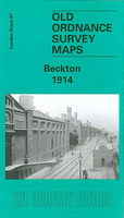
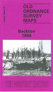
Beckton 1914
Beckton in 1914 in a fascinating series of reproductions of old Ordnance Survey plans in the Alan Godfrey Editions, ideal for anyone interested in the history of their neighbourhood or family. Two versions of this map have been published to show how the area developed across the years. Until the 1840s Beckton was ”a marshy waste, a notorious venue for illegal prize-fighting” writes author Stephen Pewsey, and these maps still show an area with few inhabitants. The principal feature is the vast Gas Works of the Gas Light & Coke Company, shown here with all its many railway sidings, and adjacent to a large Tar & Liquor Works. The Northern Outfall Sewer runs across the map, as does the GER Beckton Branch, with its Beckton station. Other features include the group of streets known as
Cyprus, a section of the Royal Albert Docks Railway, St Michael & All Angels church, and the group of houses known as Roman Road. The 1894 map also includes a section of Essex Sheet 73.16, which takes coverage northward across the marshes, up High Street South, Gooseley Lane and Claps Gate Lane. The 1914 map has a 1915 GER Timetable for the Liverpool Street to North Woolwich line, including occasional trains to Beckton.About the Alan Godfrey Editions of the 25” OS Series:Selected towns in Great Britain and Ireland are covered by maps showing the extent of urban development in the last decades of the 19th and early 20th century. The plans have been taken from the Ordnance Survey mapping and reprinted at about 15 inches to one mile (1:4, 340). On the reverse most maps have
historical notes and many also include extracts from contemporary directories. Most maps cover about one mile (1.6kms) north/south, one and a half miles (2.4kms) across; adjoining sheets can be combined to provide wider coverage.FOR MORE INFORMATION AND A COMPLETE LIST OF ALL AVAILABLE TITLES PLEASE CLICK ON THE SERIES LINK.

Product Description
Reviews/Comments
Add New
Intelligent Comparison
Archived Product
Beckton 1894 Stanfords
£3.50
Archived Product
Leyton 1914 Stanfords
£3.50
Archived Product
Beeston 1913 Stanfords
£2.95
Archived Product
Beeston 1913 Stanfords
£3.50
Vouchers
No voucher codes found.
Do you know a voucher code for this product or supplier? Add it to Insights for others to use.
Do you know a voucher code for this product or supplier? Add it to Insights for others to use.
 Denmark