
 United Kingdom
 France
 Germany
 Netherlands
 Sweden
 USA
USA
 Italy
Italy
 Spain
Spain
More From Contributor


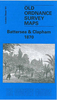


Battersea And Clapham 1894
Battersea and Clapham in 1894 Battersea in a fascinating series of reproductions of old Ordnance Survey plans in the Alan Godfrey Editions, ideal for anyone interested in the history of their neighbourhood or family. Three versions have been published for this area, stretching from Eland Road and Culvert Road eastward to Hartington Road and Jeffrey`s Road, and from Battersea Park station southward to Lillieshall Road and Grafton Square. Major roads through the map include Lavender Hill, Wandsworth Road and Battersea Park Road east-west, Queens Road north-south. Major railways cross the map and features include Queens Road, Battersea Park, Wandsworth Road and Clapham stations, Stewarts Lane goods staion, Nine Elms loco depot, Longhedge Works, and the complicated junctions around
these: West London Jct, Pouparts Jct, Longhedge Jct, Factory Jct and Stewarts Lane Jct. Full track layouts are given, along with details such as signal boxes, signal posts, turntables etc. Each map has street directory extracts on the reverse.About the Alan Godfrey Editions of the 25” OS Series:Selected towns in Great Britain and Ireland are covered by maps showing the extent of urban development in the last decades of the 19th and early 20th century. The plans have been taken from the Ordnance Survey mapping and reprinted at about 15 inches to one mile (1:4, 340). On the reverse most maps have historical notes and many also include extracts from contemporary directories. Most maps cover about one mile (1.6kms) north/south, one and a half miles (2.4kms) across; adjoining sheets
can be combined to provide wider coverage.FOR MORE INFORMATION AND A COMPLETE LIST OF ALL AVAILABLE TITLES PLEASE CLICK ON THE SERIES LINK.

Product Description
Reviews/Comments
Add New
Intelligent Comparison
Archived Product

Battersea And Clapham 1870 Stanfords
£3.50
Archived Product

Battersea And Clapham 1913 Stanfords
£3.50
Archived Product

Battersea And Fulham 1894 Stanfords
£3.50
Archived Product
Battersea And Fulham 1866 Stanfords
£3.50
Vouchers
No voucher codes found.
Do you know a voucher code for this product or supplier? Add it to Insights for others to use.
Do you know a voucher code for this product or supplier? Add it to Insights for others to use.
 Denmark