
 United Kingdom
 France
 Germany
 Netherlands
 Sweden
 USA
USA
 Italy
Italy
 Spain
Spain
More From Contributor
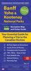


Banff And Huntly WATERPROOF
Map No. 29, Banff and Huntly, in a waterproff and tear-resistant version of the Ordnance Survey Landranger series at 1:50, 000, including Portsoy, Turriff, Aberchirder, Macduff, Cullen Portknockie, Findochty, Kirktown of Deskford, Cornhill, Kirktown of Alvah, Pennan, Gardenstown, Netherbrae, Fintry, New Byth, Bogton, Cuminestown, Inverkeithny, Howe of Teuchar, Kirkton of Auchterless, Milltown of Rothiemay, Cairnie, Largue, Cpttown, Fyvie, Rothienorman, Craigdam, Kirkton of Culsalmond, Bainshole, Bridgend and Gartly, with Strathbogie, Strath Isla, Knock Hill, Black Hill and Bin of Cullen. Edition B2; Revised 1999; Revised for selected changes 2002, 2008; Copyright date 2008 This title is also available on our website in a paper version.Maps in this series
are only published folded. Stanfords can also print flat versions of Ordnance Survey maps through the OS Select system, centring the map on a location of your choice and with a picture provided by you on the cover. For more information please click on the link at the bottom of this description.About Ordnance Survey
are only published folded. Stanfords can also print flat versions of Ordnance Survey maps through the OS Select system, centring the map on a location of your choice and with a picture provided by you on the cover. For more information please click on the link at the bottom of this description.About Ordnance Survey
Product Description
Reviews/Comments
Add New
Intelligent Comparison
Archived Product
Blackburn And Burnley WATERPROOF Stanfords
£10.39
Archived Product
Banff And Huntly Stanfords
£5.59
Archived Product
Bedford And Huntingdon WATERPROOF Stanfords
£11.19
Archived Product
Banff And Huntly OS ACTIVE Map Stanfords
£9.09
Vouchers
No voucher codes found.
Do you know a voucher code for this product or supplier? Add it to Insights for others to use.
Do you know a voucher code for this product or supplier? Add it to Insights for others to use.
 Denmark