
 United Kingdom
 France
 Germany
 Netherlands
 Sweden
 USA
USA
 Italy
Italy
 Spain
Spain
More From Contributor


Balearic Islands
Balearic Islands at 1:140, 000 in a series of indexed touring maps of Spain from Michelin with street plans of main cities. Topography is indicated by bold relief shading with spot heights and colouring for forested areas. Detailed road information, characteristic of Michelin
Product Description
Reviews/Comments
Add New
Intelligent Comparison
Archived Product
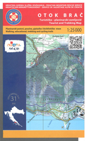
Brac Island Stanfords
£9.99
Archived Product
Canary Islands Stanfords
£10.39
Archived Product
Canary Islands Stanfords
£9.99
Vouchers
No voucher codes found.
Do you know a voucher code for this product or supplier? Add it to Insights for others to use.
Do you know a voucher code for this product or supplier? Add it to Insights for others to use.
 Denmark