
 United Kingdom
 France
 Germany
 Netherlands
 Sweden
 USA
USA
 Italy
Italy
 Spain
Spain
More From Contributor


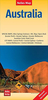

Australia Motorcycle Atlas
Motorcycle Road Atlas of Australia form Hema in a handy size, spiral-bound format, describing 200 top routes for exploring the country by motorbike, all highlighted on clear, detailed road maps indicating fuel supplies, caravan parks, national or state parks and other protected areas, etc.In this new, revised 2009 edition 200 routes are now presented, grouped by state and divided into two categories: the 100 top routes each have a separate page in the atlas with a description and photos; the next 100 rides get just a few lines each. The last, 122-page section is a road atlas, presenting each state in a series of maps overprinted with the routes. The maps indicate locations of fuel supplies, rest areas, picnic and camping sites and caravan parks. Scales vary according to the
size of the area covered by the map. The maps have latitude lines at intervals of 30
size of the area covered by the map. The maps have latitude lines at intervals of 30
Product Description
Reviews/Comments
Add New
Intelligent Comparison
Archived Product

Austria F&B Motorcycle Road Atlas Stanfords
£20.95
Archived Product

Slovenia Motorcycle Atlas Stanfords
£10.99
Archived Product
France Motorcycle Atlas Stanfords
£13.99
Archived Product

Alpine Countries Motorcycle Atlas Stanfords
£29.99
Archived Product
Australia Motorcycle Atlas Set- SPIRAL-BOUND Stanfords
£33.95
Archived Product
New Zealand Motorcycle Atlas Stanfords
£23.95
Archived Product
Australia Road Atlas Stanfords
£11.99
Archived Product
Australia Road Atlas Stanfords
£20.95
Vouchers
No voucher codes found.
Do you know a voucher code for this product or supplier? Add it to Insights for others to use.
Do you know a voucher code for this product or supplier? Add it to Insights for others to use.
 Denmark