
 United Kingdom
 France
 Germany
 Netherlands
 Sweden
 USA
USA
 Italy
Italy
 Spain
Spain
More From Contributor

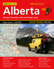


Alberta Fast Track Map (MapArt Map)
Waterproof and tear-resistant, double-sided indexed road map of Alberta, with enlargements for Calgary and Edmonton. The map presents the province in two halves, with the southern part extending westwards inside British Columbia to Kelowna, to include the whole of the Banff and Jasper plus Yoho, Kootenay and Glacier National Parks.The map provides a clear picture of the road network, with detailed road grading, rest areas and service centres, intermediate driving distances, etc. Also shown are railway lines, time zone boundaries, and administrative divisions. Extensive overprint highlights numerous places of interest, including national/provincial parks and wildlife reserves, different types of campsites, sport and recreational facilities, etc. The map has latitude and
longitude grid at intervals of 1
longitude grid at intervals of 1
Product Description
Reviews/Comments
Add New
Intelligent Comparison
Archived Product
Whistler Fast Track Map (MapArt Map) Stanfords
£10.95
Archived Product
Ontario Northern Fast Track Map (MapArt Map) Stanfords
£10.95
Archived Product
Alberta Southern (MapArt Map) Stanfords
£7.50
Vouchers
No voucher codes found.
Do you know a voucher code for this product or supplier? Add it to Insights for others to use.
Do you know a voucher code for this product or supplier? Add it to Insights for others to use.
 Denmark