More From Contributor
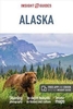
£6.95
Alanya Tourist Plan from Mepmedya at 1:9, 000 is a detailed street plan of the city. Shows main streets, urban transport & many places of interest.

Includes::
a plan of Alanya Castle & a road map of the surrounding area. * Map legend in English & Turkish.* Major & secondary roads & main streets are named or numbered. The tramway service is displayed & local bus stations are marked. Local districts are named & demarcated, & many places of interest are annotated on the map. These include: hotels, shops & museums; places of worship, public buildings, post offices, schools & emergency services; & parks, beaches, Turkish baths & sports & entertainment venues. The most important sites are numbered, with descriptions & photography appearing on the reverse of the map. Also
Includes::* An inset showing a plan of Alanya Castle (scale not shown).* A road map overview of the Alanya area at 1:325, 000, showing places of interest, relief shading & spot heights.


...
Archived Product
£6.50
Topographic coverage of the Balearic Islands at 1:25, 000 published by the Instituto Geográfico Nacional – Centro Nacional de Información Geografica, the country’s civilian survey organization. The maps have contours at 10m intervals & colouring and/or graphics to show different types of vegetation or land use. Boundaries of national parks & other protected areas are marked. In addition to all the usual information shown on topographic mapping at this scale: detailed presentation of the road & rail networks, rural tracks & paths, etc, the maps also show campsites. The maps have a 1-km UTM grid, plus margin ticks for latitude & longitude at 1` intervals. The majority of the titles have been published since late 1990s. Map legend is in Spanish only.COVERAGE: each 25K map covers one quarter of the corresponding 1:50, 000 map, with the numbering system: I = NW quarter, II = NE quarter, III = SW quarter, & IV = SE quarter. To see other titles in this series please click on the series link. ...
Archived Product
£11.95
Alaska, including the Aleutian Islands, at 1:3, 000, 000 on an exceptionally detailed map published by Imus Geographics with an extensive index listing both towns or small settlements & geographical features such as peaks, glaciers, rivers, bays & islands, etc. The map provides an uninterrupted view of the whole state, without any peripheral regions or islands tucked away in insets. Shading & latitude colouring are used to show the general relief, with names and/or spot heights for many peaks. More rivers or lakes are shown & named than on other similar scale maps of the state. Boundaries of national or state parks, forest & other protected areas are highlighted. Also marked are Indian reservations, the National Petroleum Reserve & internal administrative boundaries. With the wealth of topographic information in the background, road network is inevitably less clearly visible than on purely road maps, but is presented distinguishing between paved highways (shown with driving distances), gravel highways & other roads. Railways lines aand coastal ferry routes included & airports are graded into those with scheduled jet services, public access or military airports & seaplane bases. Also marked are the Iditarod Trail & the course of the Trans-Alaska pipeline. Symbols indicate state parks with camping facilities, visitor centres, marine parks & wildlife watching sites, ski areas, etc. Latitude & longitude lines are drawn at 2 ...
Archived Product
£8.95
Double-sided, indexed tourist road map of the state. Coverage divides the state north/south, with the Panhandle region & Pribilof Islands shown in insets, & a smaller scale inset at 1:3, 750, 000 showing the Aleutian Islands. General relief is clearly shown by elevation tinting, characteristic of this publisher ...
Archived Product
£9.95
Detailed, double-sided road map Alaska, ideal for route-planning. Clearly shows the national road network & selected provincial & local roads, with each class of road clearly indicated & road numbers shown. Topography is shown with relief shading & some spot heights, & colour shading is used to indicate land types. International & provincial boundaries are clearly marked, as are National Parks, nature reserves & restricted military areas. Symbols indicate various sights & locations of tourist interest, such as churches, temples, panoramas & viewing points, monuments & historic sites. Some hotels & campsites are marked. Railway lines, airports, oil pipelines & restricted access points are also shown. A grid divides the map at 2 ...
Archived Product
£16.99
Alaska, including the Aleutian Islands, at 1:3, 000, 000 on an exceptionally detailed map published by Imus Geographics with an extensive index listing both towns or small settlements & geographical features such as peaks, glaciers, rivers, bays & islands, etc. The map provides an uninterrupted view of the whole state, without any peripheral regions or islands tucked away in insets. Shading & altitude colouring are used to show the general relief, with names and/or spot heights for many peaks. More rivers or lakes are shown & named than on other similar scale maps of the state. Boundaries of national or state parks, forest & other protected areas are highlighted. Also marked are Indian reservations, the National Petroleum Reserve & internal administrative boundaries. With the wealth of topographic information in the background, road network is inevitably less clearly visible than on purely road maps, but is presented distinguishing between paved highways (shown with driving distances), gravel highways & other roads. Railways lines & coastal ferry routes included & airports are graded into those with scheduled jet services, public access or military airports & seaplane bases. Also marked are the Iditarod Trail & the course of the Trans-Alaska pipeline. Symbols indicate state parks with camping facilities, visitor centres, marine parks & wildlife watching sites, ski areas, etc. Latitude & longitude lines are drawn at 2° intervals. Also provided is a table of distances shown in both miles & kilometres.* * Please note:* in view of the wealth of information shown on the map, some names printed on the map are in relatively small size font. ...
Archived Product
£16.99
Alaska has both vast wilderness tracts & a modern transportation system, making eco-travelling in the state easy as well as exciting. From the broad expanses of tundra in the Arctic National Wildlife Refuge & the rich seabird colonies of the Bering Sea to the glacier-bedecked snowy mountains & magnificent forests of the Southeast, wildlife viewing opportunities abound. In this book is all the information you will need to find, identify, & learn about Alaska`s magnificent animal life.- Identifying & location information on the most frequently seen animals.- Full-colour illustrations of more than 320 of Alaska`s most common marine invertebrates, insects, amphibians, fishes, birds, & mammals.- Up-to-date information on the ecology, behavior, & conservation of the animals.- Information on Alaska`s habitats & on the most common plants you will encounter.- Brief descriptions of Alaska`s most frequently visited parks & reserves. Easy to carry, entertainingly written, beautifully illustrated-you will want to have this book as constant companion on your journey. ...
Archived Product
£15.99
All you need to inspire every step of your journey. An in-depth book, now with free app & e Book. From deciding when to go, to choosing what to see when you arrive, this Insight Guides book is all you need to plan your trip & experience the best of Alaska, with in-depth insider information on must-see, top attractions like Denali & hidden cultural gems like Flattop Mountain.· Insight Guides Alaska is ideal for travellers seeking immersive cultural experiences, from exploring Alaska Zoo, to discovering Pioneer Park· In-depth on history & culture: enjoy special features on the ecology & the national forests, all written by local experts·

Includes::
innovative, unique extras to keep youup-to-date when you`re on the move
- this guide comes with a free e Book, & an app that highlights top attractions & regional information & is regularly updated with new hotel, bar, restaurant, shop & local event listings· Invaluable maps, travel tips & practical information ensure effortless planning, & encourage venturing off the beaten track· Inspirational colour photography throughout
- Insight Guides is a pioneer of full-colour guide books· Inventive design makes for an engaging, easy reading experience


...
Archived Product
£9.99
Alaska: Alaska, Dempster & Dalton Highways Road Atlas from ITMB in an A5 paperback format presenting the road network across central Alaska linking Anchorage with Fairbanks & Prudhoe Bay, plus the Alaska Highway between Fairbanks & Fort St. John & other roads across northern British Columbia & Yukon in Canada. Map scales vary: 1:1, 500, 000 in Alaska, 1:1, 000, 000 in Yukon & 1:1, 250, 000 in British Columbia. Cartography, taken from the publisher’s individual titles for the state & the two provinces also varies, but all the mapping has altitude colouring with peak heights shown in feet within Alaska & in metres in Canada. Glaciers are marked & national parks & other protected areas are highlighted. Road network indicates gravel roads &

Includes::
winter only roads & trails. Distances are shown on main routes & as well as location of petrol stations. Railway lines, local airports & pipelines are also marked. Symbols indicate various places of interest including RV campgrounds, campsites, lodges, Day Use Areas, recreational areas, historic sites, locations with medical facilities, etc. The atlas is indexed & individual pages have latitude & longitude margin ticks at 2° intervals. To see other regional titles from ITMB covering USA please click on the series link.

...
Archived Product
£16.99
Alaska National Parks in the National Geographic National Parks guide series; comprising a selection of titles dedicated to the National Parks of the United States. Each of the titles in the series covers a different region of America & explores the area’s parks; providing a comprehensive survey for visitors. An introductory chapter profiles the region’s parks & provides practical advice on how to get there, when to go, how to make the most of your visit, entrance fees, pets, facilities for the disabled, campgrounds & hotels, motels & inns. Each of the National Parks guides is arranged by chapters dedicated to individual parks, allowing readers to locate the information they need easily. A series of information boxes provide an overview of the park, with details of size, date of establishment, the best time to visit & contact details, acreage & the activities available. There is also a What Not to Miss fact box which gives an overview of the park’s highlights. Overview maps of the region are accompanied by comprehensive descriptions of the various excursions available in each park, with appropriate advice & important tips on navigation & how to deal with wildlife on the trail. Extensive information on the flora & fauna of each park is incorporated throughout each guide in addition to the park’s history. ...
Archived Product

Alaska

Alaska in the Countries and Regions series from Lonely Planet, market-leading comprehensive guides aimed at independent travellers and serving a large range of international destinations. Frank and informal in style, the guides explore an extensive range of sights, activities, accommodation, restaurants and nightlife and are designed for practical use while travelling on the road. Written and researched by a team of experts, each book is independent in its recommendations and suggestions, often offering individual takes on individual destinations.Widely recognised for their reliability, each Lonely Planet country and region guide has the same layout. Introductory sections profile the destination with individual chapters on particular highlights, getting started, (including when
to go) itineraries, history, culture, arts, food and drink and the environment. Each guide is organised geographically by region, with individual sections detailing an extensive range of sights, places of interest, attractions, restaurants, nightlife, accommodation and any local activities. The guides have detailed explanations of historical context where relevant. There is also practical guidance on
RIP - This product is no longer available on our network. It was last seen on 25.09.2019

This page now acts as a permanent archive for this product. Add more information using the comments box below to ensure it can still be found by future generations.

Use our search facility to see if it is available from an alternative contributor.
  • Availability: Out Of Stock
  • Supplier: Stanfords
  • SKU: 9781741796964
Availability: In Stock
£11.99

Product Description

Alaska in the Countries & Regions series from Lonely Planet, market-leading comprehensive guides aimed at independent travellers & serving a large range of international destinations. Frank & informal in style, the guides explore an extensive range of sights, activities, accommodation, restaurants & nightlife & are designed for practical use while travelling on the road. Written & researched by a team of experts, each book is independent in its recommendations & suggestions, often offering individual takes on individual destinations. Widely recognised for their reliability, each Lonely Planet country & region guide has the same layout. Introductory sections profile the destination with individual chapters on particular highlights, getting started, (including when to go) itineraries, history, culture, arts, food & drink & the environment. Each guide is organised geographically by region, with individual sections detailing an extensive range of sights, places of interest, attractions, restaurants, nightlife, accommodation & any local activities. The guides have detailed explanations of historical context where relevant. There is also practical guidance on

Reviews/Comments

Add New

Price History

Vouchers

No voucher codes found.
Do you know a voucher code for this product or supplier? Add it to Insights for others to use.

Facebook

Jargon Buster

team - A group of people or animals linked by a common purpose.
History - Anything that happens in the past. An acedemic subject.
Large - something that takes up more space than normal.
Road - a manmade lane or a path that is used to speed up travel.
Accommodation - A room in which someone can live in, for example in a hotel
Practical - Weather a task is easy to carry out and realistically succeed.
Individual - A single separate item or person.
Environment - The conditions and surrounding area.

Supplier Information

Stanfords
Stanfords was established in 1853 and opened their iconic Covent Garden flagship store in 1901. They have become the top retailer of maps, travel books and accessories in the UK and arguably offer the largest selection of maps and travel books worldwide. Famous names such as Captain Robert Falcon Scott, Ranulph Fiennes and Michael Palin have purchased from Stanfords. They now have a shop in Bristol and both stores together with other venues operate a calendar of events including talks, book signings and exhibitions. As a specialist map retailer, the map selection is comprehensive and includes road maps, street maps and walking maps from worldwide destinations, as well as a selection of world atlases and wall maps. Books include travel guides and travel literature. Stanfords also stock globes, from miniatures made of blue marble to magnificent floor-standing globes. The website features a selection of interesting articles on travel topics.
Page Updated: 2023-11-12 20:15:36

Community Generated Product Tags

Oh No! The productWIKI community hasn't generated any tags for this product yet!
Menu