
 United Kingdom
 France
 Germany
 Netherlands
 Sweden
 USA
USA
 Italy
Italy
 Spain
Spain
More From Contributor

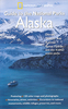
Alaska
Alaska, including the Aleutian Islands, at 1:3, 000, 000 on an exceptionally detailed map published by Imus Geographics with an extensive index listing both towns or small settlements and geographical features such as peaks, glaciers, rivers, bays and islands, etc.The map provides an uninterrupted view of the whole state, without any peripheral regions or islands tucked away in insets. Shading and altitude colouring are used to show the general relief, with names and/or spot heights for many peaks. More rivers or lakes are shown and named than on other similar scale maps of the state. Boundaries of national or state parks, forest and other protected areas are highlighted. Also marked are Indian reservations, the National Petroleum Reserve and internal administrative
boundaries.With the wealth of topographic information in the background, road network is inevitably less clearly visible than on purely road maps, but is presented distinguishing between paved highways (shown with driving distances), gravel highways and other roads. Railways lines and coastal ferry routes included and airports are graded into those with scheduled jet services, public access or military airports and seaplane bases. Also marked are the Iditarod Trail and the course of the Trans-Alaska pipeline. Symbols indicate state parks with camping facilities, visitor centres, marine parks and wildlife watching sites, ski areas, etc. Latitude and longitude lines are drawn at 2° intervals. Also provided is a table of distances shown in both miles and kilometres.* *Please note:*
in view of the wealth of information shown on the map, some names printed on the map are in relatively small size font.
Product Description
Reviews/Comments
Add New
Vouchers
No voucher codes found.
Do you know a voucher code for this product or supplier? Add it to Insights for others to use.
Do you know a voucher code for this product or supplier? Add it to Insights for others to use.
 Denmark