
 United Kingdom
 France
 Germany
 Netherlands
 Sweden
 USA
USA
 Italy
Italy
 Spain
Spain
More From Contributor

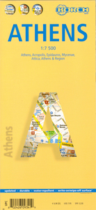
Athens Borch
Laminated and waterproof tourist map for visitors to Athens from Borch, combining a plan of the central part of the city with a map of its environs showing road and rail connections to the airport and to the port in Piraeus, a road map of Attica and north-eastern Peloponnese, and plans of main archaeological sites. The main plan at 1:7, 500 covers the central districts of the city, including all of its main sites, the Acropolis and the Filopappou Hill, Lycabettus, the National Archaeological Museum, etc. The plan indicates various places of interest, selected hotels, metro stations with line numbers, one way streets, etc.On the reverse the environs of Athens, including the port of Piraeus and the airport, are presented at 1:100, 000, showing road and rail connections. Attica
and north-eastern Peloponnese are shown at 1:750, 000 indicating archaeological sites, including Delphi, beaches, campsites, etc. The plan and both maps are indexed, with lists of streets/localities, parks, public buildings, places of interest, etc. Top 30 sights in the city and the region are prominently marked. Detailed plans are provided for the Acropolis, Mycenae and Epidaurus. The map also includes a diagram of the metro network, an administrative map of Greece showing its provinces and information on the city’ climate.
and north-eastern Peloponnese are shown at 1:750, 000 indicating archaeological sites, including Delphi, beaches, campsites, etc. The plan and both maps are indexed, with lists of streets/localities, parks, public buildings, places of interest, etc. Top 30 sights in the city and the region are prominently marked. Detailed plans are provided for the Acropolis, Mycenae and Epidaurus. The map also includes a diagram of the metro network, an administrative map of Greece showing its provinces and information on the city’ climate.

Product Description
Reviews/Comments
Add New
Intelligent Comparison
Archived Product
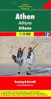
Athens F&B Stanfords
£9.99
Archived Product
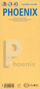
Phoenix Borch Stanfords
£8.99
Vouchers
No voucher codes found.
Do you know a voucher code for this product or supplier? Add it to Insights for others to use.
Do you know a voucher code for this product or supplier? Add it to Insights for others to use.
 Denmark