More From Contributor

£11.99
Have you ever tried to `dig a hole to China, ` just so you could see who was on the other side of the world? With At The Same Moment, Around The World readers can compare what is happening in all time zones across the globe at exactly the same time. Watch Benedict drinking hot chocolate in the morning in Paris & Kanka having a little nap in Vietnam. Discover a secret kiss in San Francisco & a baby born in the middle of the night in Peru! Clotilde Perrin takes readers eastward from the Greenwich meridian, from day to night, with each page portraying one of (the original) twenty-four time zones. ...
Archived Product
£10.99
Paraguay
- the name conjures up everything most exotic & extreme in South America. It`s a place of hellish jungles, dictators,
...
Archived Product
£8.99
For the last thirty years John Lister-Kaye has taken the same circular walk from his home deep in a Scottish glen up to a small hill loch. Each day brings a new observation or an unexpected encounter
- a fragile spider`s web, an osprey struggling to lift a trout from the water or a woodcock exquisitely camouflaged on her nest
- & every day, on his return home, he records his thoughts in a journal. Drawing on this lifetime of close observation, At The Water`s Edge encourages us to look again at the nature around us, to discover its wildness for ourselves & to respect & protect it.

...
Archived Product
£6.99
Dramatic dystopian adventure from the bestselling Incarceron author. Caz has been living in the department store since the day the Blue Star came & killed everyone who breathed in its toxic snow. She can`t do so much as look outside. But life in the store is getting dangerous & so Caz decides to take her chances in the world outside, with only Will for company. What will she find in the bleak landscape? & is there even anything to find? A compelling vision of a dystopian society. Particularly suitable for struggling, reluctant & dyslexic readers aged 12+ ...
Archived Product
£14.99
This biography of Atat?rk aims to strip away the myth to show the complexities of the man beneath. Born plain Mustafa in Ottoman Salonica in 1881, he trained as an army officer but was virtually unknown until 1919, when he took the lead in thwarting the victorious Allies` plan to partition the Turkish core of the Ottoman Empire. He divided the Allies, defeated the last Sultan & secured the territory of the Turkish national state, becoming the first president of the new republic in 1923. He imposed coherence, order & mordernity & in the process, created his own legend & his own cult. ...
Archived Product
£6.95
Map No. 437 – Ateca is part of the topographic coverage of Spain at 1:50, 000 in the MTN50 (Mapa Topográfico Nacional) series from the Instituto Geográfico Nacional – Centro Nacional de Información Geograficá, the country’s civilian survey organization. The maps have contours at 20m intervals, enhanced by relief shading, plus colouring and/or graphics to show different types of terrain, vegetation or land use. Boundaries of national parks & other protected areas are marked. In addition to all the usual information shown on topographic maps at this scale, detailed presentation of the road & rail networks, rural tracks & paths, etc, the maps also show campsites & mountain refuges. On more recent editions some GRs, the official long-distance hiking routes, are also marked (although not as clearly as on hiking maps from other publishers).A small inset shows local administrative boundaries & a table of UTM coordinates for triangulation points is also provided. Each map covers an area of 27x 18 km (17x 11 miles approx.) The maps have a 1-km UTM grid, with margin ticks for latitude & longitude at 5` intervals. Map legend is in Spanish only.*PLEASE READ THE NOTES BELOW BEFORE ORDERING!** Map Titles:* The grids shown on our website serve both the civilian & the military 1:50, 000 topographic series. Although the areas covered by sheets in both series are identical (apart from some border or coastal sheets), occasionally map titles differ – only one title is shown on the grid, usually the military one. Map titles listed on our website are based on information received by us at the time of publication, but sometimes maps arrive showing a completely different title! * As long as the map number is as ordered, the correct map has been supplied.* In Galicia, the Basque country & in the Catalan speaking areas the tendency now is to use local place names rather than the often better known Castilian names. Where possible, both versions are included in our titles. * Publication dates:*MTN50 series was begun in late 1990s, with most sheets listed here published in 2000s. Numbers not included on our website may still be available in the previous series but the maps will be very old, some dating back to 1940s or 1950s. If required, please contact us by e-mail.* How to choose the right 1:50, 000 map:* All the titles in the [LINK: 1800caption: IGN 200K Provincial Road Maps series at 1:200, 000] are overprinted with the grid for the 1:50, 000 maps & can be used to see precisely the area covered by each 50K title. ...
Archived Product
£6.95
Topographic coverage of mainland Spain at 1:50, 000 in the MTN50 (Mapa Topográfico Nacional) series from the Centro Nacional de Información Geografica, the country’s civilian survey organization. The maps have contours at 20m intervals, enhanced by relief shading, plus colouring and/or graphics to show different types of terrain, vegetation or land use. Boundaries of national parks & other protected areas are marked. In addition to all the usual information featured on topographic mapping at this scale, detailed presentation of the road & rail networks, rural tracks & paths, etc, the maps also show campsites & mountain refuges. On more recent editions some GRs, the official long-distance hiking routes, are also marked (although not as clearly as on hiking maps from other publishers). Each map covers 29.5x 18.5 km (with adjustments in the border or coastal areas). The maps have a 1-km UTM grid, plus margin ticks for latitude & longitude at 1` intervals. Map legend is in Spanish only.HOW TO CHOOSE THE RIGHT 50K MAP: all the titles in CNIG’s 200K Provincial Road Maps series at 1:200, 000 are overprinted with the grid for the 1:50, 000 maps & can be used to see the area covered by each 50K title. TO SEE THE LIST OF TITLES IN THIS SERIES PLEASE CLICK ON THE SERIES LINK.PLEASE NOTE
- MAP TITLES: the grids shown on our website serve both the civilian & the military 1:50, 000 topographic series. Although the areas covered by maps in both series are identical (apart from some border or coastal sheets), occasionally map titles differ – only one title is shown on the grid, usually the military one. In Galicia, the Basque country & in the Catalan speaking areas the tendency now is to use local place names rather than the often better known Castilian ones. Where possible, both versions are included in our titles. Map titles listed on our website are based on information received by us at the time of publication, but sometimes maps arrive showing a completely different title! As long as the map number is as ordered, the correct map has been supplied.
...
Archived Product
£9.50
Topographical survey of Belgium at 1:20, 000 from Nationaal Geografisch Instituut / Institut Géographique National, the country’s national survey organization. Each 20K map covers one quarter of the corresponding 1:50, 000 map (with adjustments in the border & coastal areas). The maps provide all the information expected of topographic mapping at this scale & in addition have an unusually large amount of vegetation and/or land use information (different types of woodlands, gardens, orchards, heath, etc). The maps have a 1-km UTM grid, with margin ticks for latitude & longitude at intervals of 1`. Map legend & a glossary of terms used on the maps include English. Stanfords keeps as regular stock 20K maps for the World War I battlefields around the Ypres, Messines & Passchendaele, & for the area of the Battle of Waterloo. The 1:20, 000 survey covers the whole of Belgium & maps for other regions can be supplied as special orders. To see the list of titles in this series please click on the series link.PLEASE NOTE: the Long-Distance Footpaths Map of Belgium at 1:300, 000 which shows the division of Belgium into the 50K survey sheets can also be used to see in more detail coverage by the 20K maps. ...
Archived Product
£11.99
Topographical survey of Belgium at 1:50, 000 from the country’s national survey organization, Nationaal Geografisch Instituut / Institut Géographique National. Contour interval varies according to the terrain, from 2.5 metres in the coastal areas to 10 metres in the Ardennes. The maps provide all the information expected of topographic mapping at this scale & in addition have an unusually large amount of vegetation and/or land use information (different types of woodlands, gardens, orchards, heath, etc). Each standard sheet covers Approx. 32 x 20 km / 20 x 12 miles, with larger maps published for the border or coastal areas. The maps have a 1-km UTM grid, with margin ticks for latitude & longitude at intervals of 1`. Map legend & a glossary of terms used on the maps include English.PLEASE NOTE: the Long-Distance Footpaths Map of Belgium at 1:300, 000 is overprinted with the grid for the 1:50, 000 topographic survey, showing the exact coverage of each sheet. Stanfords keeps as regular stock 50K maps for the World War I battlefields around the Ypres, Messines & Passchendaele, & for the area of the Battle of Waterloo. Maps for other regions can be supplied as special orders – to see the list of all the titles in this series please click on the series link. ...
Archived Product
£14.99
Discover the adventures of Athena, the ancient Greek goddess of wisdom, war & courage. From her extraordinary birth
- sprung
...
Archived Product

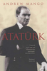
Ataturk: An Intellectual Biography

When Mustafa Kemal Ataturk became the first president of Turkey in 1923, he set about transforming his country into a secular republic where nationalism sanctified by science--and by the personality cult Ataturk created around himself--would reign supreme as the new religion. This book provides the first in-depth look at the intellectual life of the Turkish Republic`s founder. In doing so, it frames him within the historical context of the turbulent age in which he lived, and explores the uneasy transition from the late Ottoman imperial order to the modern Turkish state through his life and ideas. Shedding light on one of the most complex and enigmatic statesmen of the modern era, M. Sukru Hanioglu takes readers from Ataturk`s youth as a Muslim boy in the volatile ethnic cauldron of
Macedonia, to his education in nonreligious and military schools, to his embrace of Turkish nationalism and the modernizing Young Turks movement. Who was this figure who sought glory as an ambitious young officer in World War I, defied the victorious Allies intent on partitioning the Turkish heartland, and defeated the last sultan?Hanioglu charts Ataturk`s intellectual and ideological development at every stage of his life, demonstrating how he was profoundly influenced by the new ideas that were circulating in the sprawling Ottoman realm. He shows how Ataturk drew on a unique mix of scientism, materialism, social Darwinism, positivism, and other theories to fashion a grand utopian framework on which to build his new nation. Now with a new preface, this book provides the first
in-depth look at the intellectual life of the Turkish Republic`s founder.
RIP - This product is no longer available on our network. It was last seen on 25.09.2019

This page now acts as a permanent archive for this product. Add more information using the comments box below to ensure it can still be found by future generations.

Use our search facility to see if it is available from an alternative contributor.
  • External links may include paid for promotion
  • Availability: Out Of Stock
  • Supplier: Stanfords
  • SKU: 9780691175829
Availability: In Stock
£14.95

Product Description

When Mustafa Kemal Ataturk became the first president of Turkey in 1923, he set about transforming his country into a secular republic where nationalism sanctified by science--and by the personality cult Ataturk created around himself--would reign supreme as the new religion. This book provides the first in-depth look at the intellectual life of the Turkish Republic`s founder. In doing so, it frames him within the historical context of the turbulent age in which he lived, & explores the uneasy transition from the late Ottoman imperial order to the modern Turkish state through his life & ideas. Shedding light on one of the most complex & enigmatic statesmen of the modern era, M. Sukru Hanioglu takes readers from Ataturk`s youth as a Muslim boy in the volatile ethnic cauldron of Macedonia, to his education in nonreligious & military schools, to his embrace of Turkish nationalism & the modernizing Young Turks movement. Who was this figure who sought glory as an ambitious young officer in World War I, defied the victorious Allies intent on partitioning the Turkish heartl&, & defeated the last sultan? Hanioglu charts Ataturk`s intellectual & ideological development at every stage of his life, demonstrating how he was profoundly influenced by the new ideas that were circulating in the sprawling Ottoman realm. He shows how Ataturk drew on a unique mix of scientism, materialism, social Darwinism, positivism, & other theories to fashion a grand utopian framework on which to build his new nation. Now with a new preface, this book provides the first in-depth look at the intellectual life of the Turkish Republic`s founder.

Reviews/Comments

Add New

Intelligent Comparison

Oooops!
We couldn't find anything!
Perhaps this product's unique.... Or perhaps we are still looking for comparisons!
Click to bump this page and we'll hurry up.

Price History

Vouchers

No voucher codes found.
Do you know a voucher code for this product or supplier? Add it to Insights for others to use.

Facebook

Jargon Buster

Education - A term used to describe the act of learning a new skill or information
World - A physical grouping, commonly used to describe earth and everything associated with ti
Set - a group of items usually related to one another. Some objects cannot function without the complete set of items.

Supplier Information

Stanfords
Stanfords was established in 1853 and opened their iconic Covent Garden flagship store in 1901. They have become the top retailer of maps, travel books and accessories in the UK and arguably offer the largest selection of maps and travel books worldwide. Famous names such as Captain Robert Falcon Scott, Ranulph Fiennes and Michael Palin have purchased from Stanfords. They now have a shop in Bristol and both stores together with other venues operate a calendar of events including talks, book signings and exhibitions. As a specialist map retailer, the map selection is comprehensive and includes road maps, street maps and walking maps from worldwide destinations, as well as a selection of world atlases and wall maps. Books include travel guides and travel literature. Stanfords also stock globes, from miniatures made of blue marble to magnificent floor-standing globes. The website features a selection of interesting articles on travel topics.
Page Updated: 2023-11-12 20:15:36

Community Generated Product Tags

Oh No! The productWIKI community hasn't generated any tags for this product yet!
Menu