
 United Kingdom
 France
 Germany
 Netherlands
 Sweden
 USA
USA
 Italy
Italy
 Spain
Spain
More From Contributor


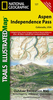


Aspen & Central Colorado
Topo map of central Colorado with a small map of Aspen. The map has contours, spot heights and uses relief shading also to depict the physical landscape of the region. Towns, highways, tracks and hiking/biking trails are indicated. National forest areas and wilderness areas aer similarly marked. Tourist information includes boat landings, campsites, ghost towns, museums, skiing areas and picnic areas. The reverse side has historical information about Aspen and the surrounding area.

Product Description
Reviews/Comments
Add New
Vouchers
No voucher codes found.
Do you know a voucher code for this product or supplier? Add it to Insights for others to use.
Do you know a voucher code for this product or supplier? Add it to Insights for others to use.
 Denmark