
 United Kingdom
 France
 Germany
 Netherlands
 Sweden
 USA
USA
 Italy
Italy
 Spain
Spain
More From Contributor

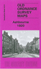


Ashbourne, Cheadle And District 1895
Ashbourne, Cheadle and District in 1895 in a series of reproductions of Ordnance Survey’s famous ”Inch to the Mile” maps published in the Alan Godfrey Editions to provide a historical record of England and Wales in the second half of 19th and early 20th century.The map covers an area from Dilhorne eastward to Hollington, and from Grindon southward to Royleston. Features include the Churnet Valley with its railway and the Ashbourne Branch Railway. Other locations covered include: in DERBYSHIRE Alkmonton, Atlow, Ballidon, Boyleston, Bradbourne, Bradley, Brassington, Carsington, Clifton, Edlaston and Wyaston, Fenny Bentley, Great Cubley, Hognaston, Hulland, Kniveton, Longford, Mapleton, Marston Montgomery, Norbury and Roston, Offcote & Underwood, Osleston and
Thurvaston, Osmaston, Parwich, Rodsley, Shirley, Snelston, Sturston, Thorpe, Tissington and Yeaveley; plus in STAFFORDSHIRE Alton, Bradley in the Moors, Caldon, Checkley, Cheddleton, Consall, Denstone, Draycott in the Moors, Ellastone, Ilam, Ipstones, Kingsley, Mayfield, Okeover, Stanton, Waterfall and Wootton. On the reverse is a detailed map of the village of Rocester with a directoryAbout the Alan Godfrey Editions of the OS Inch to the Mile Maps: the maps provide an invaluable overview of a wider area, typically 18 x 12 miles (29 x 19 kms approx.), and offer historical mapping for small towns and villages not covered by the more detailed series for which the Godfrey Editions are better known. On the reverse all the maps have historical notes and most titles also
include a more detailed, large scale map of a small town or a village in the area.To see other titles in this series please click on the series link.

Product Description
Reviews/Comments
Add New
Vouchers
No voucher codes found.
Do you know a voucher code for this product or supplier? Add it to Insights for others to use.
Do you know a voucher code for this product or supplier? Add it to Insights for others to use.
 Denmark