More From Contributor
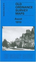
£9.99
BRITAIN`S GREATEST CLIMBER.` He is the David Attenborough of mountaineering... Bonington`s most personal memoir yet.` The Times.` This is a compelling tale of fortitude & endurance.`
- The Sunday Times Sir Chris Bonington memoir Ascent will chart not only his many triumphs in the climbing world
- such as the Eiger, & the Himalaya
- but also the struggles he has faced in his life bringing up a family, & maintaining a successful & loving marriage over the decades of travelling the world to conquer mountains. He has undertaken nineteen Himalayan expeditions, including four to Mount Everest which he climbed in 1985 at the age of fifty, & has made many first ascents in the Alps & greater ranges of the world. Along the way we will be fascinated by his many daring climbs, near-death adventures, & the many luminaries of the mountain fraternity he has climbed with, & in some cases
- witness their deaths on the rock. The mercurial Dougal Haston; the legendary-tough Don Whillans, the philosopher of the rock Stephen Venables, & the enigmatic Doug Scott, plus many more
- this will be an expert`s opinion on the past sixty years of British/ world mountaineering. In Ascent Chris also discusses his first wife (Wendy) who tragically passed away after a long battle with motor neuron disease
- his many years of caring for her, & then in his twilight years deciding to return to an iconic climb from his past
- The Old Man of Hoy
- to summit at the age of 80 years of age. He has now also found love again amidst the sadness & grief. It is a truly inspirational tale. Ascent will be a memoir like no other. Not only a cerebral narrative on what it takes to conquer fear, & learn/ develop the technical skills necessary to climb the world`s greatest peaks; what it is like to survive in places no human being can ultimately reside in for longer than a few months at very high altitude, but also how one overcomes emotional obstacles, too, & rediscover what drives us on to happiness.


...
Archived Product
£9.99
The Ascent of Rum Doodle is an outrageously funny spoof about the ascent of a 40, 000-&-a-half-foot peak & has been a cult favourite since its publication in 1956. Led by the reliably under-insightful Binder, a team of seven British men including Dr Prone (constantly ill); Jungle the route finder (constantly lost), Constant the diplomat (constantly arguing) & 3, 000 Yogistani porters, set out to conquer the highest peak in the Himalayas. ...
Archived Product
£11.50
Maps in this series feature extensive overprint highlighting local & long-distance footpaths & cycle routes, including King Ludwig Way or different variants of the Way of St James, indicating their waymarking. Symbols highlight different types of accommodation (campsites, youth hostels, refuges, etc), sport & recreational facilities, various places of interest, etc. The maps have a 1-km UTM grid. Map legend & all the text are in German only. To see other titles in this series please click on the series link. ...
Archived Product
£7.95
Ascoli Piceno Province in a series of handy size road maps from Litografia Artistica Cartografica (LAC) with more minor local roads & tracks than can be found on most regional maps. The series is gradually being changed to a new style of digitally derived cartography, so presentation of adjoining titles may vary. All the maps have hill shading to represent the general relief with spot heights for selected peaks, & show a few more local roads & rough tracks than the other road map series. Intermediate road distances are indicated. Regional, provincial & communal borders are marked, & railways, funiculars, airports, sea ferry links & campsites are shown. The legend is in Italian only. The new, digitally produced editions are indexed & have enhanced, more finely drawn cartography: the hill-shading is less bold, motorway service areas are marked, natural parks are highlighted & an expanded range of symbols indicates various landmarks & sites, e.g. antiquities, churches, etc. Two styles of the new cartography are produced, differing only in the colour of the predominant background shading: grey or yellow/green. Some of the new editions include geographical coordinates for the map corners. The index of localities is on the reverse. This title is now published with digital cartography. ...
Archived Product
£19.99
The new Supertrail Maps show the best singletrails in Europe’s hottest mountain bike spots. These unique topographic maps make the knowledge of locals available to other mountain bikers. Consistent difficulty rating & useful additional information prevent the user from critical situations on the trails. The best singletrails in the best mountain bike spots throughout Europe
- this is the convincing formula of the brand new Supertrail Maps. For the first time ever, these unique topographic maps make the knowledge of locals available to others. All the trails on a map have been biked & rated in five difficulty levels for up- & downhill separately by specially trained authors. This consistent rating facilitates tour planning & spares a user from getting into sketchy situations on the trails. In addition to the difficulty rating, extraordinary nice trails are marked with a «highlight»-pictogram. The maps in a scale of 1:50 000 show all information required for tour planning & orienting oneself on the trails, such as: difficulty, highlight-trails, mountain railways with mountain bike transport, mountain bike shuttles, dangerous falls, restaurants, bike shops, emergency numbers & touristic infopoints. Thanks to the especially chosen map section, one map covers the whole area. The Supertrail Maps are printed on tear- & waterproof foil which makes them very sturdy. On the back of any map, additional information about the area & the use of a Supertrail Map are presented in two languages. Folded

Dimensions of 10x 15cm allow the map to fit into any pocket without squeezing.


...
Archived Product
£18.00
The Ash Hiking Staff by Classic Canes is a practical walking stick suitable for everyday use in the countryside. Fitted with a Combi-spike ferrule (a rubber ferrule fitted over a spiked one so that the stick may be used on hard & soft ground) & leather wrist strap. Overall height 120cm (47). Produced using the coppicing method, these sticks are formed from the shoot that grows when the upper part of a young ash tree is removed. They are grown in the woodland of the manufacturer, Classic Canes, in Somerset, Engl&. ...
Archived Product
£3.50
Ashbourne in 1920 in a fascinating series of reproductions of old Ordnance Survey plans in the Alan Godfrey Editions, ideal for anyone interested in the history of their neighbourhood or family. The map is double-sided. The main map covers the area west of the town, from St Oswald`s church westward to part of Mayfield, including the Hanging Bridge & Gallowstree Hill. Features include Hangingbridge, Ashbourne Workhouse, railway with engine shed, Nestle`s Condensed Milk Factory, cemetery, etc. On the reverse is a good section of the adjacent sheet 43.02 which covers the town itself. Features here include Church Street, Compton Street, station, Compton, Ashbourne Hall, Market Place, St John`s church, Dove House, The Leys, corset factory, Keeperleys Farm, Spitalhill, cattle market etc. About the Alan Godfrey Editions of the 25” OS Series: Selected towns in Great Britain & Ireland are covered by maps showing the extent of urban development in the last decades of the 19th & early 20th century. The plans have been taken from the Ordnance Survey mapping & reprinted at about 15 inches to one mile (1:4, 340). On the reverse most maps have historical notes & many also include extracts from contemporary directories. Most maps cover about one mile (1.6kms) north/south, one & a half miles (2.4kms) across; adjoining sheets can be combined to provide wider coverage.FOR MORE INFORMATION & A COMPLETE LIST OF ALL AVAILABLE TITLES PLEASE CLICK ON THE SERIES LINK. ...
Archived Product
£3.50
Ashbourne, Cheadle & District in 1895 in a series of reproductions of Ordnance Survey’s famous ” Inch to the Mile” maps published in the Alan Godfrey Editions to provide a historical record of England & Wales in the second half of 19th & early 20th century. The map covers an area from Dilhorne eastward to Hollington, & from Grindon southward to Royleston. Features include the Churnet Valley with its railway & the Ashbourne Branch Railway. Other locations covered include: in DERBYSHIRE Alkmonton, Atlow, Ballidon, Boyleston, Bradbourne, Bradley, Brassington, Carsington, Clifton, Edlaston & Wyaston, Fenny Bentley, Great Cubley, Hognaston, Hull&, Kniveton, Longford, Mapleton, Marston Montgomery, Norbury & Roston, Offcote & Underwood, Osleston & Thurvaston, Osmaston, Parwich, Rodsley, Shirley, Snelston, Sturston, Thorpe, Tissington & Yeaveley; plus in STAFFORDSHIRE Alton, Bradley in the Moors, Caldon, Checkley, Cheddleton, Consall, Denstone, Draycott in the Moors, Ellastone, Ilam, Ipstones, Kingsley, Mayfield, Okeover, Stanton, Waterfall & Wootton. On the reverse is a detailed map of the village of Rocester with a directory About the Alan Godfrey Editions of the OS Inch to the Mile Maps: the maps provide an invaluable overview of a wider area, typically 18 x 12 miles (29 x 19 kms approx.), & offer historical mapping for small towns & villages not covered by the more detailed series for which the Godfrey Editions are better known. On the reverse all the maps have historical notes & most titles also include a more detailed, large scale map of a small town or a village in the area. To see other titles in this series please click on the series link. ...
Archived Product
£2.95
Ashby-de-la-Zouch in 1902 in a fascinating series of reproductions of old Ordnance Survey plans in the Alan Godfrey Editions, ideal for anyone interested in the history of their neighbourhood or family. Selected towns in Great Britain & Ireland are covered by maps showing the extent of urban development in the last decades of the 19th & early 20th century. In this title: the map is double-sided. The main map covers the centre & southern part of the town. Features include Main Street, St Helen's church, Midland Railway with station, Royal Hotel, Ivanhoe Baths, Holy Trinity church, Rotherwood, Hungerford House, castle ruins, Highfields, etc. On the reverse is a portion of the adjacent sheet 16.09, extending coverage north to include Workhouse, Castle Soap Works, Holywell Roller Flour Mills, Gas Works etc. About the Alan Godfrey Editions of the 25 ...
Archived Product
£3.50
Ashby-de-la-Zouch in 1902 in a fascinating series of reproductions of old Ordnance Survey plans in the Alan Godfrey Editions, ideal for anyone interested in the history of their neighbourhood or family. The map is double-sided; the main map covers the centre & the southern part of the town. Features include Main Street, St Helen`s church, Midland Railway with station, Royal Hotel, Ivanhoe Baths, Holy Trinity church, Rotherwood, Hungerford House, castle ruins, Highfields, etc. On the reverse is a portion of the adjacent sheet 16.09, extending coverage north to include Workhouse, Castle Soap Works, Holywell Roller Flour Mills, Gas Works, etc. About the Alan Godfrey Editions of the 25” OS Series: Selected towns in Great Britain & Ireland are covered by maps showing the extent of urban development in the last decades of the 19th & early 20th century. The plans have been taken from the Ordnance Survey mapping & reprinted at about 15 inches to one mile (1:4, 340). On the reverse most maps have historical notes & many also include extracts from contemporary directories. Most maps cover about one mile (1.6kms) north/south, one & a half miles (2.4kms) across; adjoining sheets can be combined to provide wider coverage.FOR MORE INFORMATION & A COMPLETE LIST OF ALL AVAILABLE TITLES PLEASE CLICK ON THE SERIES LINK. ...
Archived Product

Ascot 1910

Ascot in 1910 in a fascinating series of reproductions of old Ordnance Survey plans in the Alan Godfrey Editions, ideal for anyone interested in the history of their neighbourhood or family. The map is double-sided to provide maximum coverage. The main map covers the area from Ascot station and the racecourse eastward to Sunninghill and St Michael & All Angels church. Much of the celebrated race course is included: the Grand Stand, New Stand and New Mile Course. Other features include the station, High Street, St George`s School, King`s Wick, The Mount, Wells Hotel PH, Frognal, etc. Part of Sunninghill, including Lower Village Road and Upper Village Road, is to the south-east, while South Ascot with All Souls church is shown below the railway; much of this development became
possible by the draining of Sunningdale Bog. On the reverse is part of sheet 39.15, taking coverage further west to the Royal Ascot Hotel, the saddling paddock, All Saints church, Englemere, Ascot Heath House and Bowledge Hill. Tony Painter`s introduction explains how Ascot developed into a top horse-racing venue.About the Alan Godfrey Editions of the 25” OS Series:Selected towns in Great Britain and Ireland are covered by maps showing the extent of urban development in the last decades of the 19th and early 20th century. The plans have been taken from the Ordnance Survey mapping and reprinted at about 15 inches to one mile (1:4, 340). On the reverse most maps have historical notes and many also include extracts from contemporary directories. Most maps cover about one mile (1.6kms)
north/south, one and a half miles (2.4kms) across; adjoining sheets can be combined to provide wider coverage.FOR MORE INFORMATION AND A COMPLETE LIST OF ALL AVAILABLE TITLES PLEASE CLICK ON THE SERIES LINK.
RIP - This product is no longer available on our network. It was last seen on 25.09.2019

This page now acts as a permanent archive for this product. Add more information using the comments box below to ensure it can still be found by future generations.

Use our search facility to see if it is available from an alternative contributor.
  • External links may include paid for promotion
  • Availability: Out Of Stock
  • Supplier: Stanfords
  • SKU: 9781841517704
Availability: In Stock
£3.50

Product Description

Ascot in 1910 in a fascinating series of reproductions of old Ordnance Survey plans in the Alan Godfrey Editions, ideal for anyone interested in the history of their neighbourhood or family. The map is double-sided to provide maximum coverage. The main map covers the area from Ascot station & the racecourse eastward to Sunninghill & St Michael & All Angels church. Much of the celebrated race course is included: the Grand St&, New Stand & New Mile Course. Other features include the station, High Street, St George`s School, King`s Wick, The Mount, Wells Hotel PH, Frognal, etc. Part of Sunninghill, including Lower Village Road & Upper Village Road, is to the south-east, while South Ascot with All Souls church is shown below the railway; much of this development became possible by the draining of Sunningdale Bog. On the reverse is part of sheet 39.15, taking coverage further west to the Royal Ascot Hotel, the saddling paddock, All Saints church, Englemere, Ascot Heath House & Bowledge Hill. Tony Painter`s introduction explains how Ascot developed into a top horse-racing venue. About the Alan Godfrey Editions of the 25” OS Series: Selected towns in Great Britain & Ireland are covered by maps showing the extent of urban development in the last decades of the 19th & early 20th century. The plans have been taken from the Ordnance Survey mapping & reprinted at about 15 inches to one mile (1:4, 340). On the reverse most maps have historical notes & many also include extracts from contemporary directories. Most maps cover about one mile (1.6kms) north/south, one & a half miles (2.4kms) across; adjoining sheets can be combined to provide wider coverage.FOR MORE INFORMATION & A COMPLETE LIST OF ALL AVAILABLE TITLES PLEASE CLICK ON THE SERIES LINK.

Reviews/Comments

Add New

Price History

Vouchers

No voucher codes found.
Do you know a voucher code for this product or supplier? Add it to Insights for others to use.

Facebook

Jargon Buster

Contemporary - Modern era design
Contemporary - A design reference to indicate post war modern design
Hotel - An establishment which provides lodging for a fee
History - Anything that happens in the past. An acedemic subject.
King - The figure head of a monarch
Road - a manmade lane or a path that is used to speed up travel.
Horse - A large animal with four legs that tends to be ridden.
Contemporary - An object that is living in the same time.
Ideal - Something that satisfies a perfect criteria.
Family - A group of people that live together made up from parents and children.

Supplier Information

Stanfords
Stanfords was established in 1853 and opened their iconic Covent Garden flagship store in 1901. They have become the top retailer of maps, travel books and accessories in the UK and arguably offer the largest selection of maps and travel books worldwide. Famous names such as Captain Robert Falcon Scott, Ranulph Fiennes and Michael Palin have purchased from Stanfords. They now have a shop in Bristol and both stores together with other venues operate a calendar of events including talks, book signings and exhibitions. As a specialist map retailer, the map selection is comprehensive and includes road maps, street maps and walking maps from worldwide destinations, as well as a selection of world atlases and wall maps. Books include travel guides and travel literature. Stanfords also stock globes, from miniatures made of blue marble to magnificent floor-standing globes. The website features a selection of interesting articles on travel topics.
Page Updated: 2023-11-12 20:15:36

Community Generated Product Tags

Oh No! The productWIKI community hasn't generated any tags for this product yet!
Menu