
 United Kingdom
 France
 Germany
 Netherlands
 Sweden
 USA
USA
 Italy
Italy
 Spain
Spain
More From Contributor

Amsterdam Red Maps
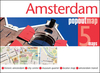
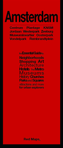
Amsterdam with an enlargement for its historic centre on a tourist street plan from Red Maps presented in a handy concertina format and printed on thick high quality paper, with thematic indexes for sights, hotels, shopping, etc.The map offers two street plans: the city central districts including the museum quarter, extending east to include the eastern docks with KNSM island for examples of modern Dutch architecture, plus an enlargement showing in much greater detail Amsterdam’s historic heart. It’s a pity that on both maps the name of the Jordaan, a popular district with visitors, is shown in the wrong place.The plans name tourist sights and important buildings, entertainment venues, selected hotels, etc. Also highlighted are main shopping streets with names of selected
individual stores. On both plans tram routes are clearly shown with stops and line numbers.On the reverse are thematic lists of sights and important buildings, hotels, etc. A special panel provides area-by-area recommendation of (mainly fashion) shops. An index lists neighbourhoods, major streets and canals.To see other street plans from Red Maps with similar presentation please click on the series link.
individual stores. On both plans tram routes are clearly shown with stops and line numbers.On the reverse are thematic lists of sights and important buildings, hotels, etc. A special panel provides area-by-area recommendation of (mainly fashion) shops. An index lists neighbourhoods, major streets and canals.To see other street plans from Red Maps with similar presentation please click on the series link.

Product Description
Reviews/Comments
Add New
Vouchers
No voucher codes found.
Do you know a voucher code for this product or supplier? Add it to Insights for others to use.
Do you know a voucher code for this product or supplier? Add it to Insights for others to use.
 Denmark