More From Contributor

£5.99
A city for romantics, art enthusiasts, & lovers of café culture, Amsterdam is a compelling city that is simply a joy to explore. From its picturesque waterways, to its fascinating cultural history, Amsterdam has much to tempt the visitor. Berlitz Pocket Guide Amsterdam is a concise, full-colour travel guide that combines lively text with vivid photography to highlight the best that the city has to offer. Inside Amsterdam Pocket Guide:· Where To Go details all the key sights in the city, from the Rembrandt House Museum, to Dam Square, to the Heineken Experience, while handy maps on the cover flaps help you find your way around, & are cross-referenced to the text.· Top 10 Attractions gives a run-down of the best sights to take in on your trip.· Perfect Tour provides an itinerary of the city.· What To Do is a snapshot of ways to spend your time in Amsterdam, from visiting the Anne Frank House, to relaxing in Vondelpark, to soaking up the café culture.· Essential information on Amsterdam`s culture, including a brief history of the country.· Eating Out covers the city`s best cuisine.· Curated listings of the best hotels & restaurants.· A-Z of all the practical information you`ll need. ...
Archived Product
£3.99
Explore vibrant Amsterdam, known as the ` Venice of the North`, with this handy, genuinely pocket-sized, pop-up map. Small in size, yet big on detail, this compact, dependable Amsterdam city map will ensure you don`t miss a thing. *
Includes: two pop-up maps covering historic Amsterdam & the city centre * Additional maps covering the museum quarter, transit system & a locator map are also included * Handy, self-folding tourist map is small enough to fit in your pocket yet offers extensive coverage of the city in an easy-to-use format * Thorough street index is also featured & cross-referenced to the map so you can easily find your destination * Hotels, restaurants, stores & attractions are all included on the maps What`s new for this edition? * Fully updated transit map featuring the new north-south metro line * Features the new bridges across Oosterdok *

Includes::
the new development around the Central Station & Stationsplein as well as the new bus station & ferry stops behind Central Station * Fully updated listings of shops, cafes, hotels & restaurants * enhanced legibility Ideal to pop in a pocket or bag for quick reference while you explore Amsterdam. Contents include maps of: Historic Amsterdam City Centre Museum Quarter Amsterdam transit Locator map Fold

Size:
95mm x 130mm (3.75” x 5.25”) Sheet

Size:
215mm x 225mm (8.5” x 9.75”) (per sheet; 2 sheets) Approx scale: 1:13500 Central map; 1:7000 Historic map; Scale must be used as a guideline only


...
Archived Product
£4.99
This work is a revolutionary new design for pocket-sized travel guides. Open the cover & discover a remarkable new design! It


...
Archived Product
£3.99
Amsterdam Pop-Out Map from Compass Maps in a series designed to provide two street plans, the city centre plus a wider area around it, in a handy format to fit neatly all but the smallest pockets, with, as appropriate, transport network diagrams, additional useful maps, etc. Each title ...
Archived Product
£3.99
Amsterdam Pop Out Map: pop-up city street map of Amsterdam city center
- folded pocket size travel map with transit map included.
...
Archived Product
£9.99
Amsterdam with an enlargement for its historic centre on a tourist street plan from Red Maps presented in a handy concertina format & printed on thick high quality paper, with thematic indexes for sights, hotels, shopping, etc. The map offers two street plans: the city central districts including the museum quarter, extending east to include the eastern docks with KNSM island for examples of modern Dutch architecture, plus an enlargement showing in much greater detail Amsterdam’s historic heart. It’s a pity that on both maps the name of the Jordaan, a popular district with visitors, is shown in the wrong place. The plans name tourist sights & important buildings, entertainment venues, selected hotels, etc. Also highlighted are main shopping streets with names of selected individual stores. On both plans tram routes are clearly shown with stops & line numbers. On the reverse are thematic lists of sights & important buildings, hotels, etc. A special panel provides area-by-area recommendation of (mainly fashion) shops. An index lists neighbourhoods, major streets & canals. To see other street plans from Red Maps with similar presentation please click on the series link. ...
Archived Product
£14.95
Photographer Jasper Leonard previously resized Antwerp & New York & now points his special tilt-shift lenses towards Amsterdam. Amsterdam Resized shows you the city like you`ve never seen it before: the famous canals of Amsterdam have been reduced to mere trickles with mini-sized bridges; the joggers in the Vondelpark now resemble Playmobil puppets, & the Stedelijk Museum now looks more like a bath tub. A new book in the Resized series, which has been a huge success in the US with articles in, among others, USA Today & the New York Post. ...
Archived Product
£7.99
Rick Steves` Pocket guidebooks truly are a ”tour guide in your pocket.” This colorful, compact 220-page book

Includes::


...
Archived Product
£7.99
Amsterdam in the Shortlist Guide series from Time Out; exploring a range of international destinations in a handy, pocket-sized format designed to introduce visitors to the best nightlife, entertainment & local attractions in the city. Expert local writers provide an encyclopaedic knowledge of each city, ensuring that the guides have won a reputation for their accuracy & reliability. Each guide opens with a ‘ Don’t Miss’ section profiling recommendations by the author & accompanied by detailed commentary. An Itineraries chapter provides inspiration for travellers with a series of thematic walks around the city. The main section explores the city by region, with each area divided into sights & museums, eating & drinking, shopping, nightlife & arts & leisure. Contact details, addresses, opening times & prices for each establishment are also given where relevant.A further section on Essentials provides listings of hotels by area, accompanied by a description & with details of opening times, addresses, directions & outline room prices. Further information on getting to the city & around is also provided. There is also a Resources index, with practical guidance on accidents & emergencies, credit card loss, customs, dental emergencies, disabled visitors, embassies & consulates, left luggage, opening hours, smoking, telephones, tickets, visas & what’s on where. ...
Archived Product
£7.99
Amsterdam in the Shortlist Guide series from Time Out; exploring a range of international destinations in a handy, pocket-sized format designed to introduce visitors to the best nightlife, entertainment & local attractions in the city. Expert local writers provide an encyclopaedic knowledge of each city, ensuring that the guides have won a reputation for their accuracy & reliability. Each guide opens with a ...
Archived Product

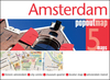
Amsterdam Railway System Map

This Amsterdam Railway System map takes a motif from tulip, the Dutch symbol. With the Centraal Station at the centre, lines of tram, metro, and railway spreads out like the stamen and pistil of the flower. The IJssel (Het IJ, river) forms the petals, and layers of fan-shaped canals complete the tulip.City Railway System is a new approach to projecting the identity of a city onto its subway map. Whereas conventional subway maps aim at conveying information as clearly and concisely as possible, the City Railway System by Zero Per Zero instinctively incorporates symbolic elements of each city into its map while preserving clarity. As a special consideration for tourists, major landmarks and tourist attractions are indicated on the subway maps, so that tourists can easily figure out
the fastest way to get to the destination at a glance. The railway map itself is also good as a souvenir.
RIP - This product is no longer available on our network. It was last seen on 25.09.2019

This page now acts as a permanent archive for this product. Add more information using the comments box below to ensure it can still be found by future generations.

Use our search facility to see if it is available from an alternative contributor.
  • Availability: Out Of Stock
  • Supplier: Stanfords
  • SKU: 9786000514396
Availability: In Stock
£8.99

Product Description

This Amsterdam Railway System map takes a motif from tulip, the Dutch symbol. With the Centraal Station at the centre, lines of tram, metro, & railway spreads out like the stamen & pistil of the flower. The IJssel (Het IJ, river) forms the petals, & layers of fan-shaped canals complete the tulip. City Railway System is a new approach to projecting the identity of a city onto its subway map. Whereas conventional subway maps aim at conveying information as clearly & concisely as possible, the City Railway System by Zero Per Zero instinctively incorporates symbolic elements of each city into its map while preserving clarity. As a special consideration for tourists, major landmarks & tourist attractions are indicated on the subway maps, so that tourists can easily figure out the quickest way to get to the destination at a glance. The railway map itself is also good as a souvenir.

Reviews/Comments

Add New

Intelligent Comparison

Oooops!
We couldn't find anything!
Perhaps this product's unique.... Or perhaps we are still looking for comparisons!
Click to bump this page and we'll hurry up.

Price History

Vouchers

No voucher codes found.
Do you know a voucher code for this product or supplier? Add it to Insights for others to use.

Facebook

Jargon Buster

Flower - The reproductive part of a plant. Colourful to attract insects to pollenate
Tulip - A perennial flower. Often related to the Netherlands. They come in many different colours
Flower - A product that comes from planting a seed, tend to be the brightly coloured part at the end of the stem.
Tram - A large vehicle common in cities for public transport, also known as a cable car.
Fan - A piece of equipment that has blades that rotate to cool the air, can be installed within other equipment,

Supplier Information

Stanfords
Stanfords was established in 1853 and opened their iconic Covent Garden flagship store in 1901. They have become the top retailer of maps, travel books and accessories in the UK and arguably offer the largest selection of maps and travel books worldwide. Famous names such as Captain Robert Falcon Scott, Ranulph Fiennes and Michael Palin have purchased from Stanfords. They now have a shop in Bristol and both stores together with other venues operate a calendar of events including talks, book signings and exhibitions. As a specialist map retailer, the map selection is comprehensive and includes road maps, street maps and walking maps from worldwide destinations, as well as a selection of world atlases and wall maps. Books include travel guides and travel literature. Stanfords also stock globes, from miniatures made of blue marble to magnificent floor-standing globes. The website features a selection of interesting articles on travel topics.
Page Updated: 2023-11-12 20:15:36

Community Generated Product Tags

Oh No! The productWIKI community hasn't generated any tags for this product yet!
Menu