
 United Kingdom
 France
 Germany
 Netherlands
 Sweden
 USA
USA
 Italy
Italy
 Spain
Spain
More From Contributor


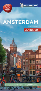
Amsterdam Michelin Citymap
Amsterdam at 1:12, 500 on a “write & wipe” waterproof and tear-resistant, indexed street plan from Michelin, with the city centre shown in greater detail, a road map of the environs, a metro/tram/railway diagram, plus sightseeing recommendations based on the publisher’s Green Guide.On one side is a street plan extending from the motorway ring in the west to the eastern docklands Java Island, and south to include de Pijp district. On the reverse the old town centre - between the Singel Canal, Central Station and the Stopera - is shown in greater detail at 1:7, 000. Important buildings and places of interest are clearly marked and named, with 31 specially selected locations cross-referenced to their descriptions on the reverse. Two street indexes, for the main plan and the
city centre enlargement, both include a list of points of interest.The reverse side also includes three sections with 31 star-rated recommendations: The Essentials, Also Worth Seeing, and Our Favourites. Also provided is a road map of the Amsterdam area (including Haarlem and access to the Schiphool airport) a diagram of the metro/tram/railway networks, plus practical information (getting around, opening hours and public holidays, etc). All the text is in English.To see other titles in this series please click on the series link.
city centre enlargement, both include a list of points of interest.The reverse side also includes three sections with 31 star-rated recommendations: The Essentials, Also Worth Seeing, and Our Favourites. Also provided is a road map of the Amsterdam area (including Haarlem and access to the Schiphool airport) a diagram of the metro/tram/railway networks, plus practical information (getting around, opening hours and public holidays, etc). All the text is in English.To see other titles in this series please click on the series link.

Product Description
Reviews/Comments
Add New
Vouchers
No voucher codes found.
Do you know a voucher code for this product or supplier? Add it to Insights for others to use.
Do you know a voucher code for this product or supplier? Add it to Insights for others to use.
 Denmark