More From Contributor
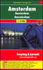
£12.99
Amsterdam in the Eyewitness guide series from Dorling Kindersley; lavishly illustrated & particularly concerned with providing the visitor with detailed background information to sightseeing in the chosen destination & a broad cultural introduction. Popular historical buildings & museums are often described with cutaway diagrams allowing you to view ...
Archived Product
£12.99
DUE OUT MARCH 2014
- Amsterdam in the Eyewitness guide series from Dorling Kindersley; lavishly illustrated & particularly concerned
...
Archived Product
£12.99
Amsterdam in the Eyewitness guide series from Dorling Kindersley; lavishly illustrated & particularly concerned with providing the visitor with detailed background information to sightseeing in the chosen destination & a broad cultural introduction. Popular historical buildings & museums are often described with cutaway diagrams allowing you to view ...
Archived Product
£7.99
Amsterdam in the Eyewitness Top 10 series from Dorling Kindersley is a condensed format guide book featuring dozens of illustrated, top ten lists for the traveller regardless of their disposable budget. To save you time & money a Top 10 Things to Avoid is also included. Top 10 lists are given for things to see & do in & around town, as well as the top ten features of particular locations or events. Practicalities are not forgotten as Top 10s are also provided for topics such as planning your trip, getting around town & shopping. Accommodation lists provide the ten most recommended places to stay for a range of budgets, whilst restaurant top tens feature as the guide works its way through the location in question. Simple, small street plans illustrate the location of the top ten recommends within their neighbourhoods & basic, fold out maps form the inside covers. An additional pull out feature of the guide suggests ideas on how to spend your day & a phrase section is included which will help the traveller to acclimatise. ...
Archived Product
£4.99
Central Amsterdam in a series of handy pocket street plans from Freytag & Berndt. Each map is laminated, so waterproof & tear-resistant, & highlights the publishers’ recommendations of five best choices in five categories: shopping, restaurants & cafes, culture, nightlife & sights. On one side is an indexed street plan annotated with colour-coded markers highlighting the publishers’ recommendations, all listed on the reverse of the map with brief notes in several languages. In larger cities the plans cover only the central districts. Also provided are a small road map of the city’s environs, if appropriate a diagram of the metro network, & a Fact Box with phone numbers for tourist offices, car hire & emergency services. Map legend & notes on the recommendations include English. To see other titles is this series please click on the series link. ...
Archived Product
£8.99
Amsterdam with outer suburbs at 1:1:14, 500 from Falk B.V., Netherlands’ leading publishers of street plans, plus an enlargement at 1:7, 500 of the city’s central part, both with one way streets & traffic restrictions. The main plan covers Amsterdam with its outer suburbs, extending west to include the docks & Osdorp & south beyond the A10 to cover Zuideramstel. Three insets on the reverse side complete the eastern side of the city, with coverage of the IJburg (including the areas under development), Diemen & Zuidoost Amsterdam. Main routes are highlighted & one way streets & traffic restrictions are marked throughout, with car parks & P+R facilities. Metro & railway lines show stations with their names. The plan itself does not include tram or bus lines, but a list of all the routes is provided in the index. Within the western docks area sector numbers are indicated. On the reverse an enlargement covers the central part of the city within the canal girdle plus Joordan (but without the museum quarter). Both plans highlight various places of interest, public buildings & facilities. The plan has a comprehensive street index. Map legend

Includes::
English.

...
Archived Product
£5.99
Flexi Map Amsterdam is laminated, durable & has its own index that has been categorised for ease of use. Inside Flexi Map Amsterdam:- A list of recommended sights, divided by theme & linked to the mapping by numbered markers.- A handy information section with concise details on getting around, tourist offices, money, tipping, opening times, public holidays, telephones, emergency telephone numbers & climate.
- The main map shows all one-way streets, car parks, pedestrian zones & public transport routes. About Insight Guides: Insight Guides has over 40 years` experience of publishing high-quality, visual travel guides. We produce around 400 full-colour print guide books & maps as well as picture-packed e Books to meet different travellers` needs. Insight Guides` unique combination of beautiful travel photography & focus on history & culture together create a unique visual reference & planning tool to inspire your next adventure.
...
Archived Product
£5.99
Central Amsterdam on an Insight Flexi Map in their new format introduced to provide more convenient access to the special features of this series: various additional maps and/or street plans plus tourist information including a list of must-see sights. The map is tear-resistant, waterproof, & can be written on with non-permanent marker pens. On one side is an indexed street plan at 1:12, 000 showing the canal ring & the surrounding districts. Coverage extends from the A10 motorway & the Rembrandt Park in the west to eastern docks; & from Vondelpark & The Pijp across the Ij to include parts of North Amsterdam. On the reverse are this title’s additional

Features:

- An enlargement showing in greater detail the city’s historic heart, from the Singel – the first concentric canal to the tunnel under the Ij; also indexed for streets, points of interest, etc.- A map of Amsterdam’s tram network plus a diagram of the metro lines.- An indexed road map at 1:360, 000 of the environs of Amsterdam including Schiphol Airport, Haarlem, Leiden & Utrecht.- Brief descriptions of the city’s 28 main sights, neatly grouped into sections covering Top Museums & Galleries, Other Major Attractions, Main Shopping Areas & Markets, plus Further Afield
- all prominently highlighted on the street plans and/or the road map of the environs.- Information about Getting Around & Facts for Visitors, including tourist offices, public holidays, opening times, money, tipping, health, telecommunications & monthly climate charts. To see the list of other Insight Flexi titles in this series please click on the series link.


...
Archived Product
£7.99
The first water-resistant “ Comfort Map“ with direct access to useful additional information from the Internet Amsterdam in a scale of 1:15, 000 including a detailed presentation of the city centre in a scale of 1:10, 000 presented on a practical map; inclusive of the High 5 Edition app technology for calling up additional travel information & many other benefits:- just the right size
- 9.6 x 16.1 cm
- to fit comfortably into your handbag or trouser pocket- it is water-resistant (laminated/cellophane coating)- can be conveniently folded in any direction thanks to the patented “ Comfort Map” folding design It doesn’t matter what weather it is used in or how often it is folded, the condition of the “CITYMAP Amsterdam” will not deteriorate. Parks, streets & railway lines are easily recognisable thanks to the clear layout of the map. A separate map of the underground & tram lines, & a street index round off the map. The “ Interactive Mobile CITYMAP Amsterdam” – a “paper backup” just in case...... & when used in conjunction with a smartphone, it is a great tool for planning trips. What’s not on the map is in the app By scanning the section of the map you want with the High 5 Edition app, you can get a lot of useful additional information about major attractions in Amsterdam. The app is based on Augmented Reality technology & is available free of charge from the Apple App store & Google Play store.

...
Archived Product

Amsterdam F&B

Amsterdam on a large street plan of Freytag & Berndt, covering the city within its motorway ringroad, but extending slightly further west to include the districts adjoining the metro ring and south to central Amstelveen and Amsterdam Zuid-Oost.Main traffic arteries are highlighted and motorway junctions and exits well presented. One way streets are marked throughout the city. Metro and railway stations and ferry routes on the IJ are clearly marked, and the city’s main places of interest and various institutions highlighted. There is no separate enlargement for the central area. Map legend includes English. Street index is in the reverse.
RIP - This product is no longer available on our network. It was last seen on 25.09.2019

This page now acts as a permanent archive for this product. Add more information using the comments box below to ensure it can still be found by future generations.

Use our search facility to see if it is available from an alternative contributor.
  • Availability: Out Of Stock
  • Supplier: Stanfords
  • SKU: 9783707906127
Availability: In Stock
£9.99

Product Description

Amsterdam on a large street plan of Freytag & Berndt, covering the city within its motorway ringroad, but extending slightly further west to include the districts adjoining the metro ring & south to central Amstelveen & Amsterdam Zuid-Oost. Main traffic arteries are highlighted & motorway junctions & exits well presented. One way streets are marked throughout the city. Metro & railway stations & ferry routes on the IJ are clearly marked, & the city’s main places of interest & various institutions highlighted. There is no separate enlargement for the central area. Map legend

Includes::
English. Street index is in the reverse.

Reviews/Comments

Add New

Price History

Vouchers

No voucher codes found.
Do you know a voucher code for this product or supplier? Add it to Insights for others to use.

Facebook

Jargon Buster

Large - something that takes up more space than normal.

Supplier Information

Stanfords
Stanfords was established in 1853 and opened their iconic Covent Garden flagship store in 1901. They have become the top retailer of maps, travel books and accessories in the UK and arguably offer the largest selection of maps and travel books worldwide. Famous names such as Captain Robert Falcon Scott, Ranulph Fiennes and Michael Palin have purchased from Stanfords. They now have a shop in Bristol and both stores together with other venues operate a calendar of events including talks, book signings and exhibitions. As a specialist map retailer, the map selection is comprehensive and includes road maps, street maps and walking maps from worldwide destinations, as well as a selection of world atlases and wall maps. Books include travel guides and travel literature. Stanfords also stock globes, from miniatures made of blue marble to magnificent floor-standing globes. The website features a selection of interesting articles on travel topics.
Page Updated: 2023-11-12 20:15:36

Community Generated Product Tags

Oh No! The productWIKI community hasn't generated any tags for this product yet!
Menu