More From Contributor
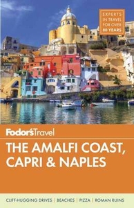
£7.99
All Evie wants is to be normal. & now that she`s almost off her meds & at a new college where no one knows her as the-girl-who-went-nuts, there`s only one thing left to tick off her list... But relationships can mess with anyone`s head
- something Evie`s new friends Amber & Lottie know only too well. The trouble is, if Evie won`t tell them her secrets, how can they stop her making a huge mistake?
...
Archived Product
£11.99
One of the titles in a series of topographic maps covering much of north-west Africa, produced as part of the IMW* project in 1960’s. Each map covers an area spanning 6° in longitude & 4° in latitude. There is some variation in colouring & the depiction of terrain, but hill-shading, spot heights & contours are used to show the general relief. Additional graphics show features such as dunes, rock outcrops, cliffs, sand areas, escarpments, marshes, seasonal lakes & watercourses, & areas liable to flooding. Bathymetric contours are also included. Communications detail

Includes::
roads, major trails & railways, although there is some inconsistency in colouring & the extent of classification, e.g. not all maps distinguish seasonal roads. On most maps intermediate road distances are indicated on main routes. Symbols show airports, mosques, mines, oil & gas fields, lighthouses, ruins & significant isolated buildings. Administrative boundaries are marked & latitude & longitude lines are drawn at 1° intervals, with further margin ticks at 1’ intervals. The map legend is in French only on some sheets, & in English & French on others.* The International Map of the World was a project conceived in the early 20th century to compile a world map series at 1:1, 000, 000 through the efforts of participating nations. The value of the program has declined since 1970 & the IMW is no longer regarded as an active international series.

...
Archived Product
£17.99
Mt. Everest area on a contoured & GPS-compatible map at 1:40, 000 from Nepa Maps, designed to show trekking routes from Namche, Tengboche & Pangboche towards the Ama Dablam & Imja Tse (Island Peak) Base Camps, & the continuation climbing routes towards these two peaks, Lhotse & Lhotse Star. With Thamo & Namche Bazar in the south-western corner of the map, coverage extends north to the Old Everest BC & the Kala Patthar viewpoint, & eastwards beyond the glaciers of Island Peak. The summits of Ama Dablam & Island Peak are annotated with arrows indicating views of the surrounding peaks. The map also shows the course of the main Everest Trek as far as the Old Everest BC, as well as the routes from Namche to Gokyo. The map has contours at 40m intervals, enhanced by relief shading & colouring/graphics to show glaciers, forested areas, cultivated l&, etc. Main trekking trails are highlighted, as are important settlements & locations with tourist accommodation including campsites, medical facilities, religious sites, etc. Latitude & longitude are shown by margin ticks at 2’30” intervals. The index lists places, base camps, peaks, passes & lakes. Map legend

Includes::
English. The map also

Includes::
basic street maps of Namche & Lukla indicating tourist accommodation & facilities, plus a small inset showing the area between these two main locations for exploring the Everest region. To see other titles in this series please click in the series link.


...
Archived Product
£6.95
Topographic coverage of mainland Spain at 1:50, 000 in the MTN50 (Mapa Topográfico Nacional) series from the Centro Nacional de Información Geografica, the country’s civilian survey organization. The maps have contours at 20m intervals, enhanced by relief shading, plus colouring and/or graphics to show different types of terrain, vegetation or land use. Boundaries of national parks & other protected areas are marked. In addition to all the usual information featured on topographic mapping at this scale, detailed presentation of the road & rail networks, rural tracks & paths, etc, the maps also show campsites & mountain refuges. On more recent editions some GRs, the official long-distance hiking routes, are also marked (although not as clearly as on hiking maps from other publishers). Each map covers 29.5x 18.5 km (with adjustments in the border or coastal areas). The maps have a 1-km UTM grid, plus margin ticks for latitude & longitude at 1` intervals. Map legend is in Spanish only.HOW TO CHOOSE THE RIGHT 50K MAP: all the titles in CNIG’s 200K Provincial Road Maps series at 1:200, 000 are overprinted with the grid for the 1:50, 000 maps & can be used to see the area covered by each 50K title. TO SEE THE LIST OF TITLES IN THIS SERIES PLEASE CLICK ON THE SERIES LINK.PLEASE NOTE
- MAP TITLES: the grids shown on our website serve both the civilian & the military 1:50, 000 topographic series. Although the areas covered by maps in both series are identical (apart from some border or coastal sheets), occasionally map titles differ – only one title is shown on the grid, usually the military one. In Galicia, the Basque country & in the Catalan speaking areas the tendency now is to use local place names rather than the often better known Castilian ones. Where possible, both versions are included in our titles. Map titles listed on our website are based on information received by us at the time of publication, but sometimes maps arrive showing a completely different title! As long as the map number is as ordered, the correct map has been supplied.
...
Archived Product
£16.99
Sverigeserien is an outdoor map series consisting of 116 sheets with coverage of southern & central Sweden & the northern coastline. The map is suitable for outdoor activities such as hiking, excursions, trail running, hunting, fishing, riding, cycling, mountain biking, paddling, skating & much more. Every sheet covers an area of 45x 68km. These topographical maps in scale 1:50 000 contain all the information needed for outdoor activities: Terrain information, hiking trails, illuminated tracks, camping, shelters, golf courses, leisure baths, historical remains, roads in different categories, railway lines & much more. Easy to read topography with contour lines, vertical interval 5 m. Sverigeserien is a high-quality map series & is durable for frequent use! Updated content with map data from Lantmäteriet (National Land Survey of Sweden) & printed on Polyart which is water & tear resistant. This means that the map can be folded repeatedly without breaking & can withstand the challenging weather in Sweden during both winter & summer. Legend is in Swedish, English & German. ...
Archived Product
£13.99
Frommer's Complete Guides
- IN FULL COLOR America's 1 bestselling travel series More full-color guides than ever before Foldout
...
Archived Product
£4.99
Sorrento Peninsula (Amalfitana) in a series of handy holiday pocket maps from Freytag & Berndt. The map is laminated, so waterproof & tear-resistant, & highlights the publishers’ recommendations of five best choices in five categories: adventure, culture, food, nature & sights, all listed on the reverse with a brief note. On one side is a road map of the peninsula, with coverage along the coast extending from Castellammare di Stabia on the northern side to Amalfi & Ravello along the southern coast. Insets provide street plans of Sorrento & Amalfi. Icons prominently highlight numerous places of interest, including campsites & youth hostels, sport & recreational facilities, marinas & beaches, architectural & historical sites, etc. The map has no geographical coordinates. The road map & the street plans are annotated colour-coded markers highlighting the publishers’ recommendations of five best choices in five categories: adventure, culture, food, nature & sights, all listed on the reverse of the map with brief notes in several languages. Also provided is a Fact Box with phone numbers for tourist offices, emergency services, etc. Map legend & notes on the recommendations include English. To see other titles in this series please click on the series link. ...
Archived Product
£7.99
Thomas Austin Preston. Six foot four, skinny as a rake. He played poker with two US presidents
- & drug lord Pablo Escobar; made
...
Archived Product
£5.99
Amarillo in Texas in a series of indexed street plans of US cities from Universal MAP, with an enlargement for central Amarillo. On the reverse the plan is extended to include Canyon & Lake Tanglewood. Street plans from Universal MAP are indexed & show each city’s administrative divisions, zip code areas & various facilities & services. ...
Archived Product
£65.00
Cristina Mittermeier knows a thing or two about water. Trained as a marine biologist & a photographer, the Mexico City-born Mittermeier combines her work behind the lens with her passion for environmentalism, taking pictures around the world to explore our relationship to the earth & ocean & to draw attention to the beauty & the plight of our planet. In Amaze, Mittermeier elicits our wonder & awe at the natural world & the labyrinth or ”maze” of navigating a sustainable existence. The book combines two series: ” Enoughness” & ” The Water`s Edge.” The first draws out Mittermeier`s philosophy for a mindful & sustainable way of being in the world. Bringing together photographs from some of the most isolated corners of the earth, the book shows wild animals, remote landscapes, & indigenous peoples-challenging the cult of material wealth & proposing alternatives for a meaningful & sustainable connection to our environment, each other, & ourselves. In ” The Water`s Edge, ” Mittermeier presents photographs from around the globe that capture the frontier between land & ocean & the special meaning it has for human life. Whether it is fishermen bringing in their daily haul, women washing laundry in the shallows, or surfers frolicking in the spray, the water`s edge is revealed as an integral & universal space in which ephemeral moments reveal not only our common dependency on the planet, but also our common humanity. As much an inspiration for sustainable living as a staggering collection of nature photography, Amaze is a must-have book for all those who care about our planet & those we share it with. ...
Archived Product

AMALFI

Abundant color photos, combined with thorough coverage, bring one of Italy`s most beautiful destinations to dazzling life. The Bay of Naples and neighboring Amalfi Coast epitomize southern Italy at its best: in one concentrated area travelers find spectacular natural beauty, world-class art, rich history, and that quintessential Italian zest for living.
RIP - This product is no longer available on our network. It was last seen on 25.09.2019

This page now acts as a permanent archive for this product. Add more information using the comments box below to ensure it can still be found by future generations.

Use our search facility to see if it is available from an alternative contributor.
  • External links may include paid for promotion
  • Availability: Out Of Stock
  • Supplier: Stanfords
  • SKU: 9781101879863
Availability: In Stock
£14.99

Product Description

Abundant color photos, combined with thorough coverage, bring one of Italy`s most beautiful destinations to dazzling life. The Bay of Naples & neighboring Amalfi Coast epitomize southern Italy at its best: in one concentrated area travelers find spectacular natural beauty, world-class art, rich history, & that quintessential Italian zest for living.

Reviews/Comments

Add New

Intelligent Comparison

Oooops!
We couldn't find anything!
Perhaps this product's unique.... Or perhaps we are still looking for comparisons!
Click to bump this page and we'll hurry up.

Price History

Vouchers

No voucher codes found.
Do you know a voucher code for this product or supplier? Add it to Insights for others to use.

Facebook

Jargon Buster

Italian - A word used ot descibe something from Italy
History - Anything that happens in the past. An acedemic subject.
World - A physical grouping, commonly used to describe earth and everything associated with ti
Natural - not manmade
Italy - a country in Europe.
Spectacular - Something that catches that eye due to its eye catchingness.

Supplier Information

Stanfords
Stanfords was established in 1853 and opened their iconic Covent Garden flagship store in 1901. They have become the top retailer of maps, travel books and accessories in the UK and arguably offer the largest selection of maps and travel books worldwide. Famous names such as Captain Robert Falcon Scott, Ranulph Fiennes and Michael Palin have purchased from Stanfords. They now have a shop in Bristol and both stores together with other venues operate a calendar of events including talks, book signings and exhibitions. As a specialist map retailer, the map selection is comprehensive and includes road maps, street maps and walking maps from worldwide destinations, as well as a selection of world atlases and wall maps. Books include travel guides and travel literature. Stanfords also stock globes, from miniatures made of blue marble to magnificent floor-standing globes. The website features a selection of interesting articles on travel topics.
Page Updated: 2023-11-12 20:15:36

Community Generated Product Tags

Oh No! The productWIKI community hasn't generated any tags for this product yet!
Menu